New York City Map Printable
Find reviewed sources for new york city map printable, including printable map downloads, format notes, source quality, and licensing cautions.
Curated printable map guide
New York City Map Printable
Find printable New York City maps for borough orientation, subway planning, walking routes, tourist planning, classroom use, and neighborhood lookup. NYC maps can be very different depending on whether you need streets, transit, borough boundaries, attractions, or bike routes.
Boroughs
5
Manhattan, Brooklyn, Queens, the Bronx, and Staten Island.
Best map type
Street + transit
Best for most visitors.
Good formats
PDF / Web
Official transit maps are often PDF-friendly.
Why this printable map is useful
A printable New York City map is useful because the city is dense and organized around boroughs, neighborhoods, transit lines, bridges, tunnels, and walking routes. A tourist map, subway map, bike map, and planning map all answer different needs.
Best pick for most users
MTA Maps
The strongest starting point when a printable NYC map needs subway, rail, or transit context rather than only streets.
View best sourceRecommended New York City map sources
Sources are sorted by likely usefulness, format hints, and source type. The strongest options usually match the page intent, use a print-friendly layout, and make the key labels easy to read.
MTA Maps
mta.info
The strongest starting point when a printable NYC map needs subway, rail, or transit context rather than only streets.
NYC DOT Bike Maps
nyc.gov
Helpful for printable street and bike-route context, especially for users planning local travel rather than general sightseeing.
NYC Department of City Planning Maps and Data
nyc.gov
Useful when the map needs official borough, neighborhood, community district, or planning context.
More map sources
 Source preview
NYC Parks Maps
nycgovparks.org
Useful if the printable NYC map is for parks, outdoor planning, walking routes, or neighborhood-specific recreation.
 Source preview
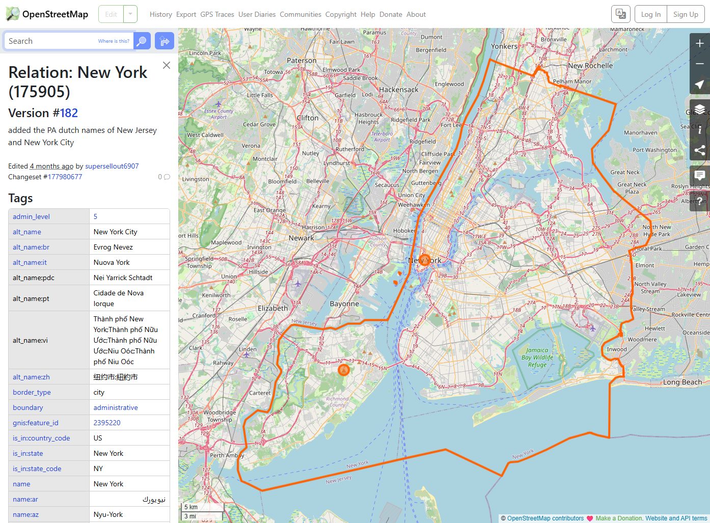
OpenStreetMap New York City
openstreetmap.org
OpenStreetMap is useful for custom NYC views where you need street, neighborhood, or local place detail.
 Source preview
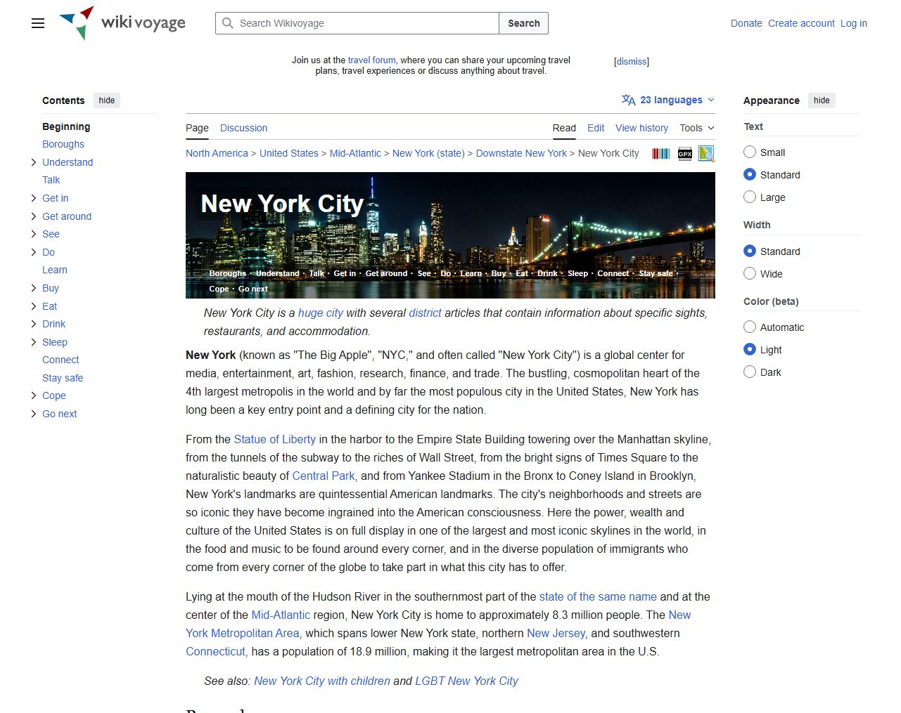
Wikivoyage New York City
wikivoyage.org
A practical travel reference that can help connect boroughs, attractions, and visitor-friendly map context.
NYCgo / New York City Tourism
nyctourism.com
A visitor-focused source for planning trips, attractions, and borough orientation alongside more map-specific resources.
New York City map types to look for
NYC subway map
Best for transit planning and visitor navigation.
NYC street map
Best for walking routes, neighborhoods, and local orientation.
NYC borough map
Useful for understanding the five-borough structure.
Official planning or DOT map
Best for boundaries, bike routes, and city data context.
Quick comparison
| Source | Map type | Formats | Best for |
|---|---|---|---|
| MTA Maps | NYC transit maps | Web, PDF | subway reference, transit planning |
| NYC DOT Bike Maps | NYC bike and street maps | Web, PDF | bike routes, street context |
| NYC Department of City Planning Maps and Data | NYC planning and boundary maps | Web | official boundaries, borough context |
| NYC Parks Maps | parks and recreation maps | Web | parks, walking plans |
| OpenStreetMap New York City | editable NYC street map | Web | custom map views, street detail |
| Wikivoyage New York City | visitor reference map | Web, Image | travel planning, borough overview |
| NYCgo / New York City Tourism | visitor map context | Web | visitor planning, attractions |
How to choose the right city map
Choose an MTA map if transit is the main task. Choose a street map for walking, neighborhoods, or local reference. Choose NYC Planning or city data sources when official boundaries matter. For tourists, pair a simple visitor map with the MTA subway map.
Printing tips for New York City maps
- Print subway maps separately from street maps for better readability.
- Use borough-specific maps if a full NYC map is too dense.
- For walking plans, choose a map with street names and landmarks.
- For classroom use, a borough outline map may be clearer than a detailed street map.
- Check source terms before using map images in guides or products.
Source and licensing notes
These cards link to external map resources. Always check the original source before reusing a map in commercial projects, apps, printed products, or public materials. Classroom use, personal printing, and commercial reuse may have different license rules.
Related printable maps
FAQ
What is the best printable map of New York City for tourists?
Most visitors need two maps: an MTA subway map and a simple street or attraction map. A single dense city map is often hard to read when printed small.
Should I use a borough map or a street map?
Use a borough map for orientation and school/reference use. Use a street map for walking, neighborhoods, and local navigation.
Can I print the official NYC subway map?
The MTA provides official maps online, often in print-friendly formats. Check the MTA page for the current version and usage terms.
Why do some NYC maps look too crowded?
New York City has dense streets, transit lines, and neighborhoods. For printing, borough-level or purpose-specific maps are often clearer than one all-in-one map.
Related guides
More useful articles from the Map Tools & Printable Maps topic.
- California Road Map Printable
Find reviewed sources for california road map printable, including printable map downloads, format notes, source quality, and licensing cautions.
- Florida County Map Printable
Find reviewed sources for florida county map printable, including printable map downloads, format notes, source quality, and licensing cautions.
- Printable Simple Map of London
Find reviewed sources for printable simple map of london, including printable map downloads, format notes, source quality, and licensing cautions.
- North Carolina Map with Cities and Towns Printable
Find reviewed sources for north carolina map with cities and towns printable, including printable map downloads, format notes, source quality, and licensing cautions.
- Printable Map of Nova Scotia
Find reviewed sources for printable map of nova scotia, including printable map downloads, format notes, source quality, and licensing cautions.
About MyGpsTools Editorial Team
MyGpsTools publishes practical guides about GPS apps, maps, navigation tools, EXIF photo metadata, satellite imagery, Android Auto, Apple CarPlay, ZIP code maps, and location-based technologies. We focus on clear instructions, practical checks, official documentation, and reader feedback.