Unlock Offline Navigation on Android Auto: Top Apps & How-To Guide
Discover the best offline map apps for Android Auto. Learn how to use offline maps step-by-step, ensuring you never get lost, even without internet access
For many people, Android Auto has become the preferred navigation app. It offers a convenient and efficient way to get from place to place using an Android mobile device such as Samsung Galaxy, Xiaomi or Google Pixel.
But what happens when you travel in an area with poor cell reception or no internet access? Thankfully, there is a solution – using offline maps on Android Auto. In this article, we’ll discuss how you can make use of this feature on the head unit to ensure you never get lost.
Table of contents
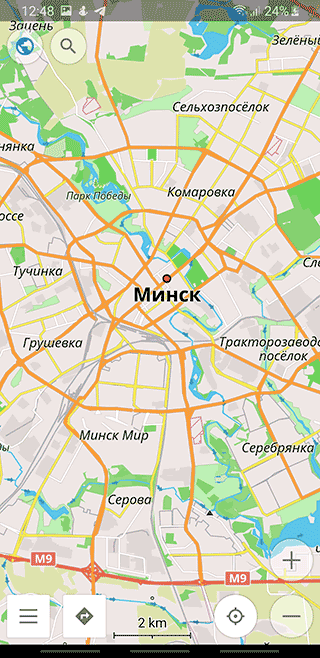
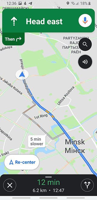
How To Use Offline Maps On Android Auto
While riding a car with Android Auto, traveling and so on it's better to follow the most optimal route. Navigation apps for Android Auto can help you with walking routes and getting to the desired location as fast as possible.
We've compared the most outstanding navigation apps for Android Auto by the following criteria: its usability and functionality. In fact, at the end of the review we will sum everything up: which navigation app can be considered as the best one for Android Auto.
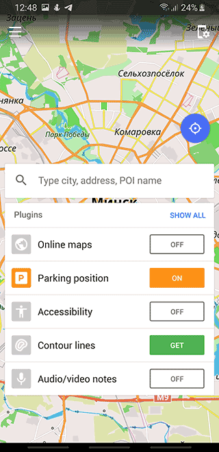
Using offline maps on Android Auto is a relatively straightforward process which can be done in just a few steps.
Although there is very little information on the Internet about the offline use of Android Auto, using maps on the head unit is no different than using them on a mobile device.
Step 1. Download Google Maps for Android Auto and offline navigation
The first step is downloading the right app for your situation – for example, Waze if you’re looking for a real-time route with traffic updates or Google Maps if you just need directions from point A to B without any other bells and whistles.
Both apps can be downloaded from the AppStore and PlayMarket. They are free to use but we will review Google Maps as an example.
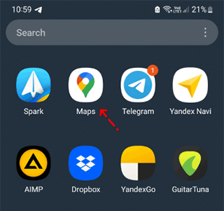
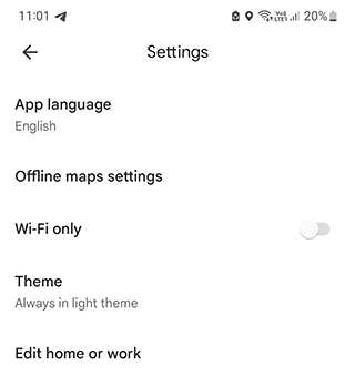
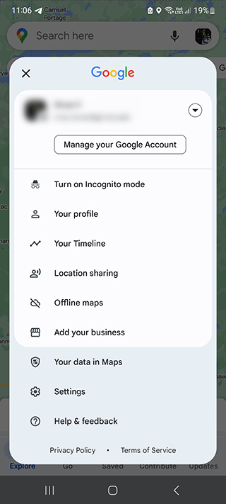
Once installed, open up Google Maps app and start setting up some settings before moving onto the next step. Go to Settings > Edit home or work.

Step 2. Select Your Region For Offline Map Downloads
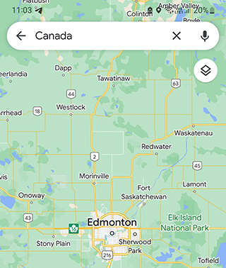
Next, select your region for offline map downloads – this will help reduce Google Maps data usage as well as ensuring that you have access to the most recent information when out of range from cellular networks or wifi connections.
For example, if you travel in Canada it would make sense to select Canada region you plan to visit so that any offline map downloads include all relevant roads and points of interest within that region rather than somewhere else entirely (e.g., Europe).
To download offline maps on Android Auto:
Step 1. Choose the biggest city in the region as a starting point.
Step 2. Tap on the three dot menu and choose Download offline map feature.
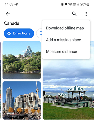
Step 3. Choose the desired region and zoom in or out buttons if needed.
Step 4. Tap on the Download button.
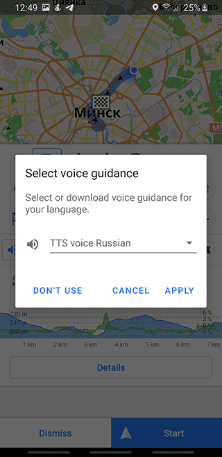
Step 3. Update Maps To Ensure Maximum Accuracy
After selecting your region, itРІР‚в„ўs time to update any outdated maps by downloading fresh copies so that all changes made since your last download are included in your new one(s).
- Go to Settings – Offline maps.
Choose the map which is expired.
Tap on the Update button.
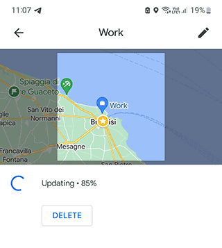
This helps ensure maximum accuracy when using offline navigation which could potentially save you time later down the line if needed!
In addition, it is necessary to update maps to get the most up-to-date information about the opening hours of cafes, restaurants, and public establishments.
Using Android Auto maps that are a month out of date or more, you can get erroneous information, which can have unpleasant consequences.
Step 4. Enable The Offline Mode For Your Car
Now it’s time to enable the offline mode for your car – this will allow all downloaded data from previous steps (regions/maps) be loaded onto its navigation system instead of using an internet connection or external GPS signals.
To enable The Offline Mode on Android Auto:
- Go to Settings > Connected Car.
- Find Navigation & Location > Offline Mode section.
- Confirm the action by tapping Ok/Yes.
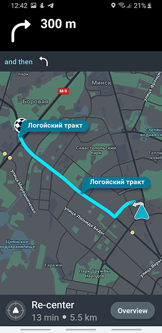
Step 5. Access Your Offline Maps And Start Navigating
Finally, open up whichever app was used previously (Waze/Google Maps etc.) then go into its menu options (usually found under More) where there should be an icon labeled Offline Areas – tap this then choose whichever area/map was previously downloaded beforehand then start navigating away from there!
Best offline map apps for Android Auto
Topo Maps
App
App rating: 4.4 out of 5
- Price
- Free / €12.99 - €34.99 (pro)
- Developer
- ATLOGIS Geoinformatics GmbH & Co. KG
If you want detailed maps similar to those used by Garmin, Topo Maps app is an excellent choice for Android Auto. It is designed mostly for outdoor navigation and hiking. The maps will also be useful for cyclists, athletes, anglers and hunters.
Features of Topo Maps:
- Maps can be downloaded for offline use on Android Auto
- Creating routes, importing and exporting them to a file
- Record route as you go via GPS
- Search: POIs, Points of Interest, Street names, Place names
- Use latitude and longitude for searching
Supported Map Types:
- Topo Maps
- Toporama Maps
- Canada Basemap
- CanTopo
- Google Maps
- Bing Maps
- Open Street Maps
Most of the features related to the maps are only available in the paid version of the application. In particular, downloading offline maps to Android Auto, disabling advertising, and building of routes are only possible in the Pro version.
All-In-One Offline Maps

App
App rating: 4.5 out of 5
- Price
- Free / €4.89 - €5.99 (pro)
- Developer
- Psyberia
All-In-One Offline Maps is the leading developer in navigation and digital maps. The app will help you navigate using Android Auto.
Available maps:
- topographic maps
- satellite maps
- military maps
- topo maps
If there is no access to the mobile network or Wi-Fi, All-In-One Offline Maps will work provided that the offline maps have been downloaded on the iPhone or Android beforehand. If, however, the mobile tariff has a data allowance limit, this application will strive to minimize data downloads when displaying terrain maps.
Pros:
Map display options: you can switch between two- and three-dimensional modes, which might be especially useful in some cases while using offline maps on Android Auto.
Switching between satellites: under any weather conditions the map with POI is always available.
The movement is conveniently accompanied by information on the speed, time remaining until the destination point, distance of the nearest turn and so on. In general, the process of navigation is well-thought-out and easy-to-handle.
User-friendly interface. You can use the lion's share of brand features from the quick access bar (top line). Also you can choose between night and day map displays.
Voice control: mapping a route and giving commands to the app and it will take into account the pitch of your voice and its tone.
It's easy-to-use. While navigating, it's quite easy and handy to manage the offline map: there is a zoom and rotation of the map by movement features, you're able to switch between pre-installed profiles for any type of vehicle.
Avenza Maps

App
App rating: 4.7 out of 5
- Price
- Free / €0.79 - €299.99 (pro)
- Developer
- Avenza Systems Inc.
The features of Avenza Maps will be useful for all lovers of hiking and trekking. This app includes all types of maps that support offline work and therefore will be indispensable in any difficult conditions. According to the developers, most of the downloadable maps are free and have no restrictions.
Features of the application:
- Locating the user's location via GPS or Wi-Fi networks
- Track fixing and route recording as a file for later import and export
- Built-in high-precision compass
- Adding location information to track or photo
- Distance measurement between several objects or selected points on the map
One of the main advantages of the Avenza application is a wide set of maps which will be useful for travelers and tourists in Canada.
Here are just some of the supported map types:
- National Geographic
- Aviation
- HarperCollins
- Topo maps
- GeoTIFF
- Satellite maps
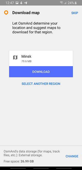
OsmAnd

App
App rating: 4.6 out of 5
- Price
- Free / €1.83 - €29.99 (pro)
- Developer
- OsmAnd
OsmAnd will be a good choice for Android Auto if you need a car or pedestrian navigator. You can choose to download a map for any (even not the most popular) city in Canada: Toronto, Winnipeg, Victoria, Quebec, etc.
Let's list the advantages of the OsmAnd navigation app.
Pros:
- Autonomy. First of all, OsmAnd is a decent offline navigation app. It's suitable for those who prefer to once download maps on their gadget and then never connect to the network and stay in offline mode.
- Informative value. OsmAnd uses for navigation raster and vector maps called Open Street Maps which are compiled by the users of the service. They allow you to filter POI-objects (tourist attractions, museums, theaters, pharmacies etc.) and choose a profile for the corresponding vehicle with Android Auto support. Any route can be optimized taking into account the shortest distance and avoiding toll and dirt roads, ferries and highways.
- Customizable offline maps. You can add objects, create or edit maps on your own. Due to the support of plugins OsmAnd functionality is greatly expanded. For example, you can activate the monitoring system OsMo which will track other gadgets using this service; also you can add yourself to groups; download sea and ski maps; calculate the optimal distance between the specified points via GPX; impose contour lines and layers of relief which is the feature tourists and athletes are certain to appreciate.
- Additional features: voice control, assistant, changing of screen orientation and profile.
Waze

App
App rating: 4.7 out of 5
- Price
- Free / €2.99 - €99.99 (pro)
- Developer
- Citymapper Limited
Waze is another reach in information and details GPS navigation app for Android Auto.
Many locations are supported including Fredericton, Trois-RiviГЁres, Kitchener, Edmonton, Kelowna, etc.
Pros:
- The social features which are integrated into Waze greatly improve the experience of driving. Its users can report any problem on the road: road repairs, traffic accidents, traffic jams, cameras and other “troubles”. Accordingly, other drivers are aware of all the changes. In addition to users' reviews, the app collects information from its own database on the server.
The map with routes is of great informative value. Waze uses OSM maps which have proven themselves to be highly detailed and accurate.
Waze automatically rebuilds a route if your phone or Android Auto accidentally crashes or anything else that may interrupt the process of navigation occurs. Standard Google Maps doesn't do the same. In the same way Waze makes it easier to view a route or a map when needed and then it always returns to the car mode.
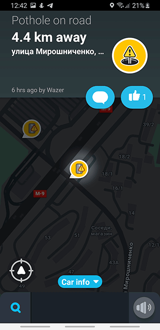
Waze partially supports offline mode. So you can build a route and follow it even if you don't have internet access. Read more about Waze offline maps here.
Guru Maps

App
App rating: 4.4 out of 5
- Price
- Free / €1.38 - €35.99 (pro)
- Developer
- Evgen Bodunov
Guru Maps app works anywhere and will be useful for navigating major cities.
Main Features:
- Routing for biking, motorcycling, hiking
- Finding the best and alternative routes
- Voice guidance while navigating
- Download maps for offline work
Who will benefit from the Offline Map Navigation app:
Those who would like to save money (it's easier to download a map of any region instead)
If you need support for several languages and countries (English, Spanish, German etc.)
For planning trips and travels on Android Auto (you can make a complex route and save it for offline viewing)
To compose optimal routes (you can choose the shortest or the most interesting route)
To find cafes, gas stations, organizations on the map via Android Auto (the built-in catalog can be used for this)
Google Maps
App
App rating: 4.3 out of 5
- Price
- Free
- Developer
- Google LLC
When we were talking about Google Maps a year ago, we noted the following: at that time some features were not improved and optimized on Android Auto. By 2023 the situation has greatly changed for the better, especially from the perspective of a user.
Pros:
This navigation app is perfectly integrated with Okey Google, which allows you to enter questions via a special search bar with a microphone.
Google Maps is a completely free app which works offline in Canada.
Another undeniable advantage is close integration with Android Auto. No need to bother with the installation or activation of extra maps. Most often, this mobile app is already installed in Android.
Cons:
However, we can't skip some of its “trouble spots”.
The main inconvenience of the navigation app is the inability to download maps for the large areas of the United States. Only selected offline maps of cities or small regions are available – for example, Ontario or Toronto. After leaving the city, it's quite a challenge for a driver to do without online syncing.
The choice of locations and attractions in Google Maps is very poor: in order to get full information on hotels, restaurants, shops, schools and etc. which you can find nearby, you have to use third party applets (such as Foursquare or TripAdvisor).
It has no data on road traffic accidents and you can't add it yourself, even though such a feature would be pretty useful for warning other drivers.
Absence of data on speed control and lack of alternative voice assistants.
MAPS.ME

App
App rating: 4 out of 5
- Price
- Free
- Developer
- Waze
MAPS.ME is a great app for Android Auto. It will help you use offline navigation. So you will save your money and at the same time you will always know where you are on the map.
Among the provinces, you can note places that are not always available as offline maps in other navigators. Of course you will find Toronto, Ontario and other big cities in the list. Osmand maps are used, which is a definite plus because they are free and of good quality.
Let's mention the most interesting features of Maps.me:
- Maps are available on Android Auto in HD quality: they are perfectly detailed, there are house numbers and street names, objects
- Offline maps are universal: use them on a bike, while walking or driving
- Map adapts to mobile device orientation: vertically or horizontally
- Address search by category or geographic coordinates
- Creation of complex routes with several stops
- Voice navigation that will not distract you while using Android Auto
Sygic GPS Navigation & Maps
App
App rating: 4.5 out of 5
- Price
- Free
- Developer
- Sygic
Sygic is an app used by more than 3 million drivers worldwide. The list of countries where you can use a Sygic GPS Truck includes the United States, Canada, Europe, Australia and other regions.
Main features for Android Auto users:
- Voice navigation
- Detailed offline maps for Android Auto, updated automatically and regularly
- Support offline mode in the presence of a GPS signal
- Take into account the physical parameters of the vehicle in calculating travel time
- A variety of Commercial Routes to choose
- Avoiding toll roads
- Real-time traffic information (available online only)
Which maps app is the best one for Android Auto
Each of the above mentioned Android navigation apps, in some aspects (its features or maps) is better than the others and is good in its own way. Which one is the most suitable for you depends on your preferences, needs and views. We hope you will be able to choose the best maps app which you'll use for a long time.
| App | Developer | Price | Offline maps support | Traffic jam | Voice assistant |
| Google Maps | Google Inc. | Free | + | + | + |
| Maps.me | MapsWithMe GmbH | Free | + | + | + |
| All-In-One Offline Maps | All-In-One Offline Maps | from $10 | + | + | + |
| Canada Topo Maps | Canada Topo Maps | Free | + | + | + |
| OsmAnd for Android | OsmAnd | from $6.75 | + | + | + |
A well-known company is responsible for the development of All-In-One Offline Maps; the quality of its products and level of technical support are at their best both for Android OS and other mobile devices.
All-In-One Offline Maps navigation app is quite appealing due to its openness and free maps. However, like any other evolving product this one has flaws. We hope the growing community will improve the quality of the app.
As for OsmAnd, this maps app will perfectly serve you when it's impossible to connect your mobile device to Android Auto.
Google Maps is the best Android Auto maps app with voice control. The best thing is that it's preinstalled on Android devices. Not very sophisticated travelers and drivers across Canada and the USA are likely to enjoy it.
Maps.me will be duly appreciated by keen travelers and pedestrians. This navigation app will please their eyes with maps rich in details and adapted for Android Auto. However, we would recommend Google Maps and Waze to drivers.
Other apps for hiking and offline navigation via Android Auto
MapFactor Navigator - https://play.google.com/store/apps/details?id=com.mapfactor.navigator
Offline Maps, GPS Directions -
Karta GPS Navigation & Traffic - https://play.google.com/store/apps/details?id=com.kartatech.karta.gps
GPS, Offline Maps & Directions - https://play.google.com/store/apps/details?id=com.maps.navigation.offlinemaps.traffic.gps.location.directions
Citymapper - https://play.google.com/store/apps/details?id=com.citymapper.app.release
Gaia GPS: https://play.google.com/store/apps/details?id=com.trailbehind.android.gaiagps.pro
FAQ
What is Android Auto?
Android Auto is an app developed by Google Inc. designed to provide an easy and intuitive driving experience for users of smartphones running the Android operating system. It works by connecting your phone wirelessly or through USB cables to compatible cars and displaying a version of your phoneРІР‚в„ўs interface on its dashboard display.
Can I use GPS apps with Android Auto navigation?
Android Auto allows access to various apps such as Google Maps and Waze as well as music streaming services like Apple Music or Spotify through voice controls.
What are Offline Maps?
Offline maps are versions of digital maps stored on your device that can be used without needing an internet connection.
What is the main difference between autonomous and online maps?
They are usually much smaller in size than regular online maps because they donРІР‚в„ўt have all the extra features and data associated with them, but they still contain enough information to help you find your way in unfamiliar areas where there might not be any mobile signal or wifi connection available.
Related guides
More useful articles from the Android Auto Guides topic.
- Best Android car launchers, dock and navigation apps
Detailed comparison of Nova Launcher, AGAMA, Parkopedia, HERE WeGo, Google Maps, Waze, CarWebGuru and other Android car apps, with offline tips and real‑world testing notes.
- Android Auto Volume Too Low? Expert Solutions to Fix Your Car Audio Problems
Solve Android Auto low volume problems with our step-by-step guide. Learn how to increase sound levels, adjust settings, and fix volume issues with Spotify, radio, navigation and Bluetooth connections.
- Android Auto Data Usage: Why It Uses So Much Data & How to Reduce Consumption
Wondering why Android Auto uses so much data? Learn how much data Android Auto consumes, factors affecting high data usage, and how to reduce mobile data consumption...
- How to Fix Black Screen on Android Auto & CarPlay
Complete guide to fix Android Auto black screen and CarPlay black screen issues. Step-by-step solutions to restore your car display screen when it's not working or showing properly.
- Turn Your Android Tablet into a Car Head Unit: Step-by-Step Guide
Complete guide to install Android Auto on tablet and create your own tablet car stereo. Transform any Android tablet for car use with our detailed setup instructions for head unit replacement.
About MyGpsTools Editorial Team
MyGpsTools publishes practical guides about GPS apps, maps, navigation tools, EXIF photo metadata, satellite imagery, Android Auto, Apple CarPlay, ZIP code maps, and location-based technologies. We focus on clear instructions, practical checks, official documentation, and reader feedback.