Best GPS coordinates apps for Android and iPhone - 2026
Compare the best GPS coordinates apps for Android and iPhone. Find apps for latitude and longitude lookup, saving locations, sharing coordinates, and opening points on a map
Today we're going to talk about best GPS coordinates apps for iPhone (iOS) and Android. We'll tell you how they operate and what are the benefits and paid features of the apps for GPS coordinates.
These apps offer features such as a compass, alternative GPS systems, coordinate formats, photo saving options with coordinates, and an SOS button for sending current location to contacts.
Table of contents
What is the best longitude and latitude app?
- MyGPSTools Finder is the simplest app, you can get the coordinates in two taps.
- GPS & Maps includes a compass, so this app will be convenient for travelers, tourists.
- Glonass coordinates is the best app if you want to use GPS alternative to find current longitude and latitude.
- GPS coordinate converter app supports many GPS coordinate formats, we advise this option for experienced travelers.
- My Location is a very handy and accurate GPS coordinates app with a lot of positive reviews.
- GPS Coordinates is an app with a simple user interface and is suitable for basic needs.
- GPS Fields Area Measure is an app suited to more advanced needs and can measure area, distance, and perimeter.
- GPS Coordinate Finder is a more basic app that can find coordinates quickly and without too many features.
The best GPS coordinates app depends on the user's needs. For basic needs, GPS Coordinates is an excellent choice. For more advanced needs, GPS Fields Area Measure is the best choice. For quick and easy coordinate finding, GPS Coordinate Finder is the best bet.
Navigation apps with maps of different cities are among the most popular and in high-demand apps in app stores.
Mostly, all longitude / latitude apps operate in more or less the same principle and they have one purpose: to give users a sense of direction in unfamiliar territory and help them map the most optimal route. The majority of them have additional functionality (which you quite often have to pay for) with the facilitation of which it becomes much easier to use these apps.
According to the GPS-navigator data, you can easily navigate on any map, in any conditions. There are many services and apps that allow you to find places by geographic coordinates. Here are the best of them:
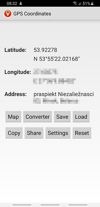
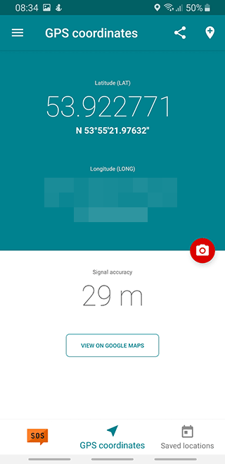
GPS Coordinates app
Google's GPS Coordinates app is a user-friendly and versatile tool designed to help users find their current location without needing an internet connection.
It can accurately save raw coordinates and convert them to an address which can then be shared through various methods. It's one of the most simple navigation apps which has some interesting features.
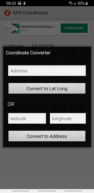
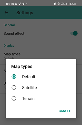
Its developers made it possible for those who have installed their utility to download, share and save coordinates in order to use them in the future. There is also a standard feature of finding the gps coordinates of a user by specifying an address and changing the way the app map is shown. It's possible to display a conventional map scheme and a satellite view.
The basic app features:
- converting any address to GPS coordinates and vice versa (latitude and longitude)
- quickly sending map coordinates via social networks or email
- local storing and download of GPS coordinates on your mobile device
- editing of saved place names
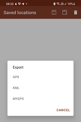
- exporting to Excel
- deleting saved locations
- quick location finding
- adding a photo of the place
- making the marker smaller
- providing DD & DMS readings
In general, GPS coordinates is an app without any extraordinary features. It will be useful for those who need the simplest maps to avoid getting lost in an unfamiliar city.
| Advantages | Disadvantages |
| Simple app to calculate coordinates | Works not always accurately |
| Sharing coordinates with other users | No points are saved on the map |
Overall, users have found the app to be reliable and helpful for everyday outdoor use such as hiking and finding surveyor beacons.
Download GPS Coordinates
Glonass coordinates
An app with maps running on a well-known navigation system called GLONASS. It has a number of useful features which we're going to discuss later.
First, what distinguishes it from other GPS navigation apps is the capability to take a photo and link it to coordinates on the app map. It is convenient way to mark important map coordinates. You can compare this feature to the one of Instagram via which you can post a photo with a specific location.
Another unconditional plus is downloading offline maps and getting map coordinates without wifi connection. Together with the previous app GPS/Glonass coordinates is one of the most accurate and often chosen apps by hikers or long distance travellers who explore remote areas.
However, it also has some drawbacks. Users mention quite intrusive Internet ads popping up. These ads take a long time to load when Internet connection is poor which prevents from checking a location before you finish viewing the ads. You can get rid of ads by purchasing the full version of the software.
| Advantages | Disadvantages |
| Useful functions for travelers and mushroom hunters | No option to save photos with coordinates |
| Accurate address and coordinates | Advertising is Annoying |
My Location - GPS Coordinates
Unlike GPS Coordinates, its functionality is a bit wider:
- Getting the coordinates of a specified point on a map as Latitude/Longitude;
- Copying, publishing, printing and saving coordinates in social networks;
- Converting your gps position / coordinates to addresses and vice versa.
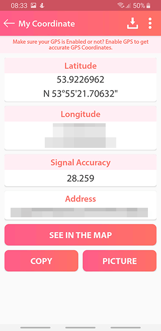
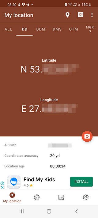
There are three sections on the main screen of the app:
- "My coordinates",
- "Saved locations"
- "Settings".
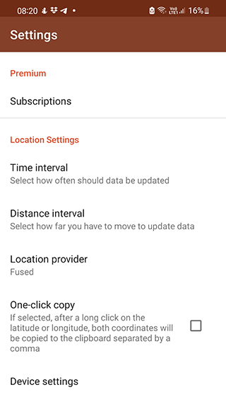
The first tab is responsible for finding via a satellite and showing on the screen your current location. The coordinates that you're planning to use in the future can be saved and you can access the list with them via the second tab. The settings allow you to specify a country, city, address or zip code.
If you want to compare the app result with a browser-based GPS locator, open the GPS location finder and check whether the latitude, longitude, and accuracy are similar.
My Location app is distributed for free, but it displays ads on the screen.

See also: Best GPS apps for iOS
GPS & Maps: Track Coordinates
The thing that differs this navigation app from others the most is its compass. It's not an extraordinary feature, especially given that iPhones, for example, have a built-in compass app. However, using a GPS navigation app with a compass is undoubtedly more convenient. Apart from that, the functionality of the GPS & Maps app is quite basic for iOS.

The interface is pretty user-friendly. By switching between the menu items at the bottom of the screen, users can:
- get their location (via latitude / longitude),
- check the compass,
- open area map,
- buy additional features via Appstore.
For an additional fee, you can mark your location and the compass will be displayed on top of the map as a widget. Other widgets can also be purchased: indicators of speed, map coordinates and more.
In our humble opinion, although the app is quite convenient, it's less worthy of your attention compared to other apps for navigation on iPhone, including the ones we've mentioned above, because they have almost the same features which don't require additional payments.
Moreover, users complain that in some areas satellite photos are extremely outdated. Therefore, we recommend you to think twice before choosing this app for iPhone.
| Advantages | Disadvantages |
| Built-in compass with coordinates | Sometimes the screen scrolls randomly without user interaction |
| Simple and user-friendly interface | Not always fixes the pin on the map |

Download GPS Maps for iOS
GPS Coordinates Finder
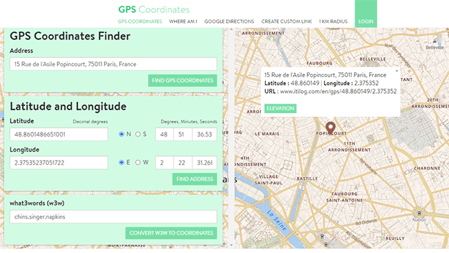
A handy service to convert a user's location into coordinates and vice versa. The interface of GPS Coordinates is optimized for Android and iOS, and the site can be accessed even on weak phones.
How to find out your current location coordinates:
Step 1. Turn on Location services on your phone.
Coordinates and address are detected automatically if geolocation is enabled on your device.
Step 2. Enter the coordinates.
If coordinates were not detected through the Location service, you can enter them yourself.
Step 3. Explore additional features
In addition to this, there are several other functions in the app:
- "Where I'm" - the function allows you to determine your current coordinates;
- Google Directions - build the route and choose the transport;
- 1 mile radius - a visual display of the circle with a radius of 1 mile.
Coordinates GPS Formatter
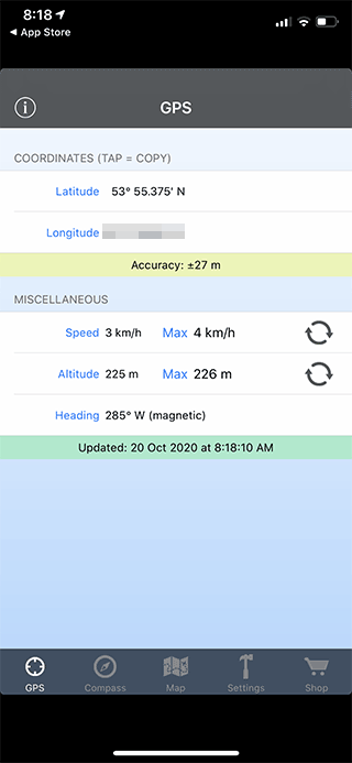
GPS Formatter is a free app with basic functionality for iPhone. You can get rid of ads after purchasing a subscription ($3 per month).
A distinctive feature of this app is its capability to choose from a huge number of coordinate formats such as Georef or military coordinate grid system.
Moreover, the app can convert incoming data into coordinates and mark them on the map or output existing data via Airdrop in the .txt format for further work via a PC.
Another bonus for Apple owners is Apple Smart Watch support with the display of the current coordinates of a user on the screen.
The built in calculator helps to deal with the geomagnetic field values: such as tension and others.
The only downside is its hard to manage interface.
We believe that this tool is one of the best and accurate GPS navigation apps for iPhone due to its really wide and interesting set of features, free distribution and low price for getting rid of advertising.
Download GPS Formatter for iOS
GPS coordinate converter
An intuitive GPS coordinates app for Android for calculating and converting coordinates to other formats. Searches by five types coordinates, puts a mark on the map and shows the address of the building, if it is present on the map. The standard map view in the settings can be changed to satellite or hybrid. The app saves all requests in the "History" tab.

App main features and functions:
- The universal transverse Mercator projection and MGRS (Grid of the military rectangular coordinate system) are used.
- The user sets the markers on the map independently.
- Search queries are saving in "History" tab for quick access to them.
- Finding GPS coordinates of location,
- Tracking forest plantations,
- Various astrophotography features
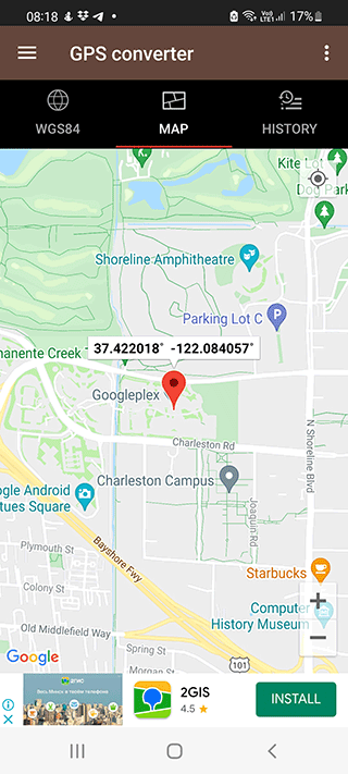
How to find out a point coordinates on the map:
- Select the address field.
- Tap on the edit icon.
- Enter the desired address in the field and tap on the "Check" button.
- If the app has defined the coordinates, the address will appear in the line below. Tap OK.
- If you see the N/A value, it means that coordinates are not defined. Tap "Cancel" and go to the "Map" tab.
- Find the desired address manually and put a marker.
- Go back to the first tab and copy the coordinates of the desired type.

| Advantages | Disadvantages |
| A simple and intuitive app without unnecessary functions | Primitive design |
| There is a possibility of disabling ads | The app is lagging and crashes |
| Supports most of the coordinate types |
To sum up, GPS Coordinate Converter is a great tool for rescues, trainings, and other activities that require GPS coordinates as it quickly and easily provides the best results when given a GPS coordinate.
Download for Android
Latlong
Handy service for converting current location into coordinates.
How to know your current latitude and longitude:
- Go to latlong.net. Enter the address of the place or zip code under "Place Name".
- You can enter the name of the country or more precise data - city, street, and house.
- latlong.net will display latitude and longitude and visually show the coordinates on maps.
- On the next step copy the link to location coordinates or URL to place the map.
- You can leave your feedback in a special column on the main page. To do this you don't need to register, just type your nickname in the special text box.
Below is a detailed description of what latitude and longitude are and how to navigate using them. Even below are statistics of recent requests from users and recently added places. All of this information is also available in the sections of the site.
A section that you may find interesting is movies and TV series. It lists the names of the series and the exact location coordinates where they were filmed. The feature will be very useful for traveling to "memorable" places. In the section you can find such pictures as "13 Reasons Why," "American Horror Story", "Better Call Saul", etc.
GPS Coordinates Converter Lite
Perfect solution for mushroom picking, hunting or hiking. GPS coordinates will help you navigate and not get lost, keeping marks and places on the map.
If you are still lost, tap on the SOS button. The program will determine the exact GPS coordinates of the location, take a photo of the area and send the data to your relatives.
The main functions of the app:
- Coordinate search in four formats: DMS, DM, DD, UTM.
- The SOS button is a tool for instantly sending the current location to selected contacts with a link to Google Maps.
- A photo with the addition of the place coordinates. Saved images and locations are stored in chronological order in the app.
How to take a photo with GPS coordinates overlay:
- You can take a photo in "My location" and "Map" tabs. In the first case, tap on the camera icon in the middle of the screen, in the second - tap on the three dots and select "Take a picture".
- The camera window will appear with all the data for overlay. Swipe to the right and to the left will change the position in the picture.
- Using the "+" button, you can save the settings for the next photos.
- To shoot, tap on the white circle at the bottom of the screen. The app will switch to the front camera.
- The app will show the result and offer to save or change the address published in the photo.
| Advantages | Disadvantages |
| To save battery power, you can reduce the frequency of GPS data updates | There are a lot of ads in the free version |
| Taking photos with GPS coordinates overlay | There is no navigator by coordinates. When trying to build a route, the program redirects to Google Maps |
| For an additional payment, you can increase the measurement accuracy of the built-in GPS receiver and get rid of ads |

Download GPS Coordinates Converter
Map Coordinates
This app is designed to help people learn to read lat/long coordinates on a globe while also allowing users to measure distances and pinpoint locations with their infrasound detector app.
Map Coordinates is suits for determining the exact coordinates of any point on the map in one tap on Android. Map Coordinates has a store where you can subscribe and add premium features.


The main functions of the app:
- Determination of the satellite coordinates of a point on the map by mark or by address
- Measuring the distance between objects
- Searching for locations on Google Maps
- Exporting coordinates to a maps app like OsmAnd
- Advanced search functions for outdoor adventurers

| Advantages | Disadvantages |
| Service selection: Google, Open Street Maps or offline maps | Offline maps are only available in the paid version |
| A large range of paid features in app store | You need to use a third-party app to navigate |
| Precise determination coordinates and address of a point on the map |
Download Map Coordinates
Guru Maps
Guru Maps is an accurate navigator with a huge set of functions and map sources. Perfect for hiking and cycling. It will show you nearest shops, attractions, cafes, public transport stops and hotels, guide you in the optimal way to the right points, record your traveled route and help you get back. Works with both online and offline maps.

The main functions of the app:
- Multiple layers support. You can overlay on the map both the downloaded coordinates and the routes of public transport, bicycle and pedestrian roads available in the app.
- Import data in GeoJSON format. This function allows you to transfer the route from your usual program for marking places on the map to Guru Maps.
- GPS tracking: it is possible to record and save the completed route with marks of places visited. The data can then be downloaded in GMX, KML, KMZ formats.
- Offline navigation. To determine the coordinates, you must first download maps of the desired region.
| Advantages | Disadvantages |
| Convenient vector offline map | In free version, you can create 15 labels, record and import 15 tracks, download 3 offline maps |
| Building a travel route by car, bike or on foot | |
| Most of the tools are available in free version | |

MapFactor Navigator
MapFactor is a free GPS navigation app using OpenStreetMap maps.
The maps are installed on the internal memory of the device or an SD memory card in advance so that there is no need to connect to the Internet during trips. Maps and the app are updated for free once a month.
The main functions of the app:
- Drawing up an accurate map based on the coordinates of the route
- Detailed route planning
- Easy car, bike or on foot navigation
- Many GPS navigation settings

| Advantages | Disadvantages |
| Navigation through free OpenStreetMap maps | Primitive map graphics |
| The ability to use paid TomTom maps | Uncomfortable search for places in free maps |
| A lot of settings and functions | |
| Regular maps updates | |
| Stable connection with the satellite | |
| High-speed navigator work |
FAQ
What are latitude and longitude apps for?
The main function of such apps is to calculate the current coordinates on the map as latitude and longitude. These coordinates can be saved or shared with others to determine your location. As a rule, you can calculate coordinates through a GPS satellite or by entering an address (city, street, etc.).
What is the most accurate GPS coordinate app for mobile?
The accuracy of coordinate determination depends not only on the mobile device, but also on the quality of the connection with the GPS satellite. Among the apps that we mentioned in the review, we would like to mention the following ones: GPS Coordinates app, My Location, GPS & Maps. They are suitable for both Android and iPhone. At the time of writing the review (2022), these are the most accurate apps for calculating geographic coordinates.
How do I find precise latitude and longitude data on mobile?
For Android:
The GPS Coordinates app is a great choice. To find out the coordinates,
- Launch the app,
- Activate your phone's GPS,
- Latitude and Longitude data will be available on the home screen.
For iOS:
Use the SIRI voice assistant.
- Say "Hey, Siri!",
- Use voice command "What is my current location" or "latitude and longitude.
- A map with your geographic coordinates will appear.
How to Get Longitude and Latitude coordinates of a place via Google Maps?
To find out the exact coordinates of the place, follow the following simple instructions:
Open Google Maps on your PC through the browser. It is important that advanced mode is enabled, otherwise you will not be able to get information;
Right-click on the part of the map where the place you need is located;
In the context menu that appears, select the "What's here"?
Look at the tab that appears at the bottom of the screen. It will display the latitude, longitude of the location.
Comparison table
| App | Features |
|---|---|
| GPS Status | -Speedometer -Compass -GPS Signal Strength -GPS Coordinates -Altitude |
| GPS Coordinates Finder | -GPS Coordinates -Address Information -Share Coordinates -Street Map View |
| GPS Essentials | -GPS Coordinates -Compass -Share Coordinates -Altitude -Speedometer |
| Maps & GPS Navigation | -GPS Coordinates -Voice Navigation -Traffic Information -Street View -Points of Interest |
| GPS Location Finder | -GPS Coordinates -Address Information -Share Coordinates -Street Map View -Calculate Distance |
| GPS Toolbox | -GPS Coordinates -Compass -Altitude -Speedometer -Track Record |
Related guides
More useful articles from the GPS Coordinates, EXIF & Location Tools topic.
- How to get GPS coordinates from a photo. EXIF data location
Extract GPS coordinates from a photo using EXIF metadata. Find latitude and longitude, check where a picture was taken, and see why location data may be missing.
About MyGpsTools Editorial Team
MyGpsTools publishes practical guides about GPS apps, maps, navigation tools, EXIF photo metadata, satellite imagery, Android Auto, Apple CarPlay, ZIP code maps, and location-based technologies. We focus on clear instructions, practical checks, official documentation, and reader feedback.