How to Export Google Maps Saved Places to CSV, Excel, KML, GPX, or PDF
Google Maps is good at collecting places and bad at letting them go. Starred cafés, a Want to go list for a trip you keep postponing
Google Maps is good at collecting places and bad at letting them go. Starred cafés, a Want to go list for a trip you keep postponing, forty client addresses in a custom list — it all lives inside the app. You can share a list as a link, but there is no button that downloads it as Excel, CSV, KML, GPX, or PDF.
The official way out is Google Takeout, and what it gives you depends heavily on which kind of list you have. This guide explains how to export Google Maps saved places to CSV or Excel, create KML or GPX for another map app, and produce a PDF that is ready to share or print.
What Google Maps does (and doesn't) let you do with saved lists
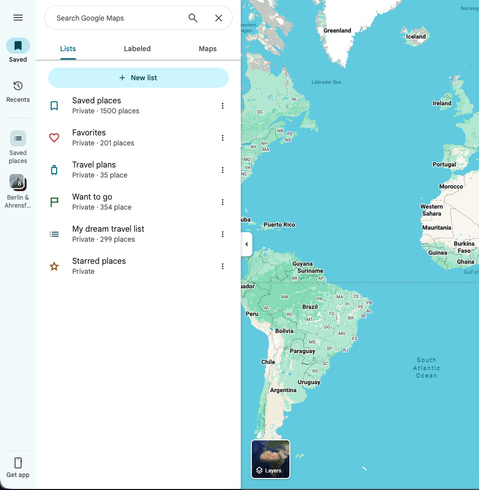
The Saved tab holds Starred places, Favorites, Want to go, your custom lists, and lists other people have shared with you. Inside the app you can do plenty: reorder places, write private notes, pick an icon, share the list as a web link.
The problem starts when you need that data anywhere else. A shared link is a web page, not a file. OsmAnd can't turn it into Favorites, MAPS.ME can't read it as bookmarks, and Excel has nothing to put in columns. Copying places by hand works for three pins. It stops being an option at forty.
The official backup: Google Takeout
Takeout splits your saved places across two separate exports, and they are not equal.
Starred places come out through Maps (your places) as a file called Saved Places.json, which does include names and coordinates. Everything else — Favorites, Want to go, custom lists — comes out through Saved as one CSV per list. Open one of those CSVs and you'll find three columns of information: the place name, your note if you wrote one, and a Google Maps URL. No separate coordinates, no address, no phone number, no hours.
| Takeout export | Lists covered | What you actually get |
| Maps (your places) | Mainly Starred places | Place names and coordinates |
| Saved | Favorites, Want to go, custom lists | Title, optional note, Google Maps URL |
So Takeout works fine as an official snapshot, and the Starred JSON can rescue a coordinate collection. But a custom-list CSV mostly proves the list existed. Before it can become KML, GPX, or a spreadsheet worth opening, something still has to look up every place.
How to export a Google Maps list with structured place data
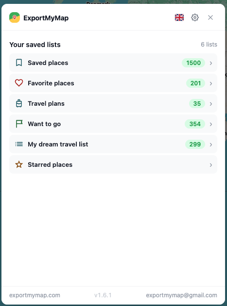
If you want to work with a specific live list rather than a whole-account archive, ExportMyMap is a Chrome browser extension that reads the list straight from Google Maps and turns it into CSV, Excel, JSON, GeoJSON, KML, GPX, PDF, a printable page, or a shareable link.
ExportMyMap has a free version that lets you work with and export the first 10 places from a list. A paid plan unlocks the complete list.
A quick walkthrough of exporting a Google Maps saved list and choosing a file format.
The workflow starts from the list you already have open:
- Open Google Maps in Chrome on a computer.
- Go to Saved and open the list you want to export.
- Launch the ExportMyMap extension.
- Pick the detected list and let the scan finish.
- Review the places and untick anything you don't need.
- Choose the export format.
- Download the file or create a shareable version.
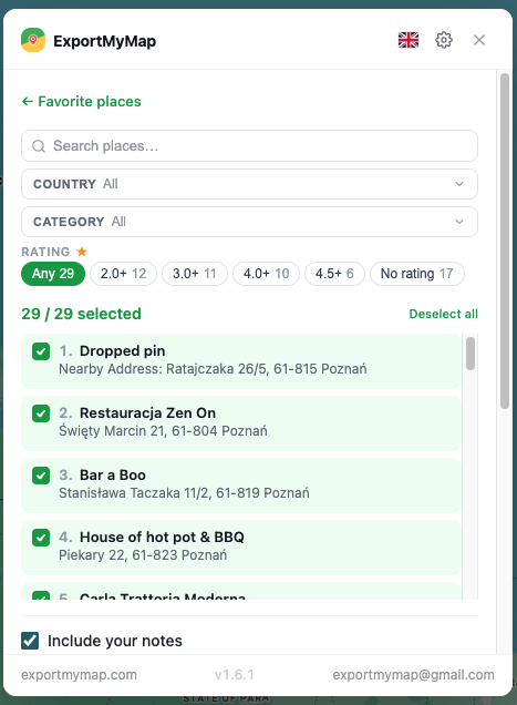
ExportMyMap detects the saved lists available in the current Google Maps session.
Depending on what Google Maps has for each place, the export can include:
Latitude and longitude
Formatted address
Phone number
Official website
Rating and review count
Opening hours
A photo
Permanently-closed status
The personal note you attached to the entry
Not every place carries every field. A dropped pin might have nothing but coordinates, and a mountain viewpoint has no phone number to offer. Skim the result before treating it as a client database or a finished travel guide.
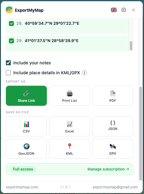
Place details can be reviewed and selected before creating the export.
Which Google Maps export format should you choose?
Pick the format for what happens after the download.
| Format | Best for |
| CSV | Simple spreadsheets, databases, maximum compatibility |
| Excel | Sorting, filtering, reports, business workflows |
| PDF / Print | Travel guides, client handouts, paper |
| KML | MAPS.ME, Organic Maps, Google Earth, Google My Maps |
| GPX | OsmAnd, outdoor navigation apps, GPS devices |
| GeoJSON | QGIS, GIS analysis, web maps, development |
| JSON | Structured backup, scripts |
| Share link | Sending a readable list without attaching anything |
If in doubt: choose CSV when the data will move into another system, Excel when a person will review it, PDF when someone will print it, KML for bookmark-style map apps, and GPX for waypoint-based navigation tools.
Choose a spreadsheet, printable document, data file, or map-compatible export format.
Export Google Maps saved places to CSV or Excel
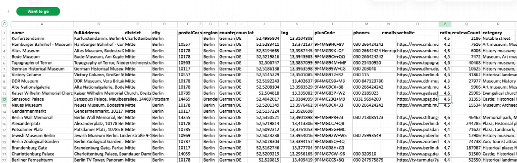
CSV is the best default when the exported data needs to move again. It can be opened in nearly any spreadsheet program and imported into databases, CRM systems, address books, and other data-processing tools. Each place becomes a row, with its available details arranged in separate columns.
This is different from the CSV files supplied for custom lists by Google Takeout. A Takeout CSV mainly records the place title, optional note, and Google Maps URL. A structured CSV created from the live list can include coordinates and current place details when Google Maps makes them available.
Excel contains similar information but is more convenient for hands-on work. Use it when you plan to sort restaurants by rating, filter places by city, review closed businesses, remove unwanted rows, or hand the file to a colleague who expects a normal workbook. If the next step is manual review, choose Excel. If the next step is an import, automation, or data pipeline, choose CSV.
Export Google Maps saved places to KML or GPX
An export is not only a backup. KML and GPX provide a bridge between Google Maps and many other map and navigation apps.
| Destination | Format | What you get |
| OsmAnd | GPX | Places imported as Favorites or waypoints |
| MAPS.ME | KML | A bookmark collection |
| Organic Maps | KML | Bookmarks |
| Google Earth | KML | Placemarks |
| Google My Maps | KML | An editable map layer |
| Locus Map | GPX or KML | Points in its data library |
| Gaia GPS | GPX | Waypoints |
| QGIS | GeoJSON or KML | A geographic layer |
| Garmin and other GPS devices | GPX | Waypoints, imported through compatible software |
OsmAnd
A saved list is a collection of independent points, not a route. Import the GPX through Favorites. If you import it as a Track instead, OsmAnd will draw one continuous line through your hotel, a pharmacy, and nine restaurants — in the order you saved them. Check a few points after import, and remember the offline map for the region is a separate download.
MAPS.ME and Organic Maps
In KML, every place becomes a placemark with a name and coordinates. Get the file onto the phone, use Open with or Share, and pick the map app. The exact menu labels shift between platforms and versions, so try a small file first and keep the original KML around.
Google Earth, My Maps, and GIS software
Earth and My Maps are the natural homes for KML: imported points can be sorted into layers and styled independently. For QGIS and other GIS tools, GeoJSON is the better choice — point geometry plus properties in a structure GIS tools expect.
Basic KML carries place names and coordinates, plus notes when they are included. Basic GPX can also carry an address and Google Maps link. When detailed place information is enabled, ExportMyMap can add phone numbers, websites, ratings, review counts, and other relevant links to the placemark or waypoint description. The receiving app decides which of those details it displays.
Create a printable PDF from a Google Maps list
PDF is useful when the destination is a person rather than another application. A travel list can become a compact guide for a group, while a set of customer or supplier locations can become a handout for a meeting or field visit. The recipient does not need Google Maps, a spreadsheet program, or a compatible GPS app to read it.
Use PDF when the layout should stay fixed and the file needs to be downloaded, emailed, or archived. Use the Print option when you want to choose a physical printer or save a copy through the browser's print dialog. Check the first and final pages before sharing a long list, especially when place names or notes contain long text.
When to use JSON or GeoJSON
JSON is the better archival format when you want to retain structured place data for later processing. GeoJSON is designed for geographic software: each place becomes a point feature with coordinates and available properties. Use GeoJSON for QGIS, web maps, spatial analysis, or development work. Places without usable coordinates cannot become GeoJSON features, so keep a CSV, Excel, or JSON copy if every row matters.
What survives the move — and what doesn't
The destination app decides what it shows. Names and coordinates travel reliably. Addresses, notes, and contact details often ride along in a description field. What none of it becomes is live data: an OsmAnd Favorite won't refresh its Google rating, and MAPS.ME won't keep checking whether the café still opens at eight.
Expect to lose:
Google reviews and review text
Photos from the place card
Current opening hours and popularity
List icons and your custom order
Any future edits to the original list
For anything important, keep two copies: KML or GPX for the map, Excel or JSON for the details.
When something goes wrong
Some places are missing. KML and GPX need coordinates. A deleted entry or an incomplete dropped pin may not make it.
OsmAnd draws a line through everything. The GPX went in as a Track. Re-import the same file through Favorites.
MAPS.ME doesn't appear in Open with. Save the actual .kml file locally and open it from the file manager — not from a cloud preview or inside a ZIP.
The KML opens as a wall of text. Use Open with or Share and pick the map app explicitly.
The map is blank around your points. Bookmarks and offline maps are separate things; download the region inside the destination app.
The CSV shows garbled characters. Reopen it with UTF-8 encoding.
One privacy check before you share
ExportMyMap does not store place data during regular exports or keep ongoing access to your Google Maps account. Share Links are the exception: the selected list is stored so anyone with the link can view it.
Before sharing, remove home or work addresses, medical locations, schools, client details, and private notes that the recipient does not need.
FAQ
Can I export just one Google Maps list?
Yes — open that list and export it directly. You don't need to pull a full Takeout archive to get one list out.
Can I export Google Maps saved places to Excel or CSV?
Yes. Both formats turn the places into rows with available details in separate columns. Choose Excel for manual review and CSV for imports or further processing.
Does ExportMyMap include GPS coordinates?
Yes. Exports include latitude and longitude for places where coordinates are available.
Can I move the exported places to another map app?
Yes. Use KML for placemark and bookmark apps such as MAPS.ME, Organic Maps, Earth, or My Maps. Use GPX for waypoint-based tools such as OsmAnd, Gaia, and compatible GPS devices.
The short version
ExportMyMap turns a saved Google Maps list into a useful file without manual copying. Depending on what Google Maps provides, it can include names, coordinates, addresses, place categories, ratings, websites, phone numbers, opening hours, and notes, then export the list as CSV, Excel, PDF, JSON, GeoJSON, KML, GPX, or a shareable link.
Related guides
More useful articles from the Google Maps Guides topic.
- Google Maps shows wrong current location: how to fix on Android and iOS
Fix Google Maps when your current location is wrong on Android or iPhone. Learn what causes GPS errors and what to check in location settings, permissions, Wi-Fi, and calibration.
- Google Maps location sharing: how to fix on iPhone / Android
If Google Maps location sharing says someone is offline or stops updating, this guide explains what usually causes it and what to check on iPhone and Android.
- What speed does Google Maps use to calculate driving time and ETA?
Learn what Google Maps actually uses to estimate travel time, including speed limits, live traffic, GPS location, and route distance. See what affects ETA, what doesn’t, and how the speed limit feature works.
- How to Clear Google Maps Recent Searches from Search History
Learn how to delete recent searches from your Google Maps history on Android, iOS, or PC. Troubleshoot issues with Google Maps search history not deleting
- 3 ways to download an image via Google Maps
3 convenient ways how to download to your phone or computer an image stored on the Google Maps service.
About MyGpsTools Editorial Team
MyGpsTools publishes practical guides about GPS apps, maps, navigation tools, EXIF photo metadata, satellite imagery, Android Auto, Apple CarPlay, ZIP code maps, and location-based technologies. We focus on clear instructions, practical checks, official documentation, and reader feedback.