Printable Map of Germany with Cities and Roads
Find free printable maps of Germany with cities, roads, towns, states, tourist regions, and direct PDF download sources for travel planning, classroom use, and quick reference.
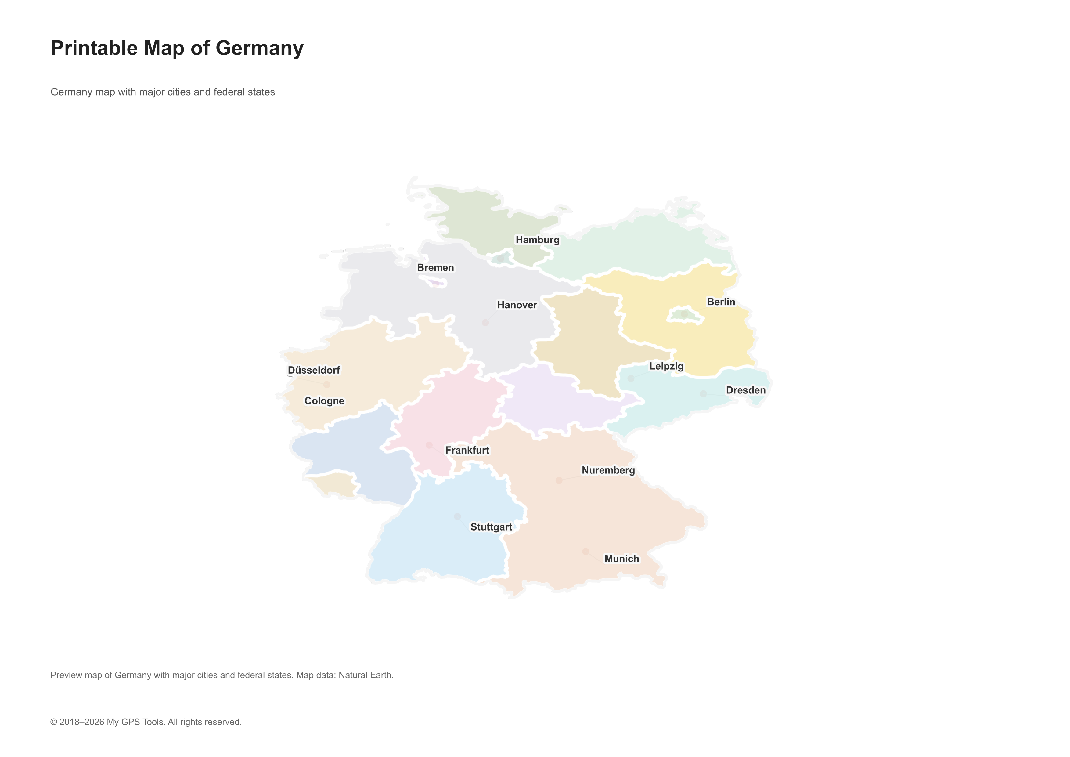
Printable map of Germany with major cities and federal states. Open full-size PNG
Table of contents
Germany is a dense map country: large cities sit close together, state borders matter for planning, and many routes cross into Austria, Switzerland, France, Poland, the Netherlands, Belgium, Czechia, or Denmark. A good printable Germany map should make the big structure clear first — Berlin in the northeast, Hamburg near the North Sea, Munich in Bavaria, Frankfurt in Hesse, Cologne and Düsseldorf in North Rhine-Westphalia, and Stuttgart in Baden-Württemberg.
For a quick trip, a simple Germany map with main cities may be enough. For driving, look for road labels, Autobahn numbers, border crossings, ferry routes, and regional city names. For classroom use, a clean map with federal states, rivers, and major towns is easier to print, label, and annotate.
Download: free PDF maps of Germany
My GPS Tools printable Germany maps
These locally generated maps are created for this guide and can be opened directly as full-size PNG files. PDF downloads can be generated later from the same PNG assets in Next.js.
| Map | Open full-size PNG |
|---|---|
| Printable map of Germany with cities and federal states | Open PNG |
| Map of Germany with main cities and towns | Open PNG |
| Detailed map of Germany | Open PNG |
| Road map of Germany | Open PNG |
| Tourist map of Germany | Open PNG |
| Germany federal states map | Open PNG |
| Blank outline map of Germany | Open PNG |
| Physical map of Germany | Open PNG |
| Germany rivers map | Open PNG |
| Germany and neighboring countries map | Open PNG |
If your query includes “PDF,” you probably want a file you can open, save, and print rather than a long article. These sources are good starting points for free Germany map PDF downloads and printable map files:
| PDF / download source | What you get | Best for |
|---|---|---|
| Germany political map PDF — Perry-Castañeda Library | A printable Germany map with cities, borders, and neighboring countries | classroom reference, travel overview, offline printout |
| Germany shaded relief map PDF — Perry-Castañeda Library | A relief map showing terrain and physical geography | geography lessons, terrain context, presentations |
| Perry-CastaГ±eda Germany map collection | Political, relief, historical, and topographic maps | education, research, printable PDF references |
| Free Vector Maps Germany | Germany outline, state, and vector map downloads in several formats | worksheets, design, presentations, editable map files |
| Wikimedia Commons Germany maps | Map images, SVG files, state maps, and outline maps | free reference maps with license checks |
Many of these sources are free to use for personal reference, classroom handouts, and trip planning. Check the license before republishing, editing, or using a map in commercial material. “Free to view” and “free to reuse” are not always the same thing.
Best Germany map types to use
| Map type | Best for | What to check |
|---|---|---|
| Germany map with cities | General orientation, presentations, quick reference | Berlin, Hamburg, Munich, Cologne, Frankfurt, Stuttgart, DГјsseldorf, Leipzig, Dresden, Bremen, Hanover, Nuremberg |
| Germany road map | Driving, route planning, cross-border travel | Autobahn routes such as A3, A7, A8, A9, A24 and major federal roads |
| Detailed map of Germany | Planning a route with towns, regions, rivers, and local context | City labels, state names, scale, print clarity |
| Germany map with main cities and towns | Regional planning, rail trips, road trips, classroom geography | Smaller towns beyond the largest cities, not only capitals |
| Printable PDF map of Germany | Offline travel, classroom handouts, trip notes | Page size, readable labels, whether the map works in grayscale |
| Tourist map of Germany | Scenic routes, cultural regions, first-time travel planning | Rhine Valley, Black Forest, Bavaria, Romantic Road, Baltic coast, major airports |
| Blank or outline Germany map | Worksheets, quizzes, labeling exercises | State borders, rivers, neighboring countries |
Free detailed city map of Germany
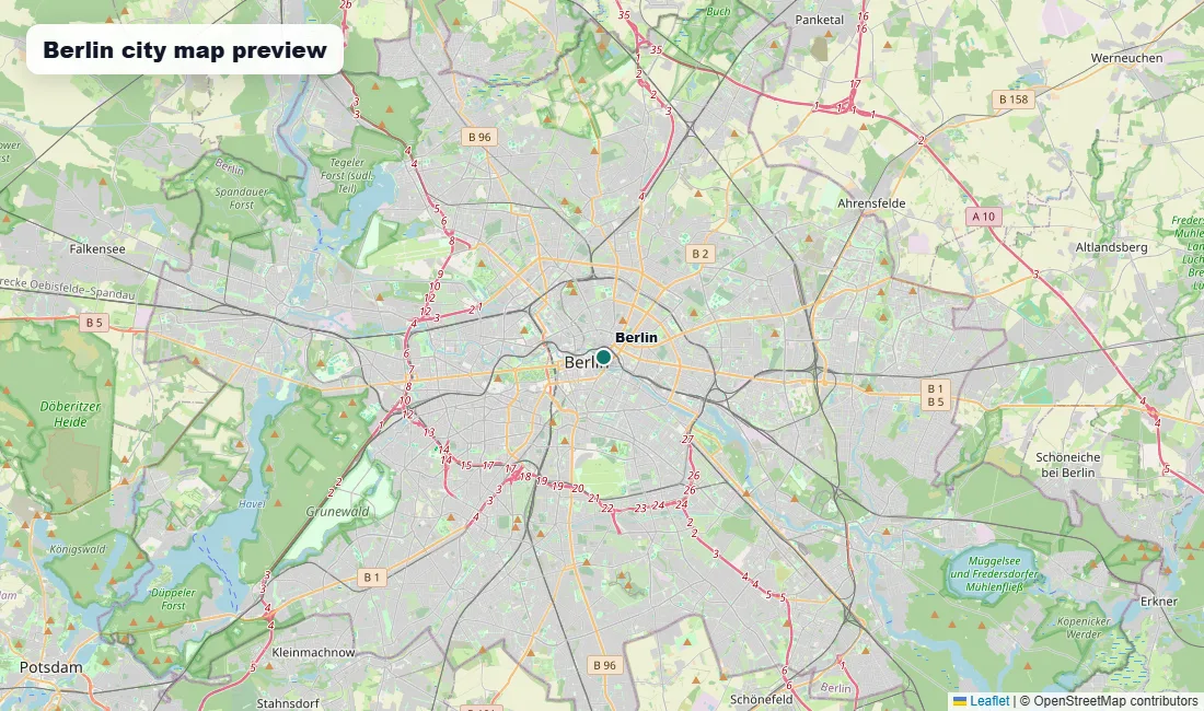
Berlin city map preview for users looking for a detailed city-level map of Germany. Map data В© OpenStreetMap contributors.
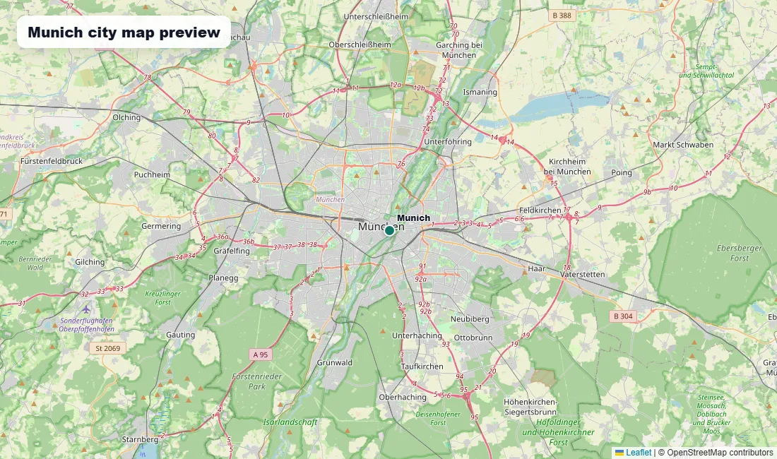
Munich city map preview for users looking for a detailed city-level map of Germany. Map data В© OpenStreetMap contributors.
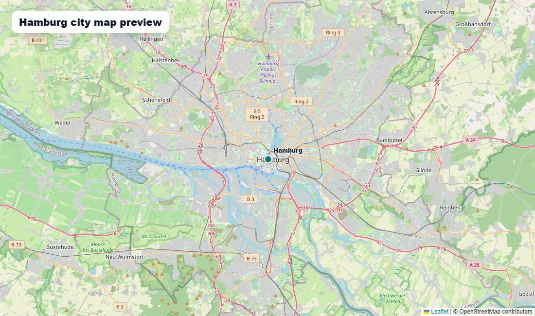
Hamburg city map preview for users looking for a detailed city-level map of Germany. Map data В© OpenStreetMap contributors.
A free detailed city map of Germany should show more than Berlin, Munich, and Hamburg. For planning, the most useful city maps include the main cities, regional towns, road corridors, and state names together, so the map explains how the country is connected rather than just where the largest labels sit.
Look for maps that include Berlin, Hamburg, Munich, Cologne, Frankfurt, Stuttgart, Düsseldorf, Leipzig, Dresden, Bremen, Hanover, Dortmund, Essen, Nuremberg, Bonn, Mannheim, Karlsruhe, Freiburg, Lübeck, Trier, and Kiel. A map that includes these places gives a better picture of Germany’s north-south and east-west structure.
For English-speaking users, choose a map of Germany in English when possible. City names such as Munich, Cologne, Nuremberg, and Hanover may appear differently from German labels such as München, Köln, Nürnberg, and Hannover. English labeling is useful for travel planning, classroom handouts, and international presentations.
Map of Germany with main cities and towns
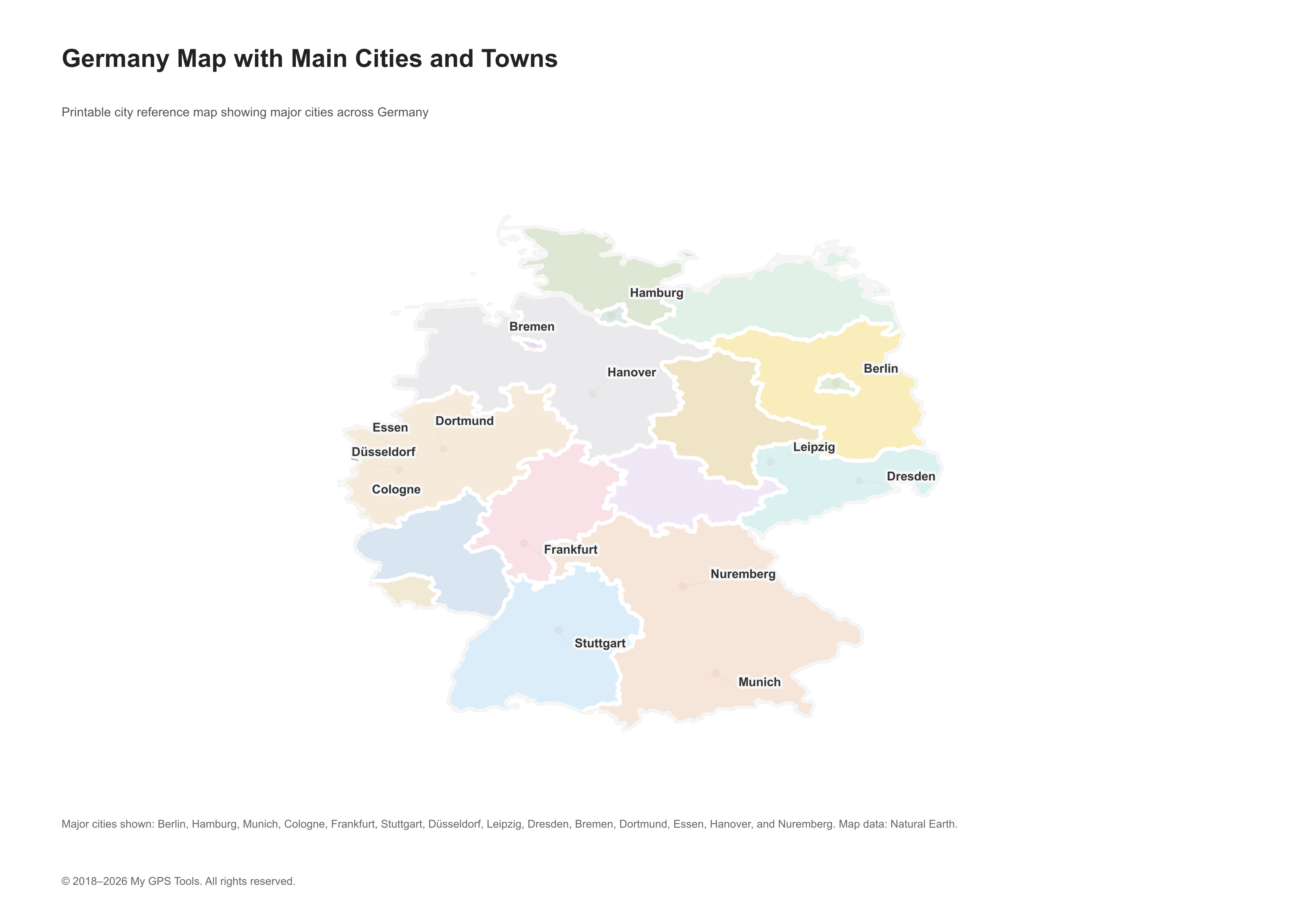
Map of Germany with main cities and towns, including Berlin, Hamburg, Munich, Cologne, Frankfurt, Stuttgart, DГјsseldorf, Leipzig, Dresden, Bremen, Hanover, and Nuremberg. Open full-size PNG
A useful map of Germany with main cities and towns should label both major cities and regional stops. Berlin, Munich, Hamburg, Cologne, Frankfurt, Stuttgart, Düsseldorf, Leipzig, Dresden, Bremen, Hanover, Dortmund, Essen, Nuremberg, Bonn, Mannheim, Karlsruhe, Freiburg, and Lübeck all help users understand the country’s regional layout.
For travel planning, city labels should be paired with roads, rail corridors, airports, or state names. A map that shows only Berlin, Munich, and Hamburg may look clean, but it is not detailed enough for road trips, rail planning, or regional comparison. Smaller towns matter in Germany because many well-known routes and attractions sit outside the largest cities: Rothenburg ob der Tauber on the Romantic Road, FГјssen near Neuschwanstein Castle, Trier on the Moselle, and towns along the Rhine Valley.
Detailed map of Germany
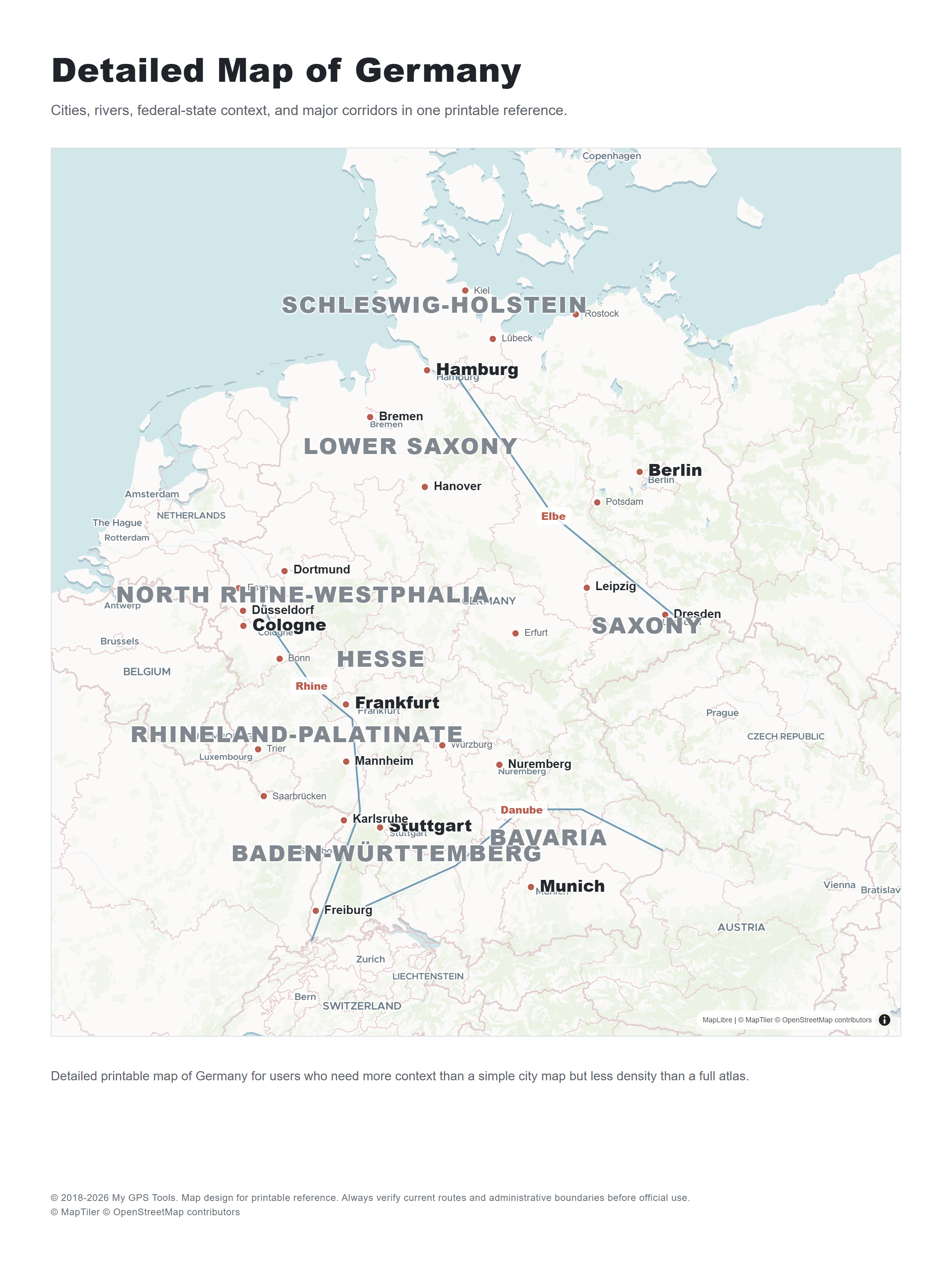
Detailed printable map of Germany with cities, rivers, federal-state context, and simplified route orientation. Open full-size PNG
The query “detailed map of Germany” can mean a road map, a political map with states and cities, a tourist map, or a printable classroom reference. The best detailed map is the one that stays readable after printing.
A detailed map of Germany should show:
- major cities and regional towns;
- state borders and state names;
- the Rhine, Elbe, Danube, Main, Weser, and Oder rivers;
- major roads and Autobahn corridors;
- neighboring countries and border regions;
- key mountain and forest areas such as the Alps, Harz, Bavarian Forest, and Black Forest.
A very dense image can become unreadable on paper. If the map will be used in a classroom or travel folder, clarity beats maximum label count.
Road map of Germany
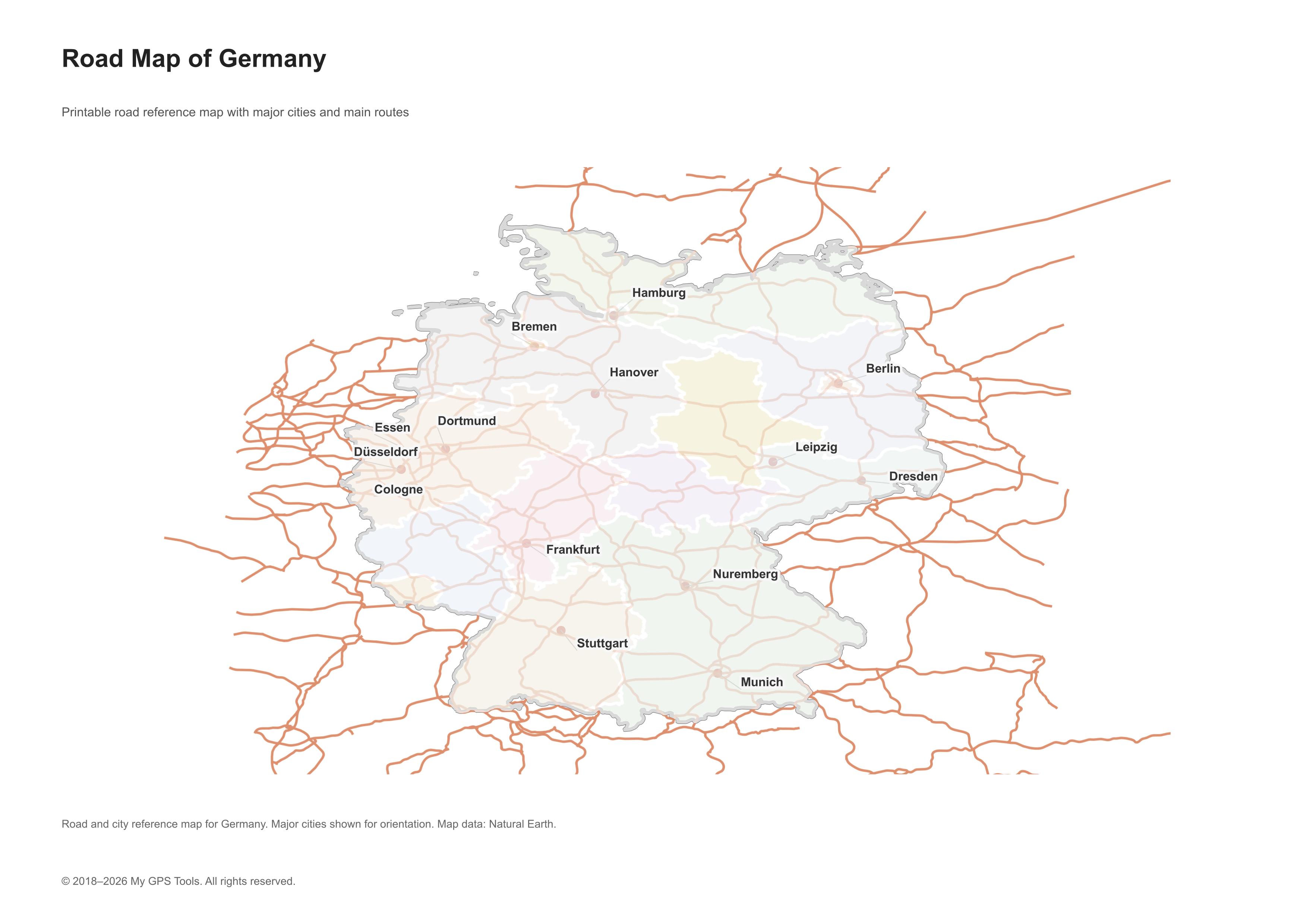
Road map of Germany with major cities and simplified Autobahn corridors for country-level route planning. Open full-size PNG
Germany’s road network is one of the main reasons people search for printable maps. A road map of Germany should clearly show the Autobahn system, major cities, and cross-border routes. Routes such as A7 north-south, A3 through western and southern Germany, A8 across the south, A9 between Berlin and Munich, and A24 toward Hamburg are useful orientation lines.
For a road trip, print both a country-wide road map and a regional map for the area where you will spend the most time. A single full-country map is good for the big picture, but it cannot show every local road, exit, or small town clearly.
Germany road map PDF and web sources
- Germany political map PDF — good country overview with cities and neighboring countries.
- Perry-Castañeda Germany maps — PDF and image maps from the Germany collection.
- Ezilon Germany Road Map — broad country-level road view with cities and neighboring countries.
- Worldometer Germany Road Map — zoomable Germany road map for quick reference.
- Maps-Germany-DE road map — road-focused map with cities and towns.
Detailed tourist map of Germany
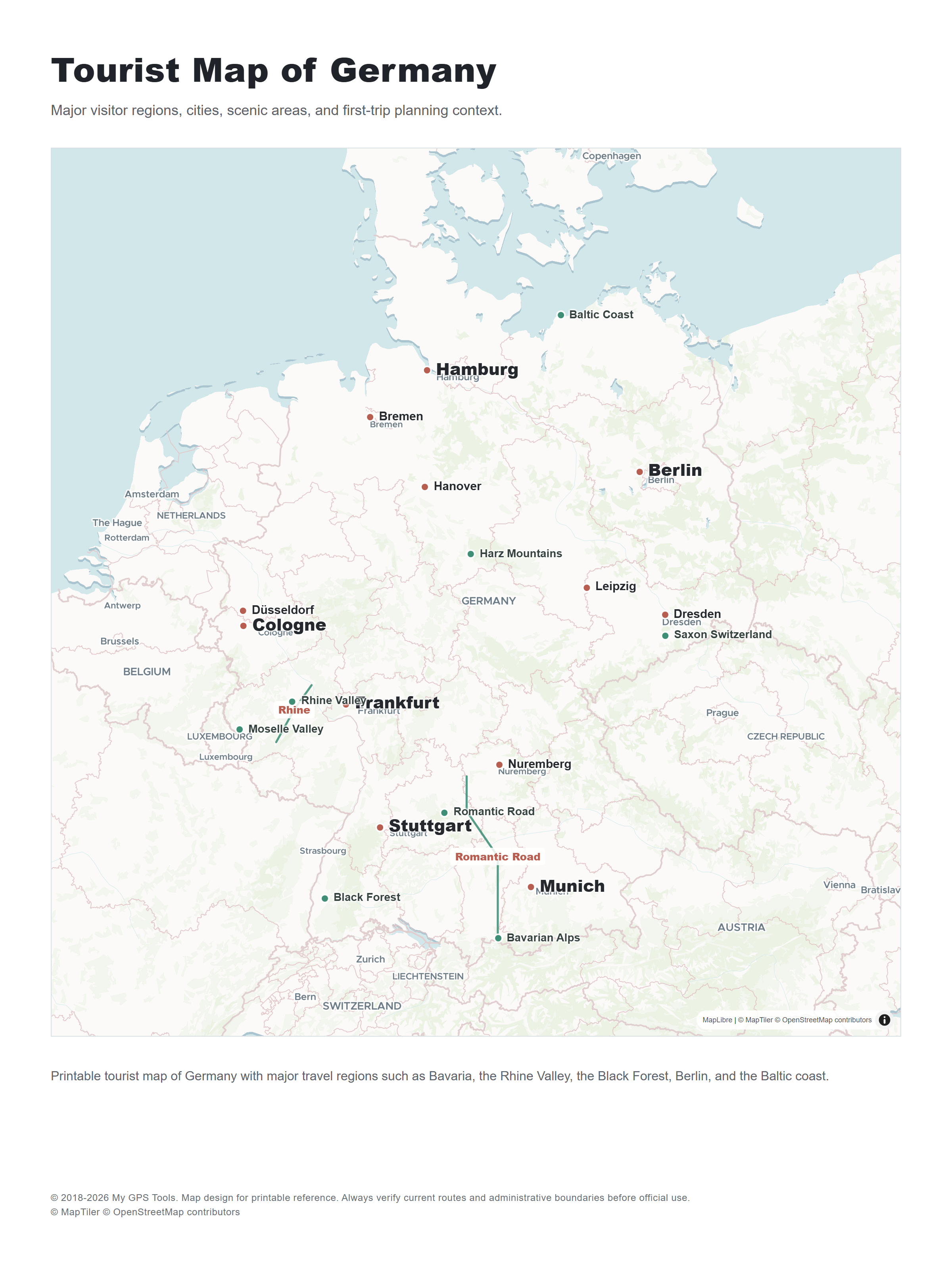
Tourist map of Germany with major visitor regions, scenic areas, and first-trip planning context. Open full-size PNG
A detailed tourist map of Germany should help you understand where the main travel regions sit before you plan a route. Berlin and Potsdam belong together for history and city breaks. Munich works as a base for Bavaria, the Alps, and Neuschwanstein. The Rhine Valley needs a map with river towns and castle areas. The Black Forest is easier to plan with a regional road or outdoor map because villages, valleys, and scenic roads matter more than national borders.
For a first trip, look for a tourist map that connects Berlin, Munich, Hamburg, Cologne, Frankfurt, Dresden, Nuremberg, Heidelberg, the Rhine Valley, the Black Forest, Bavaria, and the Baltic coast. For driving, pair the tourist map with a road map. For rail travel, use a city-and-rail reference instead of a decorative attractions map.
Germany states map: regions and federal states
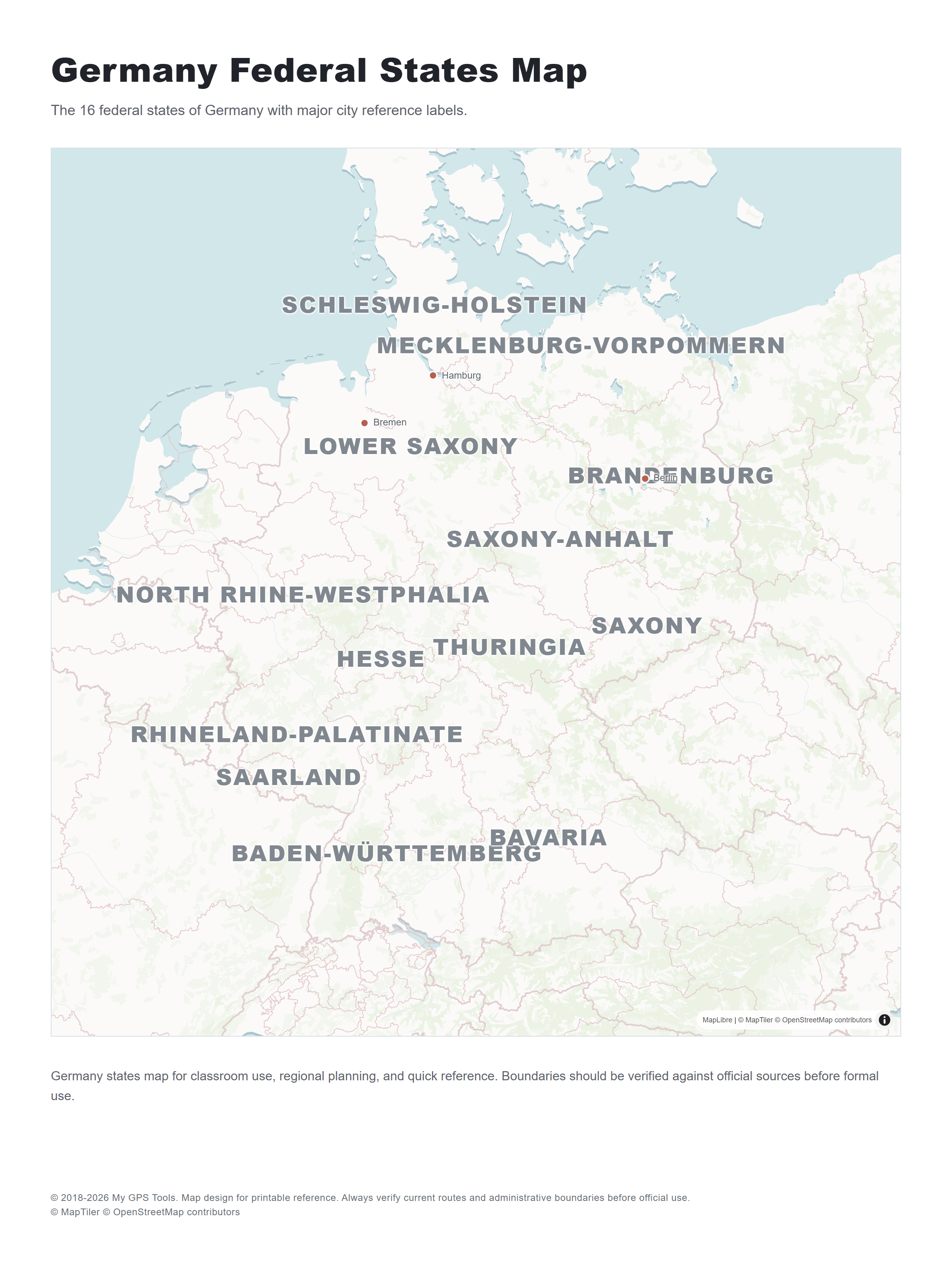
Germany federal states map for classroom use, regional planning, and quick reference. Open full-size PNG
Germany is divided into 16 federal states. A state map is useful for education, regional planning, and understanding why cities that look close together may belong to different administrative or cultural regions.
Key states to recognize on a Germany map include Bavaria, Baden-WГјrttemberg, Hesse, North Rhine-Westphalia, Lower Saxony, Saxony, Brandenburg, Schleswig-Holstein, Rhineland-Palatinate, Saxony-Anhalt, Thuringia, Mecklenburg-Vorpommern, Saarland, Berlin, Hamburg, and Bremen.
A Germany states map is useful when you compare travel areas: Bavaria for Alpine routes, North Rhine-Westphalia for dense city clusters, Baden-WГјrttemberg for the Black Forest and Stuttgart, Saxony for Dresden and Leipzig, and northern states for Hamburg, LГјbeck, and the Baltic coast.
Physical map of Germany
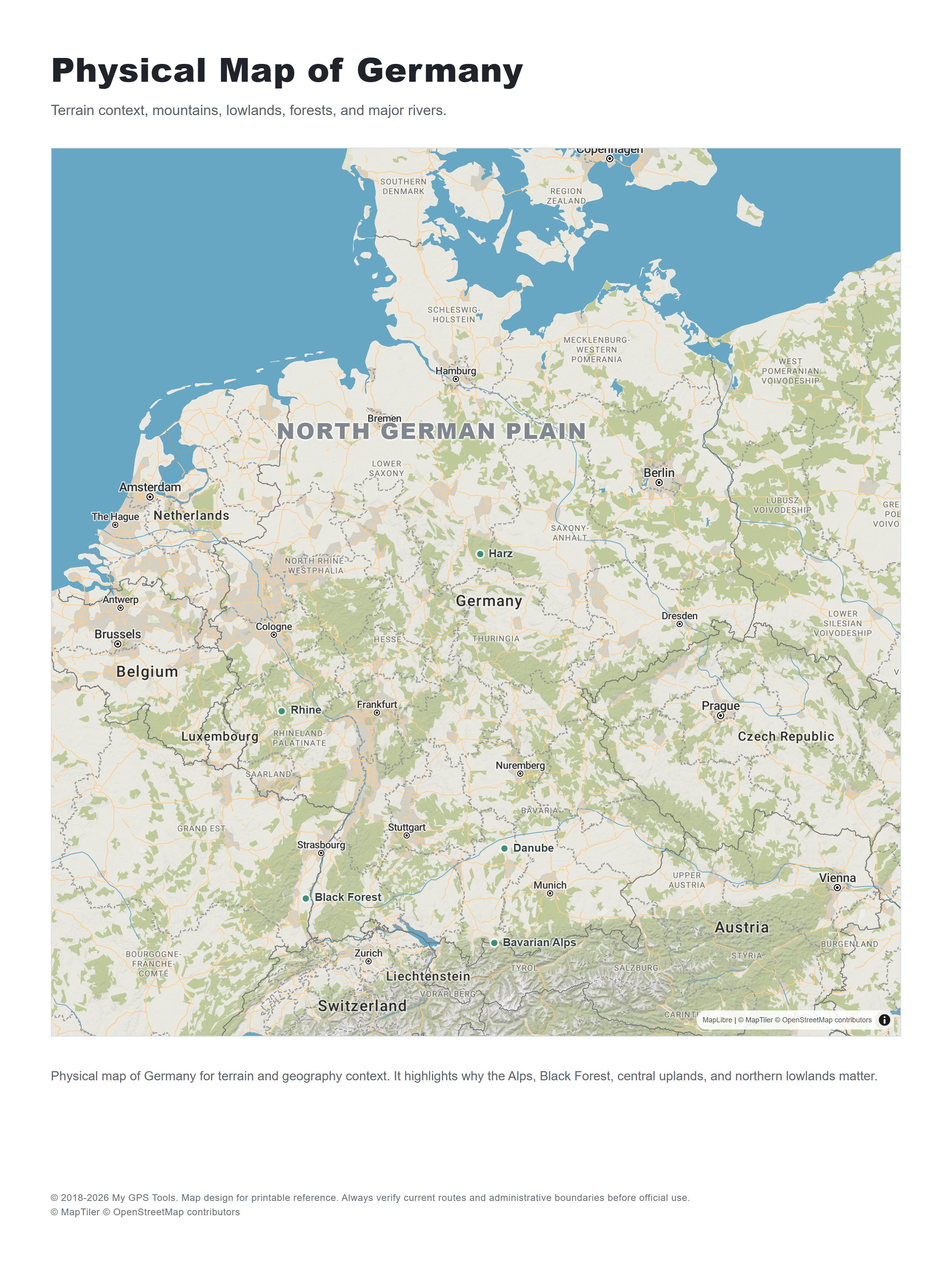
Physical map of Germany with terrain context, major lowlands, uplands, forests, mountains, and rivers. Open full-size PNG
A physical map is useful when a simple political or road map does not explain the landscape. Germany’s north is shaped by lower plains and coastal areas, while the south includes the Alps and Alpine foothills. The Black Forest, Harz, Bavarian Forest, Rhine Valley, Danube corridor, and central uplands are easier to understand with terrain context.
Germany rivers map
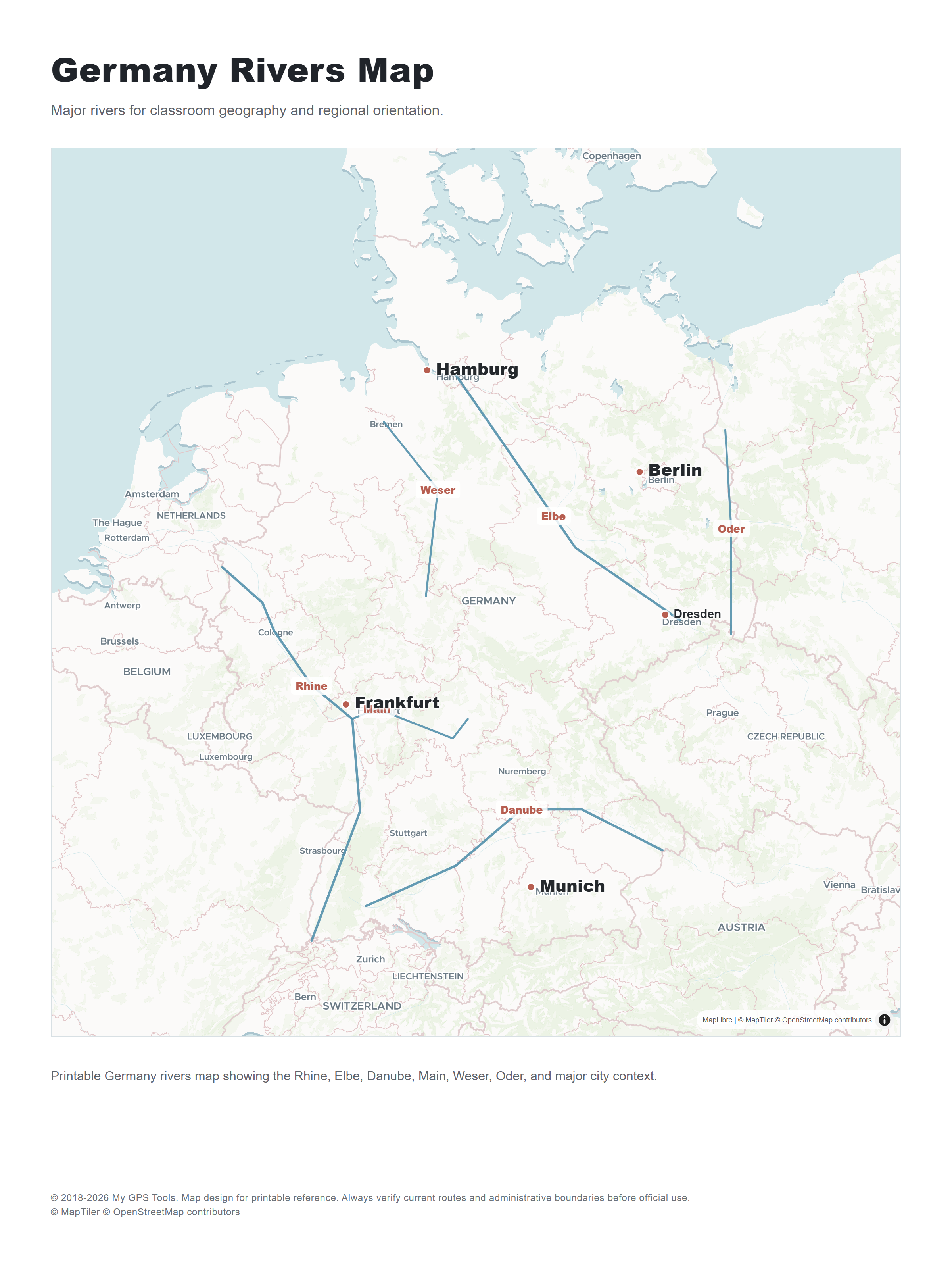
Germany rivers map showing major rivers such as the Rhine, Elbe, Danube, Main, Weser, and Oder. Open full-size PNG
A rivers map helps with classroom geography and regional orientation. The Rhine explains much of western Germany’s settlement and transport pattern, the Elbe connects Dresden and Hamburg, the Danube crosses southern Germany, and the Main links Franconia with Frankfurt and the Rhine.
Germany and neighboring countries map
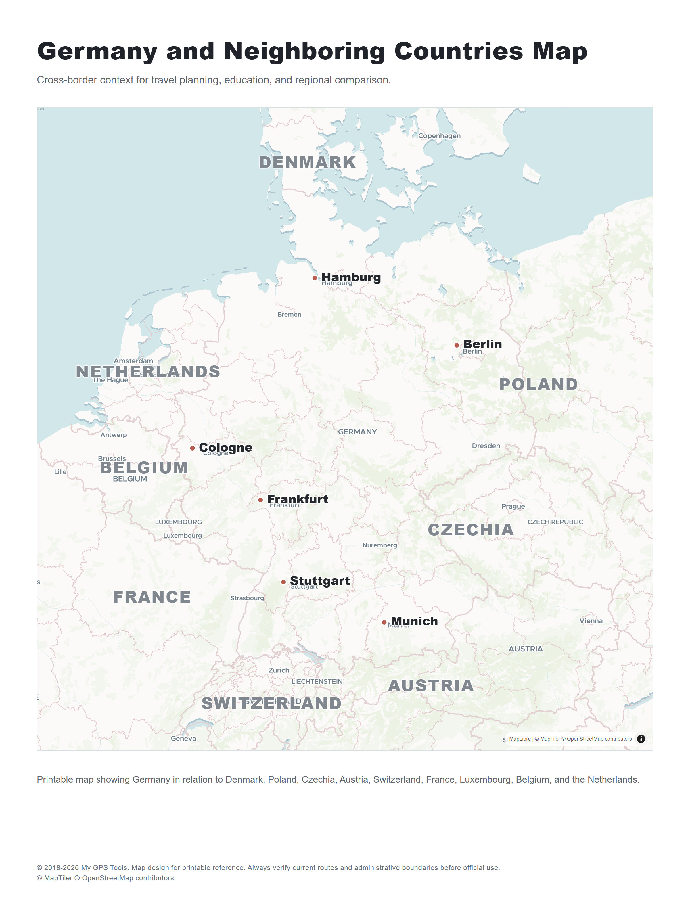
Germany and neighboring countries map for cross-border travel planning and classroom reference. Open full-size PNG
Germany borders Denmark, Poland, Czechia, Austria, Switzerland, France, Luxembourg, Belgium, and the Netherlands. A neighboring-countries map is useful for road trips, rail planning, border regions, and classroom context.
Blank outline map of Germany
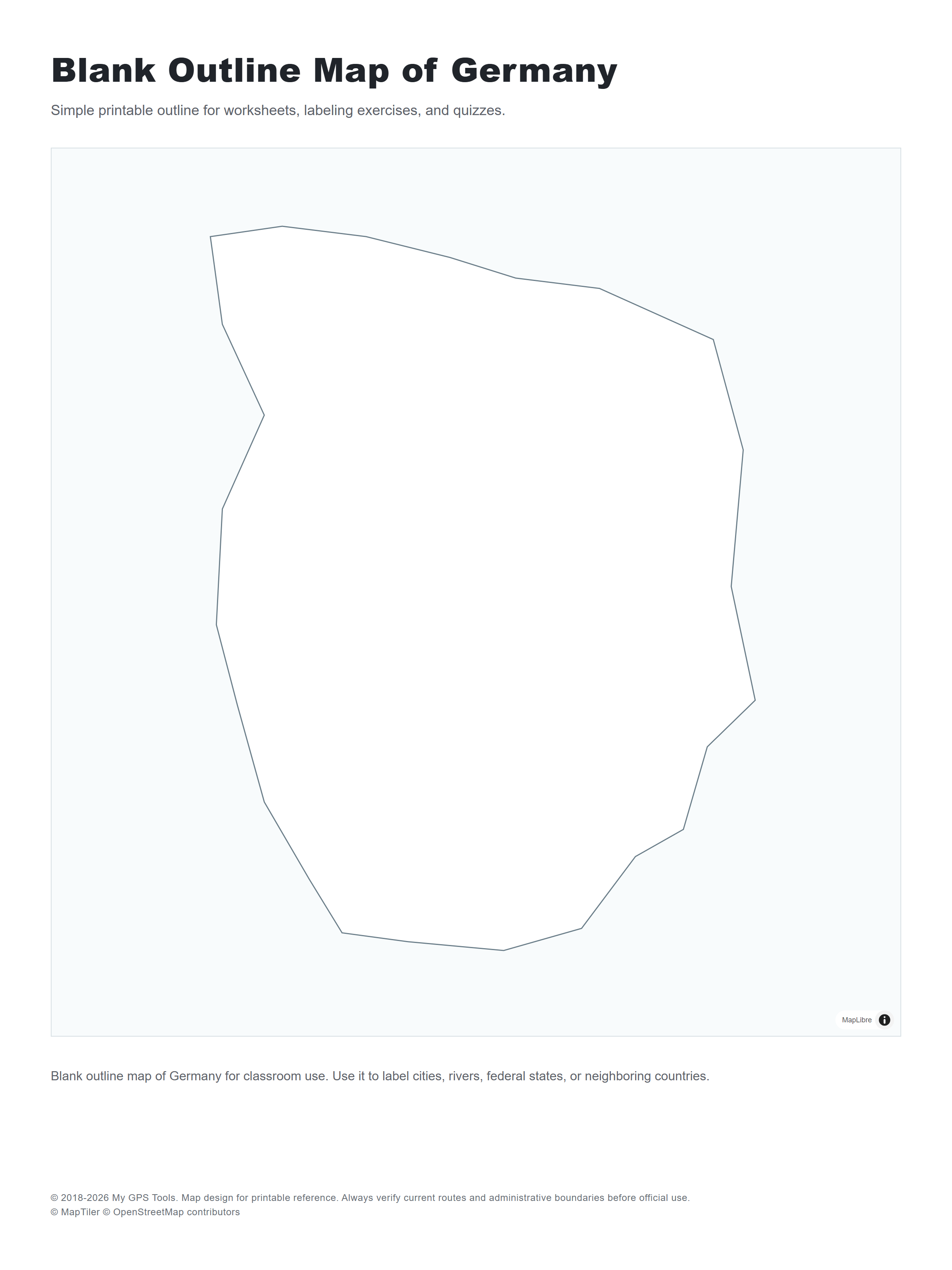
Blank outline map of Germany for worksheets, quizzes, labeling activities, and classroom handouts. Open full-size PNG
A blank outline map is better than a dense road map for student exercises. Use it to label Berlin, Munich, Hamburg, Cologne, Frankfurt, the Rhine, the Danube, the federal states, and neighboring countries.
Where to get printable maps of Germany
| Source | Map type | Format | Best for |
|---|---|---|---|
| Geoportal.de | official German geodata portal | Web | authoritative map layers and official geodata context |
| OpenStreetMap | roads, towns, local detail | Web / print tools | customized local and regional maps |
| Perry-CastaГ±eda Library Map Collection | reference and historical maps | PDF / image | education, research, older map references |
| Wikimedia Commons Germany maps | reference maps, outline maps, state maps | Image / SVG / PDF depending on file | classroom and quick visual reference |
| Germany Travel | tourist regions and official travel context | Web / guides | tourist orientation and trip planning |
| Maps-Germany-DE | road, city, regional maps | Web / image | quick printable references |
| Free Vector Maps Germany | vector outline and labeled maps | SVG / PDF / PNG / JPG | worksheets, design, presentation use |
For a map of Germany in English, check the label language before downloading. Some German sources use local names such as München, Köln, Nürnberg, and Hannover; that may be ideal for travelers in Germany, but English labels are easier for international classroom use and quick presentations.
Check the license before reusing any map in a publication, app, presentation, or commercial project. Free to view does not always mean free to republish.
How to choose the right Germany map
Start with the job the map needs to do.
For a classroom worksheet, choose a simple map with states, major rivers, and city labels. For a road trip, use a road map with Autobahn numbers and neighboring countries. For a travel itinerary, use a tourist or regional map that shows city clusters and scenic areas. For a presentation, use a clean outline or labeled vector map so the audience can read it from a distance.
A good printable Germany map should have:
- clear city labels;
- readable roads or state borders;
- a scale or enough geographic context;
- neighboring countries;
- print-friendly contrast;
- a file format that stays sharp on paper.
Avoid maps that look good on a large monitor but become muddy on paper. Germany has many mid-sized cities and towns, so label size matters.
Printing tips for Germany maps
Print one test sheet before relying on the map for a trip or class. Germany’s shape fits well in portrait orientation for a simple full-country map, while road maps and tourist maps work better in landscape if they include neighboring countries.
For classroom use, print a labeled map and a blank outline map. Students can use the outline version to mark Berlin, Munich, Hamburg, Cologne, Frankfurt, the Rhine, the Danube, and neighboring countries.
For travel, fold the printed map by region rather than by perfect halves. Put the area you need most — Bavaria, Berlin, the Rhine Valley, or the Black Forest — on the outside so you do not have to unfold the entire sheet every time.
FAQ
Where can I download a Germany map PDF?
Start with the Perry-CastaГ±eda Library Germany collection, which includes printable PDF maps, and then check Wikimedia Commons or Free Vector Maps if you need outline or editable versions. Use the PDF version when you need a clean paper printout.
Can I get a free detailed city map of Germany?
Yes, but “detailed city map” can mean different things. For a national overview, choose a Germany map with main cities and towns. For city streets, use a local city map for Berlin, Munich, Hamburg, Cologne, Frankfurt, or the region you need.
What is the best printable map of Germany?
For most users, the best printable map of Germany is a map with major cities, roads, state borders, and neighboring countries. It gives enough context for travel planning, classroom use, and quick reference without becoming too crowded.
Where can I find a map of Germany with main cities?
Look for a labeled Germany map that includes Berlin, Munich, Hamburg, Cologne, Frankfurt, Stuttgart, DГјsseldorf, Leipzig, Dresden, Bremen, Hanover, Dortmund, Essen, and Nuremberg. For more detail, choose a map that also includes regional towns and state names.
Can I download a free printable map of Germany?
Yes. Several sources offer free maps for personal reference, classroom use, or travel planning. Check the license before reusing a map in a commercial project or republishing it online.
What is the difference between a Germany city map and a Germany road map?
A city map focuses on places and labels. A road map focuses on routes, road classes, distances, and connections between cities. For travel planning, a road map is more useful; for general geography, a city map is easier to read.
What map should I use for a Germany road trip?
Use a road map of Germany with Autobahn numbers, major cities, and neighboring countries. Add regional maps for Bavaria, the Rhine Valley, Berlin-Brandenburg, the Black Forest, or northern Germany if your trip focuses on those areas.
Is a tourist map of Germany different from a road map?
Yes. A tourist map highlights attractions, scenic routes, regions, and visitor-friendly cities. A road map gives more attention to highways, federal roads, and route planning.
Can I find a map of Germany in English?
Yes. Many international map sources use English labels, while German sources may use local names such as München, Köln, Nürnberg, and Hannover. Choose English labels for classroom use or international presentations; choose German labels if you are matching road signs and local travel material.
Related guides
More useful articles from the Map Tools & Printable Maps topic.
- Athlone Town Map
Download the official Athlone map and explore attractions, landmarks, and walking routes. Discover the best things to do in Athlone, Ireland's hidden gem
- Ballina Town Map
Download the official Ballina map and explore attractions, landmarks, and walking routes. Discover the best things to do in Ballina, Ireland's hidden gem.
- Map of Ireland with Cities and Counties — Printable
Find printable maps of Ireland with cities, counties, towns, roads, tourist regions, and full-size PNG map downloads for travel planning, classroom use, and quick reference.
- Arkansas Map with Cities, Counties and Roads
Explore Arkansas maps with cities, towns, counties, highways, regions, and a blank outline map. Use these printable-style reference maps for travel planning, school projects, county research, and quick geographic orientation.
- Map of Iowa with Cities, Counties and Roads
Explore maps of Iowa with cities, counties, major roads, interstates, and a blank outline map. Use these reference maps for travel planning, school projects, and quick geographic orientation.
About MyGpsTools Editorial Team
MyGpsTools publishes practical guides about GPS apps, maps, navigation tools, EXIF photo metadata, satellite imagery, Android Auto, Apple CarPlay, ZIP code maps, and location-based technologies. We focus on clear instructions, practical checks, official documentation, and reader feedback.