Map of Ireland with Cities and Counties — Printable
Find printable maps of Ireland with cities, counties, towns, roads, tourist regions, and full-size PNG map downloads for travel planning, classroom use, and quick reference.
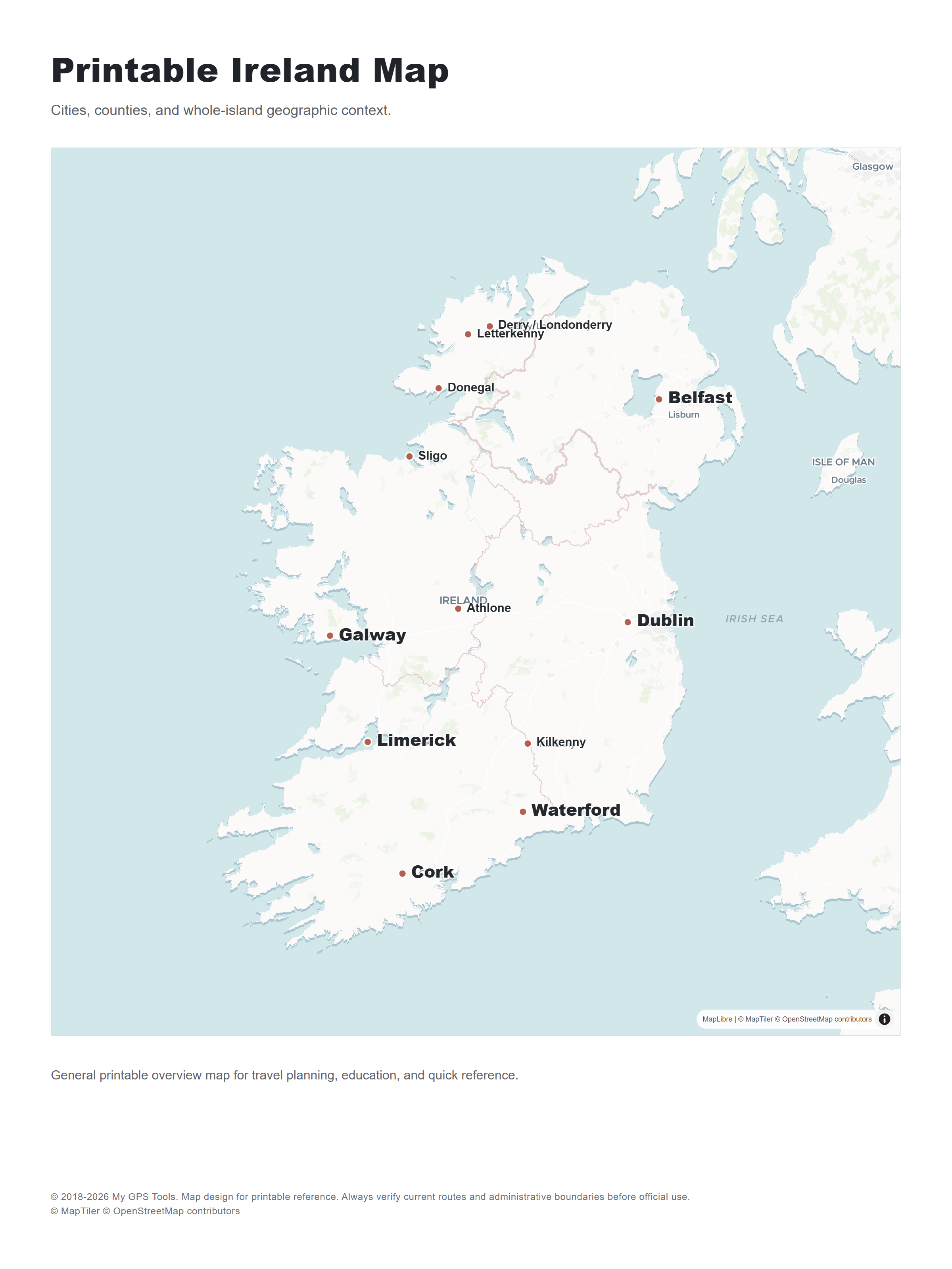
Table of contents
Ireland map searches can mean several different things: a map of the Republic of Ireland, a map of the whole island including Northern Ireland, a county map, a road map, or a printable map for school and travel planning. This guide helps you choose the right Ireland map format and gives you clean, printable PNG maps for cities, counties, provinces, roads, tourist regions, blank worksheets, and physical geography reference.
Best Ireland map types to use
| Map type | Best for | What to check |
|---|---|---|
| Ireland map with cities | General orientation, presentations, trip planning | Dublin, Cork, Galway, Limerick, Waterford, Belfast, Kilkenny, Sligo |
| Ireland county map | Counties, genealogy, school geography, local government context | Whether the map shows all 32 traditional counties or only the Republic of Ireland |
| Printable Ireland map | Classroom handouts, offline travel, quick reference | Page size, label clarity, print scaling, source permissions |
| Ireland road map | Driving, scenic routes, ferry routes, airports | Motorways, national roads, towns, ports, airports |
| Tourist map of Ireland | Attractions, regions, scenic routes | Wild Atlantic Way, Ancient East, Hidden Heartlands, national parks |
| Blank outline map | Worksheets, labeling exercises, quizzes | County borders, province labels, coastline detail |
| Physical map | Terrain, uplands, lakes, coastline | Whether the map shows relief, lowlands, mountain regions, and major water features |
If you only need one general-purpose map, choose a map of Ireland with cities and counties. It covers the main search intent behind “map of Ireland,” “Ireland map,” “map of Ireland with cities,” and “map of Ireland counties” without becoming too detailed for printing.
Printable map of Ireland: PNG download options
A printable Ireland map should be easy to read on a normal page, not just accurate on screen. Before downloading or printing, look at whether the source gives a high-resolution image, a PDF, or only an interactive web map. For this page, the maps are provided as PNG files first. PDF generation can be handled later from the same PNG images in Next.js.
Good printable Ireland map options include these formats:
- Labeled country map for quick reference and presentations.
- Cities and towns map for travel planning or orientation.
- County map for administrative, genealogy, classroom, or regional work.
- Province map for explaining Leinster, Munster, Connacht, and Ulster.
- Road map for driving and route planning.
- Blank outline map for school worksheets and map-labeling activities.
- Tourist map for scenic routes, visitor regions, and attractions.
- Physical map for terrain and elevation context.
Many map sources are free to view for personal reference, classroom preparation, or trip planning, but free viewing does not always mean free reuse. When a source does not clearly state usage rights, treat the map as personal-reference material only. For classroom distribution, commercial printing, apps, or republishing, always check the original source terms.
My GPS Tools printable Ireland map downloads
| Map | Full-size PNG |
|---|---|
| Printable Ireland map preview | Open PNG |
| Ireland map with cities and towns | Open PNG |
| Ireland county map | Open PNG |
| Ireland provinces map | Open PNG |
| Republic of Ireland map | Open PNG |
| Detailed Republic of Ireland map | Open PNG |
| Road map of Ireland | Open PNG |
| Tourist map of Ireland | Open PNG |
| Blank outline map of Ireland | Open PNG |
| Physical map of Ireland | Open PNG |
Map of Ireland with cities and towns
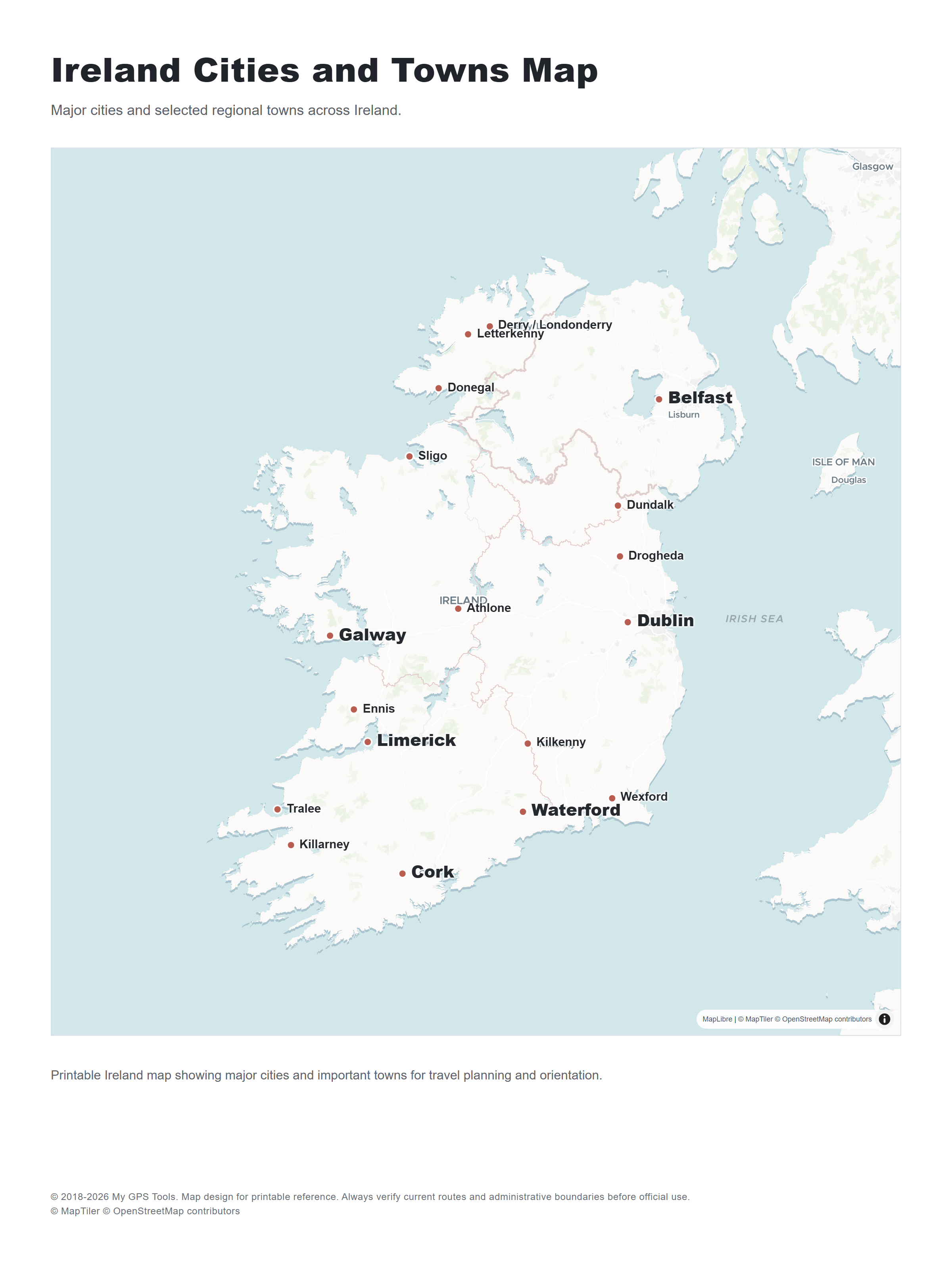
A useful map of Ireland with towns and cities should clearly label Dublin, Cork, Galway, Limerick, Waterford, Kilkenny, Sligo, Athlone, Killarney, Tralee, Drogheda, Dundalk, Wexford, Letterkenny, and other regional towns. If the map is for travel, choose one that also shows roads, airports, ferry ports, coastal regions, and nearby islands.
For a quick country overview, a simple city map works better than a dense topographic map. For road trips, however, city labels alone are not enough. You will want major roads, national routes, ferry connections, and route context between Dublin, Cork, Galway, Limerick, Waterford, Belfast, and the Atlantic coast.
Ireland county map: counties, provinces, and local government areas
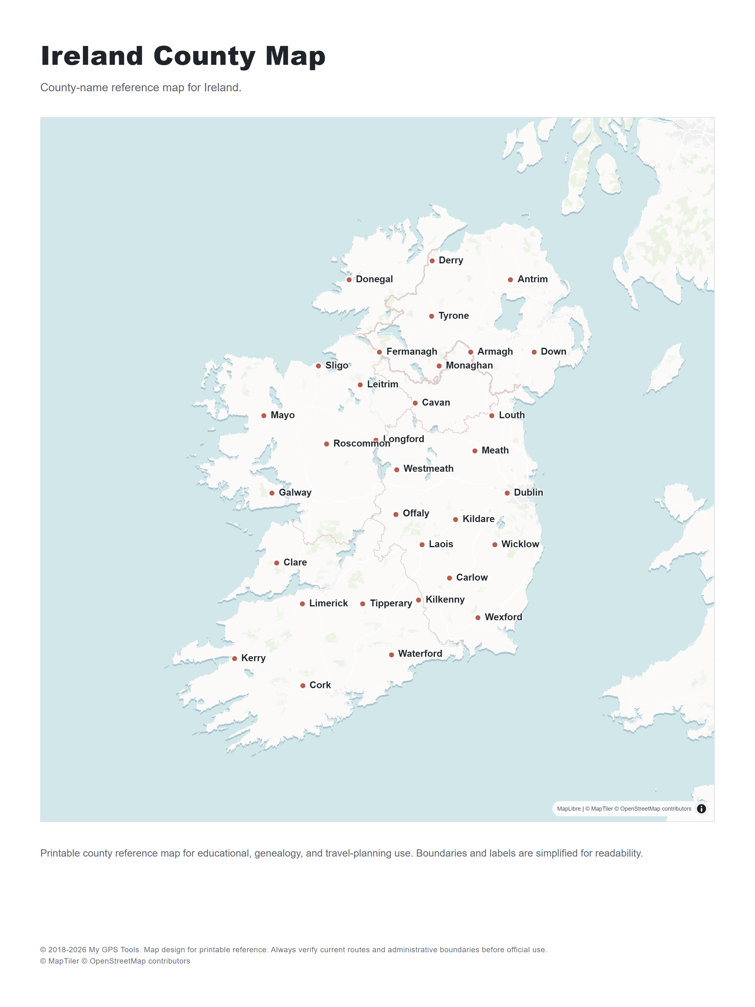
A county map of Ireland is useful for genealogy, school geography, administrative reference, local history, and regional planning. Traditional county maps often show the 32 historic counties across the island of Ireland. Modern Republic of Ireland administrative maps may instead focus on current local government areas, which can differ from the older county layout.
If you need a county map for research, confirm that it shows:
- the Republic of Ireland only;
- the whole island of Ireland;
- all 32 traditional counties;
- modern local government areas;
- provinces such as Leinster, Munster, Connacht, and Ulster.
Ireland provinces map
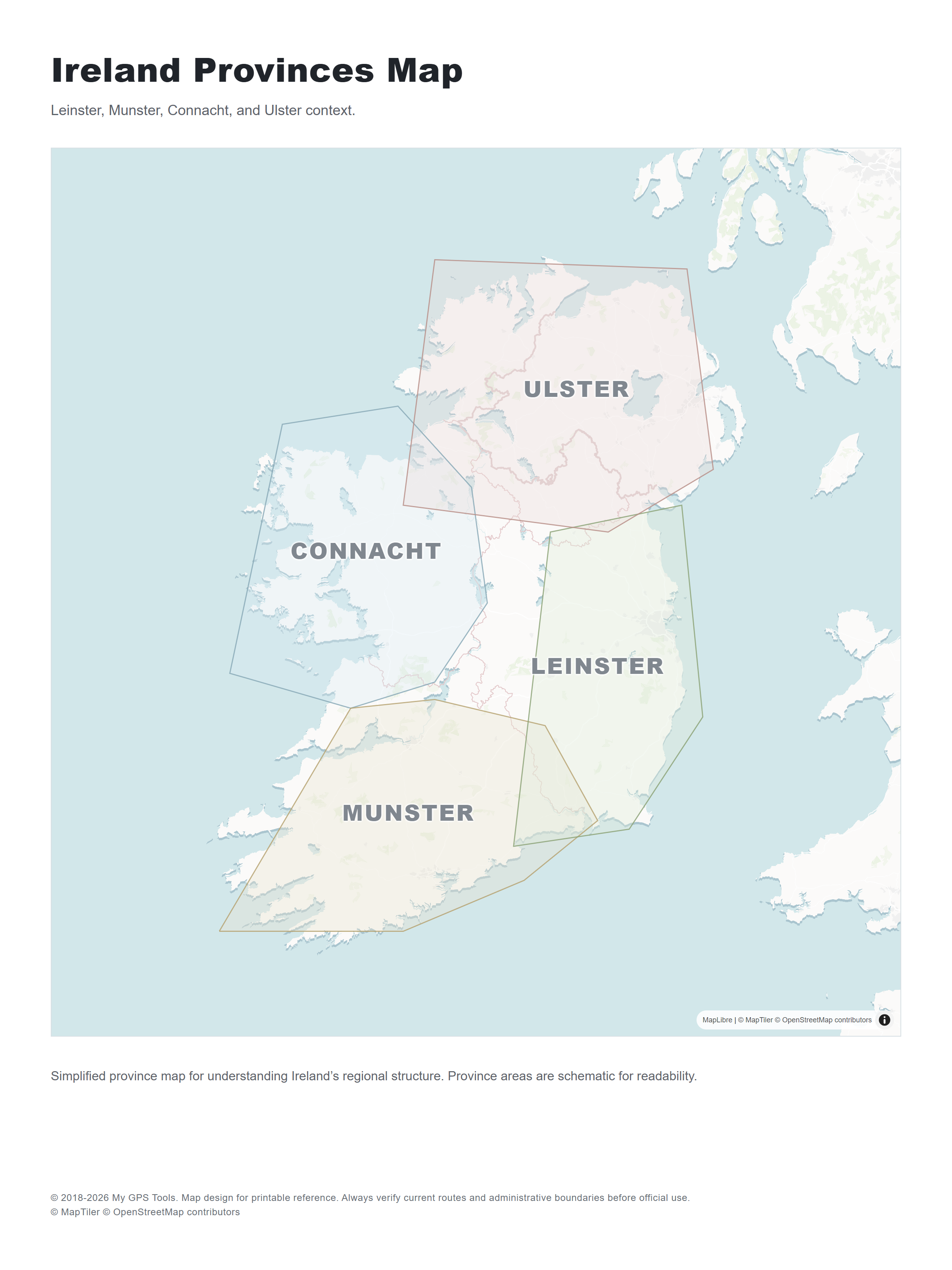
Ireland is traditionally divided into four provinces: Leinster, Munster, Connacht, and Ulster. Province maps are useful when county maps feel too detailed, especially for classroom explanations, historical context, or quick regional orientation.
Leinster province
Leinster is the province most visitors meet first because it includes Dublin, the main airport gateway, and much of Ireland’s east-coast population corridor. County maps place Carlow, Dublin, Kildare, Kilkenny, Laois, Longford, Louth, Meath, Offaly, Westmeath, Wexford, and Wicklow here.
Munster province
Munster is the largest province by area and the one many travelers associate with the south and southwest: Cork airport, the Ring of Kerry, the Cliffs of Moher, Waterford, Limerick, and long Atlantic stretches all fall here. County maps group Clare, Cork, Kerry, Limerick, Tipperary, and Waterford in Munster.
Connacht province
Connacht is the compact western province to look for when a map is focused on Galway, Mayo, Sligo, the Atlantic coast, or routes into the west of Ireland. It contains Galway, Leitrim, Mayo, Roscommon, and Sligo.
Ulster context
A whole-island map may show the nine counties of Ulster. A Republic of Ireland map normally highlights Cavan, Donegal, and Monaghan, because the other six Ulster counties are in Northern Ireland. This is the province where map scope matters most for school work, genealogy, and county reference.
Republic of Ireland map
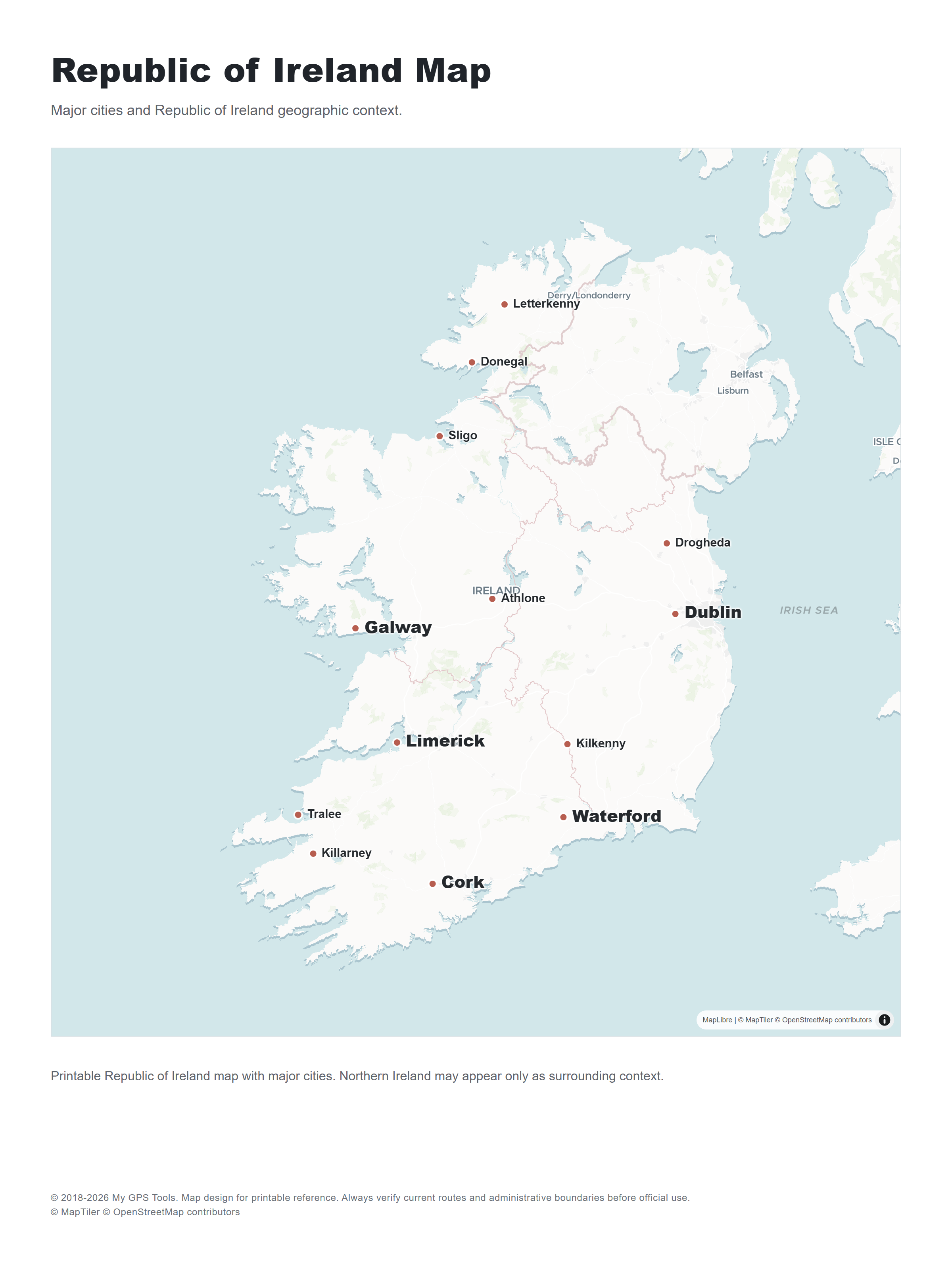
Some maps show only the Republic of Ireland. Others show the whole island, including Northern Ireland. People searching for “Ireland map” may expect the full island, while “Republic of Ireland map” normally means the state only.
For travel planning, a whole-island map can be more practical because routes, airports, ferry links, and cities such as Belfast and Derry/Londonderry may be relevant. For official administrative work, school assignments, or government context, choose a source that clearly explains whether it covers the Republic of Ireland, Northern Ireland, or the full island.
Detailed Republic of Ireland map
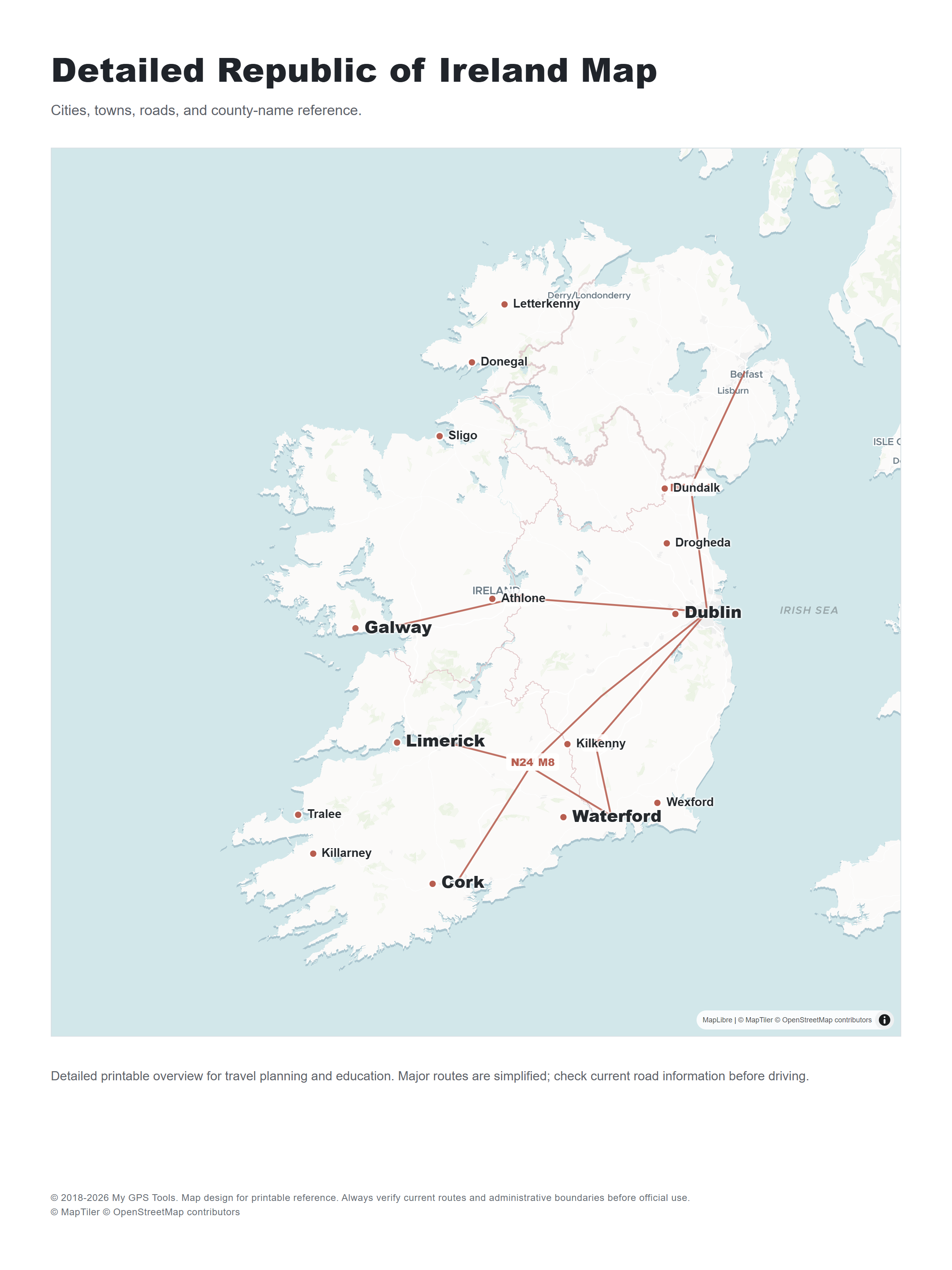
A detailed Republic of Ireland map is useful when you need cities, towns, road context, and county-name reference in one printable view. Keep the layout readable: if the map becomes too crowded, use separate road, county, and physical maps instead of forcing every layer into one image.
Road map of Ireland

Road maps are useful when the printable map is meant for travel planning rather than classroom or administrative reference. Use a road map when you need route context between Dublin, Cork, Galway, Limerick, Waterford, Belfast, ferry ports, and western coastal regions.
Tourist map of Ireland
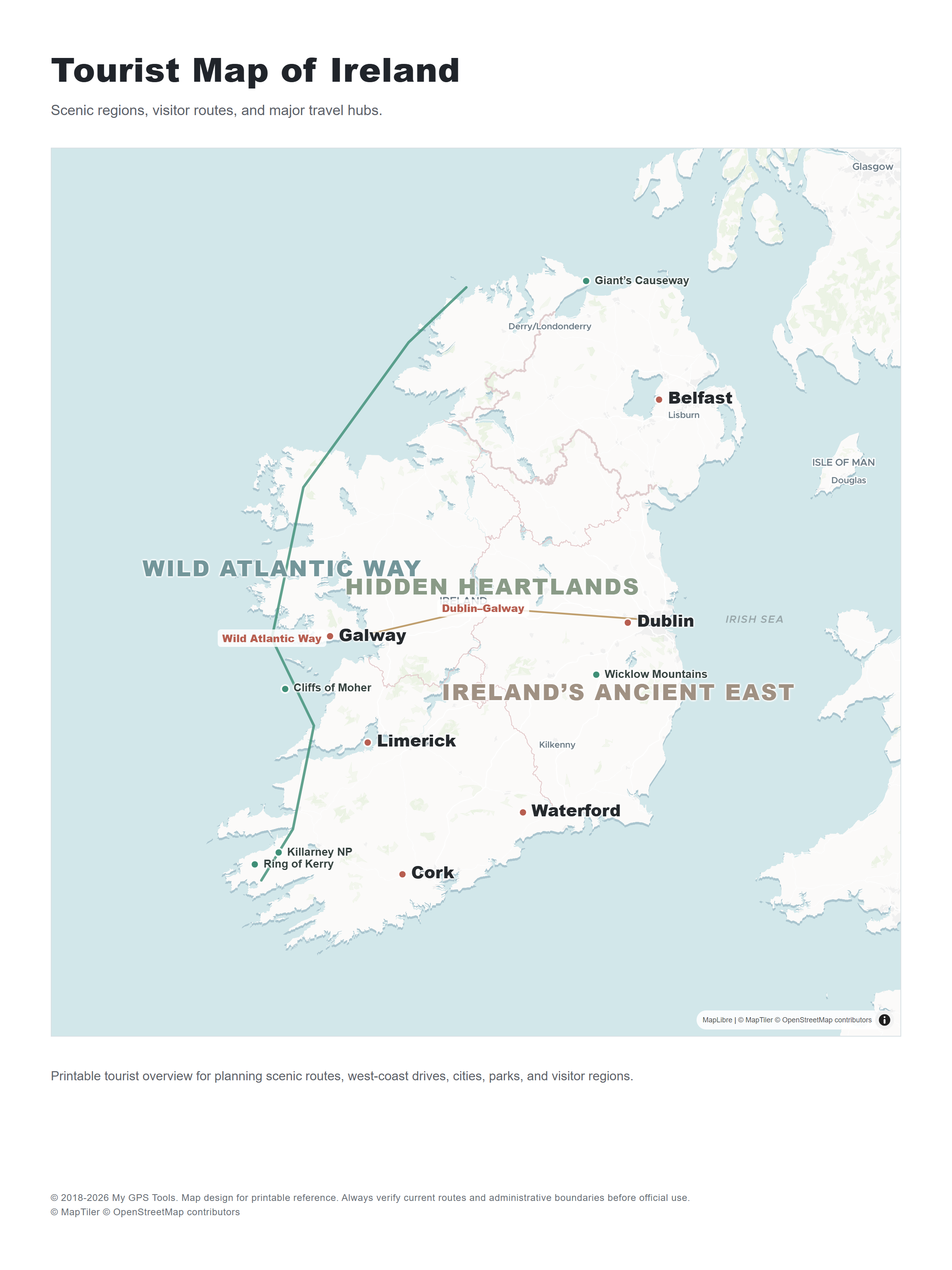
Tourist maps of Ireland should highlight scenic routes, visitor regions, major attractions, coastal drives, and city connections. The Wild Atlantic Way, Ring of Kerry, Ireland’s Ancient East, and other regional routes are easier to plan when the map shows both roads and visitor context.
For a printed trip plan, use a tourist overview map for the whole journey and city-specific or road-detail maps for each day of travel.
Blank outline map of Ireland
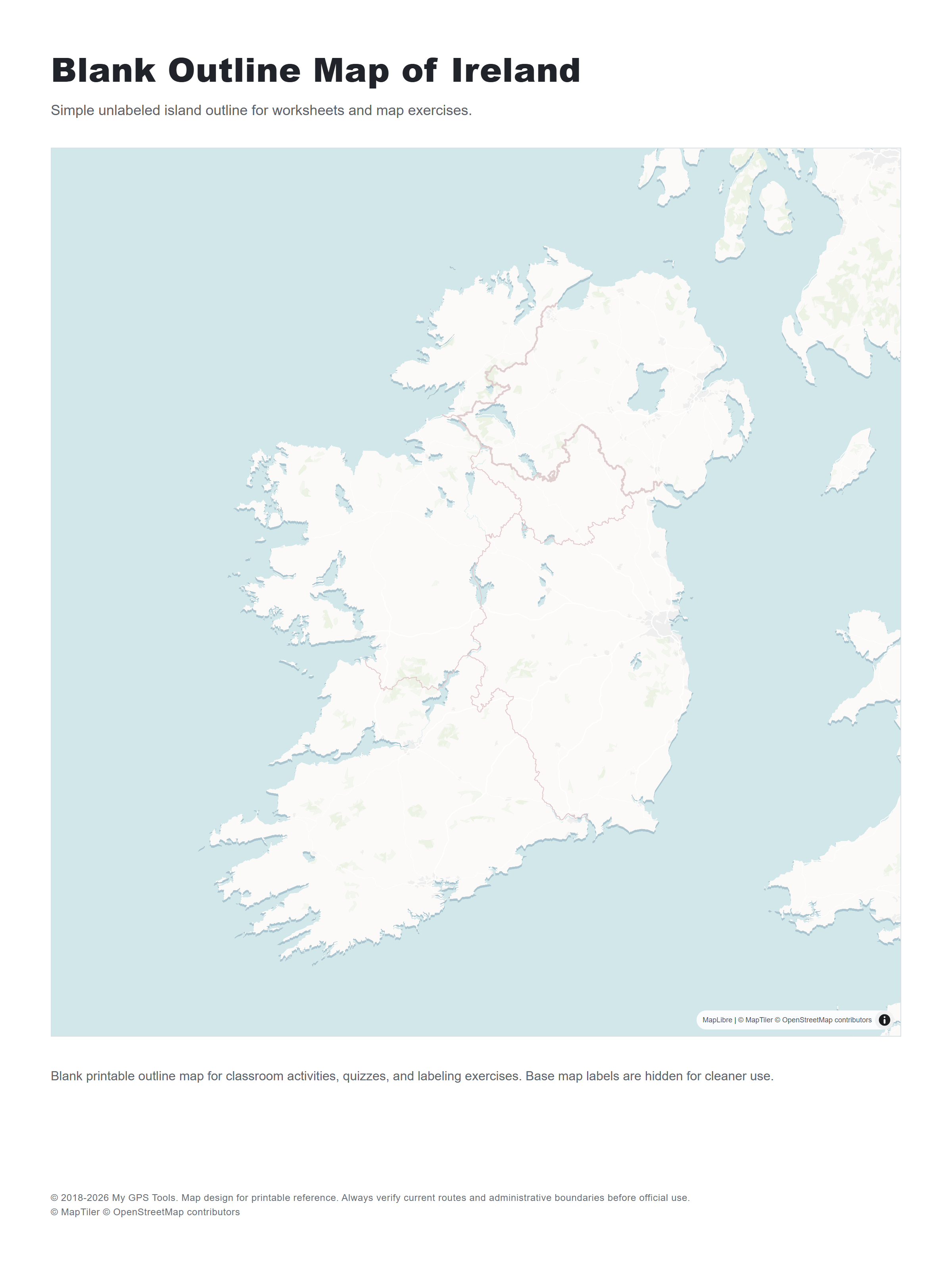
A blank outline map of Ireland is useful for worksheets, labeling exercises, quizzes, and classroom activities. It is usually a better choice for students than a crowded road map or a dense GIS export.
Physical map of Ireland
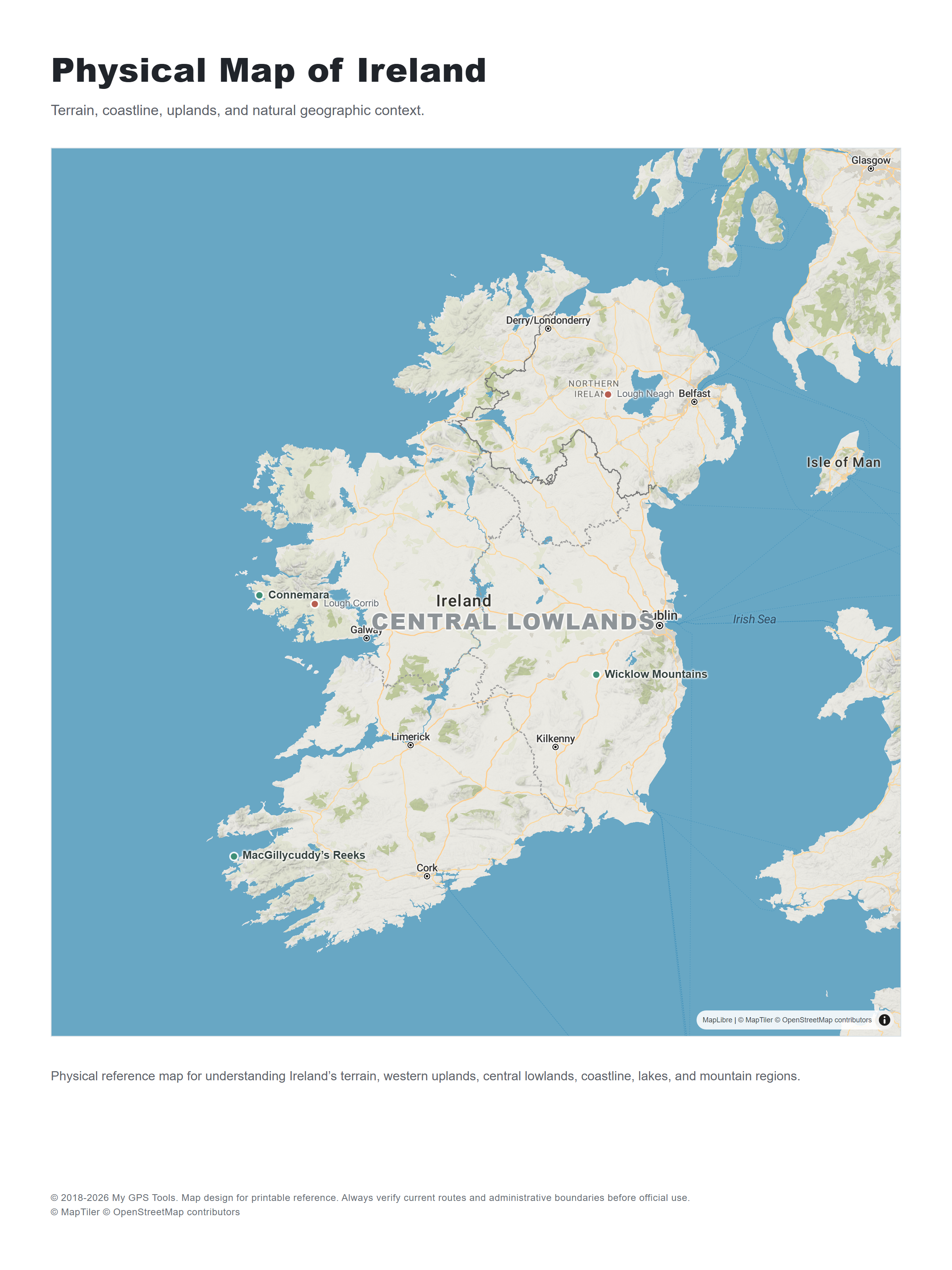
Physical and topographic maps are useful when you need more than a simple country outline. They help with terrain, hiking context, geology, environmental planning, and understanding the difference between Ireland’s central lowlands, western mountain regions, and coastal landscapes.
Interactive official map viewers are better for detailed research than for simple printing. If you need a handout, export or print only the area and layers you need, then test readability on paper before using it in class or in a printed travel pack.
Historical and townland maps
Irish Townland and Historical Map Viewer
Historical and townland maps are especially useful for genealogy, local history, and research into older boundaries. They can show historic editions, townlands, old roads, settlements, and landscape features that may not appear on a modern road map.
If you are researching family history, use a county map for orientation first, then move to townland or historic map layers for local detail.
Best sources for printable Ireland maps
| Source | Map type | Format | Best for |
|---|---|---|---|
| Tailte Г‰ireann / GeoHive map viewers | Official mapping and geographic reference | Web | authoritative map context and national datasets |
| Irish Townland and Historical Map Viewer | Historical and townland maps | Web | genealogy, local history, historic boundaries |
| Irish Genealogy Toolkit | County map reference | Web / printable where available | county research and genealogy orientation |
| OpenStreetMap Ireland | Editable street and place map | Web | roads, towns, local context, custom views |
| Wikimedia / Wikipedia map resources | General reference maps | Image / web | quick orientation and presentation reference |
| Discover Ireland / Tourism Ireland resources | Tourist and regional maps | Web / PDF where available | visitor planning and scenic regions |
| Outdooractive Ireland routes | Scenic route maps | Web | road trips, outdoor travel, route planning |
Do not assume every map is free for reuse just because it is visible online. Some maps are suitable for personal printing but not for commercial reuse, redistribution, app use, or public materials. When in doubt, link to the source rather than copying the map image.
How to choose the right Ireland map
Choose the map based on the task. For a school worksheet, a blank outline map or labeled county map is usually best. For a road trip, use a road map with towns, ferry ports, airports, and major routes. For genealogy, start with a county map and then move to historic or townland maps. For a presentation, choose a simple cities-and-counties map that stays readable when projected or printed.
If a map is too detailed, it may look impressive on screen but fail on paper. Print one test page before relying on it for a classroom, travel folder, or public handout.
Printing tips for Ireland maps
- Print city-and-county maps in portrait orientation when possible; Ireland’s shape usually fits better vertically.
- Use high-resolution PNG or PDF sources when available because labels usually stay sharper than low-resolution screenshots.
- For classroom handouts, avoid dense road maps unless students need route detail.
- If printing a county map, confirm that it shows the Republic of Ireland only or the whole island.
- For tourist use, print a national overview plus separate maps for Dublin, the west coast, and any road-trip region.
- Keep license terms in mind before reusing a map in a public PDF, app, commercial product, or printed guide.
Practical uses for Ireland maps
Classroom and education
Teachers often need simple maps of Ireland with counties, provinces, major cities, and blank outlines for labeling activities. A simplified printable map is more useful than a high-detail GIS map.
Travel planning
Travelers need city names, roads, scenic routes, airports, ferry ports, and regional labels. A tourist map or road map is more practical than a purely political map.
Genealogy and local history
County maps, townland maps, and historic map viewers are useful for understanding older place names, traditional counties, and local boundaries. This is one area where a modern road map is not enough.
Presentations and quick reference
For slides or quick orientation, choose a clean map with limited labels. Too much road, terrain, or administrative detail can make the map hard to read at small sizes.
FAQ
What is the best printable map of Ireland?
For most users, the best printable map is a labeled map of Ireland with cities and counties. It gives enough detail for travel, education, and reference without becoming too crowded on a normal printed page.
Where can I find a map of Ireland with cities and counties?
Look for sources that explicitly show both major cities and county boundaries. General country maps often show cities but not counties, while county maps may omit smaller towns and roads.
What is the difference between a Republic of Ireland map and a map of Ireland?
A Republic of Ireland map shows the state only. A map of Ireland may show the whole island, including Northern Ireland. Always check the scope if you need counties, borders, or administrative detail.
How many counties are shown on a county map of Ireland?
Traditional all-island county maps show 32 counties. Maps focused only on the Republic of Ireland may show the counties and local government areas used within the state.
Can I download a free printable map of Ireland?
Yes, but check the source format and license. Some sources provide print-friendly PDFs, while others offer web maps or image files. Before reusing or distributing a map, check the source’s license and terms.
Can I print a map of Ireland that includes both the Republic and Northern Ireland?
Yes, but choose a whole-island Ireland map rather than a Republic-only map. This is the better option for all-island county reference, genealogy, routes that include Belfast or Derry/Londonderry, and classroom work where Northern Ireland should be visible.
What map should I use for travel in Ireland?
For travel, use a road or tourist map that shows major towns, roads, airports, ferry ports, scenic routes, and visitor regions. For city trips, add separate city maps for Dublin, Cork, Galway, or other stops.
What map should I use for school or classroom work?
Use a simple outline map, county map, or cities-and-counties map. These formats are easier to print and label than dense road maps or interactive GIS screenshots.
Does an Ireland county map include Northern Ireland?
Some do and some do not. Traditional all-island county maps include Northern Ireland. Republic-only administrative maps usually do not include the six Northern Ireland counties as part of the Republic’s administrative structure.
Related guides
More useful articles from the Map Tools & Printable Maps topic.
- Athlone Town Map
Download the official Athlone map and explore attractions, landmarks, and walking routes. Discover the best things to do in Athlone, Ireland's hidden gem
- Ballina Town Map
Download the official Ballina map and explore attractions, landmarks, and walking routes. Discover the best things to do in Ballina, Ireland's hidden gem.
- Arkansas Map with Cities, Counties and Roads
Explore Arkansas maps with cities, towns, counties, highways, regions, and a blank outline map. Use these printable-style reference maps for travel planning, school projects, county research, and quick geographic orientation.
- Map of Iowa with Cities, Counties and Roads
Explore maps of Iowa with cities, counties, major roads, interstates, and a blank outline map. Use these reference maps for travel planning, school projects, and quick geographic orientation.
- Kentucky Map with Cities, Counties and Highways
Explore maps of Kentucky with cities, counties, highways, interstates, and a blank outline map. Use these reference maps for travel planning, school projects, and quick geographic orientation.
About MyGpsTools Editorial Team
MyGpsTools publishes practical guides about GPS apps, maps, navigation tools, EXIF photo metadata, satellite imagery, Android Auto, Apple CarPlay, ZIP code maps, and location-based technologies. We focus on clear instructions, practical checks, official documentation, and reader feedback.