How Often Does Google Earth and Google Maps Update Satellite Images?
Find out how often Google Maps and Google Earth update satellite images, why some areas stay old for years, and how to check the date of a Google Earth image.
Quick Answer
Google Maps does not update satellite imagery on a fixed public schedule, and regular users usually can’t see an exact refresh date inside the Maps app. In practice, newer imagery shows up more often in busy urban areas and much less often in rural or remote places.
If you want the date of a satellite image, Google Earth desktop is usually the easiest place to check. Even then, the date depends on the location, and some areas can be months or years behind.
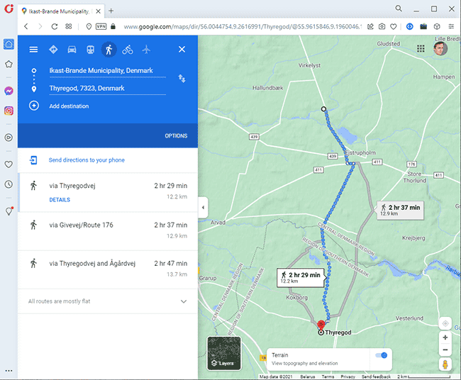
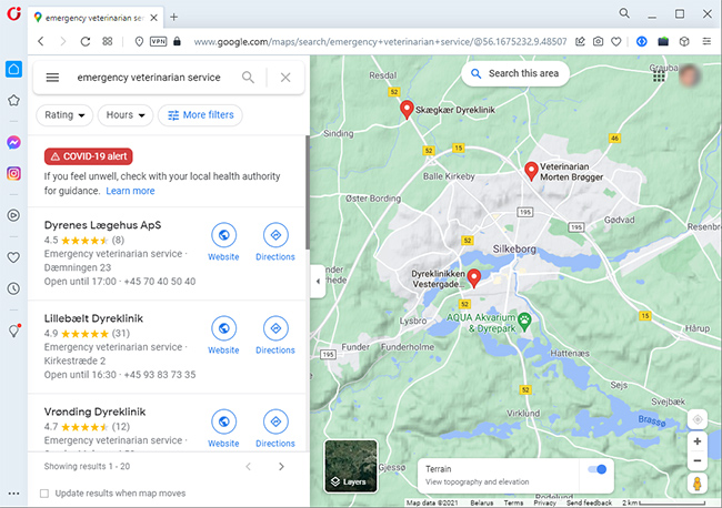
Using the Google Maps Toolkit, you can view and customize maps by adjusting their details. The service also allows you to switch between the Satellite and "Map" modes which makes it easier to focus on objects.
In this article, we'll explain how often Google Earth updates, how frequently Google Maps satellite images are refreshed, and how to check whether the data is current. The short version: map labels and traffic data change often, but satellite imagery usually does not.
Table of contents
The information on maps can become out-of-date quite fast. That’s especially true for satellite images, which often lag behind real-world changes like new construction, road work, or demolished buildings.
Google Earth Update Guide: Read here
How Often Does Google Maps Update?
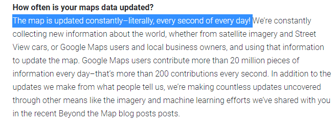
Google updates parts of Maps data continuously, but not all of it at the same pace. Business listings, traffic, reviews, and other map details can change frequently, while satellite imagery is updated much less often.
The main issue for most users is older satellite imagery, especially outside major cities. If you’re checking a house, a road, or a piece of land, the image you see may be months or even years old.
Related topic: How much data does Google Maps use on iPhone?
How Often are Google Maps Updated?
Google has said that some map data updates happen very frequently, including traffic and certain place details. That does not mean the satellite layer refreshes that often.
The practical update rhythm for satellite imagery varies a lot by location. In busy areas, new imagery may appear within months. In quiet or remote places, it can stay unchanged for several years.
How Often is Google Maps Satellite View Updated?
First, let's define what satellite images are. In Google Maps and Google Earth, the satellite layer is usually made from aerial and satellite photography, not from a live camera feed.
This is the part people usually want a straight answer on: there is no single worldwide timetable. Satellite imagery updates depend on where you are, how often the area changes, and how new imagery becomes available to Google.
This is what one Quora user writes about Google Earth update frequency:
I've checked out images from various places in Italy, the U.S. I know all these places to the smallest detail, and so I can notice that not all images have changed. Some satellite images haven't been updated in 5 years. Neighbors who live in my town rebuilt the house a long time ago, and on Google Maps it's been frozen in the past for 5 years.
That kind of complaint is common for a reason. Even when a map app feels current, the aerial image underneath can be old.
When Does Google Maps Update Satellite Images?
Satellite imagery tends to be refreshed more often in cities and places that change a lot. Less populated areas usually keep the same imagery much longer.
So the real answer to “how often does Google Maps update satellite images?” is: it depends. Some locations may be updated within months, while others can stay unchanged for years.
It’s safer to think in ranges rather than one universal schedule:
- Busy urban areas: often updated more often
- Suburbs and mixed-use areas: sometimes updated, but not predictably
- Rural or remote areas: updates can be rare
When Will Google Maps Update My House?
If you're wondering when Google Maps will update your house, there isn’t a way to request a guaranteed refresh for a single address.
Several things affect whether your area gets updated sooner:
- Your location
- How fast the area changes
- Population density
- Whether the area matters for navigation or public use
For most residential areas in cities, imagery may refresh every 1–3 years. Rural areas can take longer, and some locations go much longer than that.
Where the Google Maps Service Gets Its Updates From
Google uses multiple sources to keep Maps and Earth current:
- Data received from satellites
- Aerial photos and snapshots
- Information provided by Google Maps users
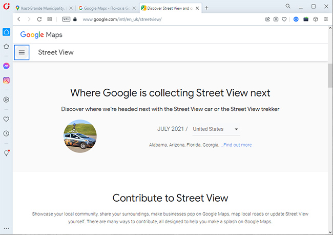
- Pictures of the area taken by Google employees (Google Street View project)
Google also draws from public and commercial data sources, including surveys and local information where available. That’s why different layers in Maps can update at different times.
Do Maps Change in Realtime?
Usually, no. Satellite imagery is not a real-time view.
Some map layers can update quickly, such as traffic, road closures, emergency information, or major event-related notices. But that’s not the same as fresh satellite imagery.
So if you're asking “are Google Maps updated often?” the answer is yes for some map data, but not for satellite photos. Those usually change on a slower schedule.
How to Find Out When Google Earth Update Occurred
You usually can’t see the satellite date inside the standard Google Maps app.
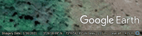
Google Earth desktop is the better option if you want the date of the image for a specific place. Open the location, and the date of the satellite photo appears in the status bar.

That’s the most practical way to check when a satellite image was captured.
Google Earth Update Schedule
Google Earth Pro is available on desktop and can show the date of the image for a location.
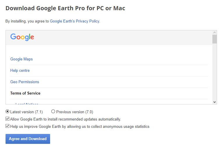
- Download and install Google Earth desktop version
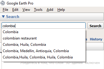
- Place the cursor in the search bar by opening the sidebar
- Enter the name of the required location and press Enter
- Wait for the location to open
- The status bar will display the date when that satellite photo was taken.
How Often Are Google Earth Images Updated Compared to Other Providers?
While we've discussed Google Earth and Google Maps update frequency, you might wonder how this compares to other providers:
Apple Maps Satellite Update Frequency
How often does Apple Maps update satellite images? Apple doesn’t publish a simple public schedule, and the imagery date isn’t always easy to check. In practice, it can be similar to Google in some places, but the timing varies by region.
Snap Map and Life360 Satellite Updates
How often does Snap Map update satellite images? Snap Map and Life360 often rely on third-party map data, so update timing depends on those providers. In many areas, the imagery may be less current than Google Earth, but it varies by region and app version.
How Up to Date is Google Earth?
Google Earth imagery can be fairly current in some places and badly dated in others. There’s no single global refresh cycle.
A practical way to think about it:
- Major cities: imagery is often newer
- Suburban areas: usually somewhere in the middle
- Rural or remote areas: often older
When will Google Earth update again? There’s no public schedule you can rely on for a specific address.
FAQ
How often does Google Maps take a picture of my house?
There isn’t a fixed schedule for a single house. In cities, the imagery may update every few years, while rural homes can stay on older imagery much longer.
How do you know the exact date of the last Google Maps update?
Google Maps usually doesn’t show the satellite photo date directly. Google Earth desktop is the easiest place to check the capture date for a location.
Are Google Maps updated often?
Some parts of Google Maps update frequently, especially traffic and business data. Satellite imagery updates much less often.
Why are some maps not updated frequently in Google Maps?
Usually because the area doesn’t change much, or because newer imagery hasn’t been added yet. Remote places tend to lag behind cities.
Is Street View updated with the same frequency as Google Maps?
No. Street View and satellite imagery follow different update cycles, and both depend on location. Busy cities tend to be refreshed more often than smaller towns.
How often do Google Earth and Google Maps update compared to each other?
For satellite imagery, they often use the same underlying data in many places, so the timing is similar. The exact date still depends on the location.
Can I request Google to update my area?
Not directly for satellite imagery. You can suggest map edits for place details, but that doesn’t force a new satellite photo.
Conclusion
If you’re trying to find the exact answer to “how often are Google Maps updated?”, the honest version is that there’s no fixed global schedule for satellite images. Some areas are refreshed often, others stay unchanged for years.
If you need the date of a specific image, Google Earth desktop is the most useful place to check. For everyday navigation, though, the map labels, traffic, and place data usually matter more than the age of the aerial photo.
Related guides
More useful articles from the Satellite Imagery & Google Earth topic.
- Best High-Resolution Satellite Imagery
Compare free and paid satellite imagery platforms in 2026. Learn the differences between Google Earth, Maxar, Airbus, Sentinel Hub, and USGS EarthExplorer. Find out which service offers the resolution, update frequency, and features you actually need.
- How Old Is Google Earth Imagery?
Learn how often Google Earth imagery updates, why image age varies by city or region, how to check the capture date, and when to use more current satellite imagery tools.
- Live Satellite View of Your House
Learn what live satellite view really means in 2026, which tools show recent or near-real-time imagery, and why true live views of a house are not available to regular users.
- What Are the Best Google Earth Alternatives? [2026 Guide]
15 powerful Google Earth alternatives for 2026. Expert-reviewed satellite imagery tools, real-time mapping, and GIS solutions for professionals and casual users.
- How to Fix Google Earth Not Working or Won’t Load Issues: Complete Troubleshooting Guide
Practical fixes for Google Earth when it won’t load, keeps crashing, or runs slowly on desktop, web, iPad, and mobile.
About MyGpsTools Editorial Team
MyGpsTools publishes practical guides about GPS apps, maps, navigation tools, EXIF photo metadata, satellite imagery, Android Auto, Apple CarPlay, ZIP code maps, and location-based technologies. We focus on clear instructions, practical checks, official documentation, and reader feedback.