Live Satellite View of Your House
Learn what live satellite view really means in 2026, which tools show recent or near-real-time imagery, and why true live views of a house are not available to regular users.
If you're trying to see your house on a live satellite view, the short answer is this: true live satellite imagery of a specific home isn't available to regular users. What you can get instead is a mix of recent satellite photos (days to months old), aerial imagery, Street View-style panoramas, and in some cases weather or disaster maps that update very frequently.
For most people, Google Earth, Google Maps, Zoom Earth, and Bing Maps are the first places to check. If you want newer commercial imagery and don't mind paying, SkyFi is the clearest paid option. If your real goal is "what does my house look like right now?", that's usually better handled by Street View or Live View-style tools, not satellite feeds.
Quick Answer
You can't reliably pull up a truly live satellite image of your house on demand. Most services show recent imagery that may be days, weeks, or even months old, depending on the area and provider.
If you want the closest thing to current imagery, start with Google Earth, Zoom Earth, and Bing Maps. For newer commercial satellite imagery, SkyFi is worth a look. For weather, fire, cloud, and storm tracking, NASA Worldview and Zoom Earth update much more frequently than residential satellite maps.
Table of contents
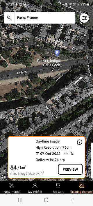
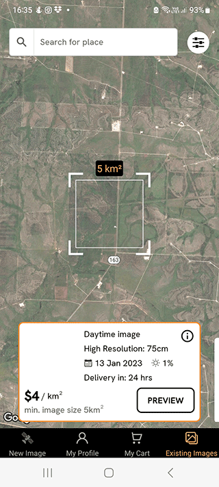
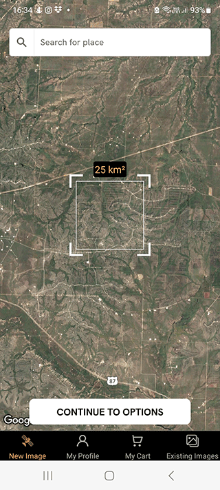
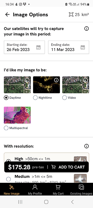
SkyFi: On-Demand Satellite Imagery of Your Property
SkyFi gives you access to high-resolution satellite imagery worldwide. It's one of the few services here that can actually get close to the "I need a fresh image of this place" use case, even though it still isn't live in the streaming sense.
Service features:
- Download existing satellite images of your house in specified format, area, and custom resolution.
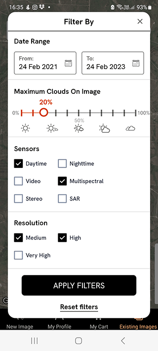
- Request fresh satellite imagery on demand, specifying preferred date, cloud cover tolerance, and retry options.
- Access hard-to-reach destinations and unpopular places not available on Google Maps/Earth.
- Use the service via web platform or Android/iOS mobile app.
For a comprehensive list of features, visit the official website.
SkyFi is aimed at people who need satellite imagery for research, site checks, or small business work, not just casual map browsing.
Pros:
- High-resolution satellite images (up to 50 cm), which can be sharper than Google Earth in some areas.
- User-friendly app interface with coordinate search for finding your property.
- Prices start at $20 for a single existing image.
- Access to multiple data sources: 80 satellites and 25 partner companies.
Download SkyFi app: Android | iOS
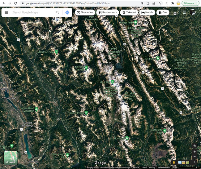
Google Earth: See Your House from Satellite
Google Earth is still the easiest place to start if you want to see your house from above. It's not live, and it's not always the newest image available, but it usually gives you a clearer residential view than weather-focused map tools.
Steps to View Your Home on Google Earth:
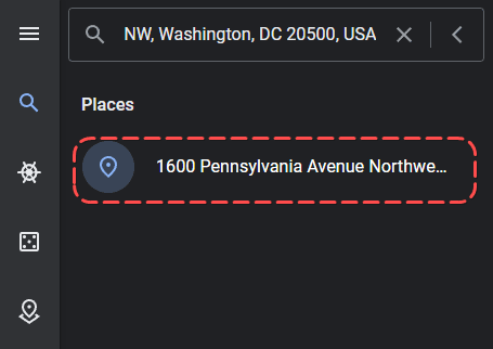
Step 1. Open the search bar in Google Earth (located on the left sidebar, magnifying glass icon).
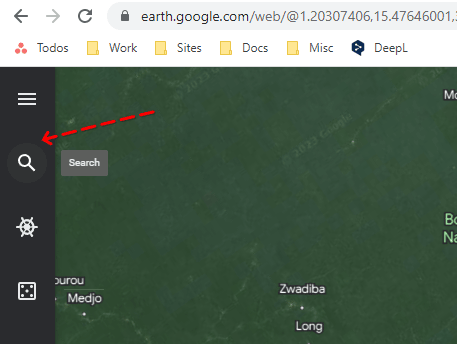
Step 2. Enter the address of your house in as much detail as possible, either by coordinates or name.
Step 3. Among the results, select the one that suits you.
Step 4. Move the Pegman icon as close as possible to your house or property.
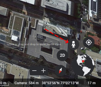
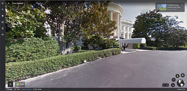
Step 5. Switch to "panorama" mode by dragging the human icon onto the globe image to see Street View-style imagery.
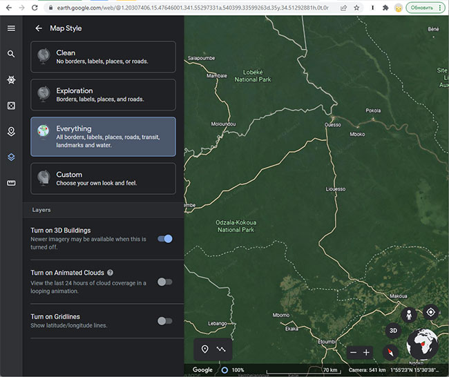
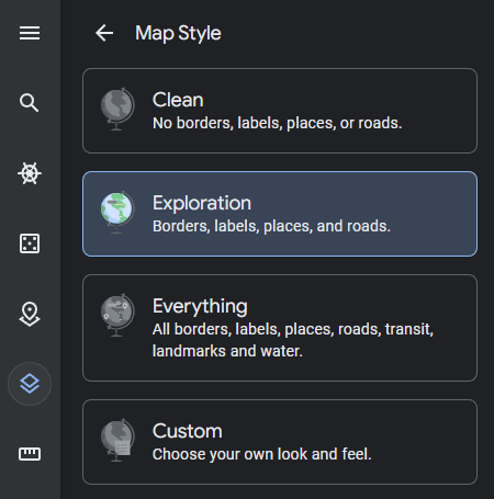
Step 6. Under "Map Style," choose from Clean, Exploration, Everything, or Custom mode for the best satellite view of your house.
Step 7. Adjust cloud animation, grid, 3D building representation, and use "ruler" mode to measure distances between objects on your property.

Step 8. Switch to 2D display mode by pressing the Exit button to return to satellite view.
Maps and satellite images are regularly updated, with the capture date shown on each photo. These are not live satellite feeds, but recent imagery.
Google Earth is better for exploring an area visually than for route planning. Google Maps handles directions more cleanly; Google Earth is more about the visuals.
Pros:
- Panoramic Street View images are available for many locations.
- You can find your city, street, or house by address or coordinates.
- Multiple viewing modes in both 3D and standard formats.
- Satellite photos are updated regularly, though Street View coverage varies by location.
NASA Worldview: Near-Real-Time Satellite Layers
NASA Worldview is built for observing Earth data, not residential close-ups. It's useful if you want current satellite layers for weather, smoke, storms, floods, or other large-scale events.
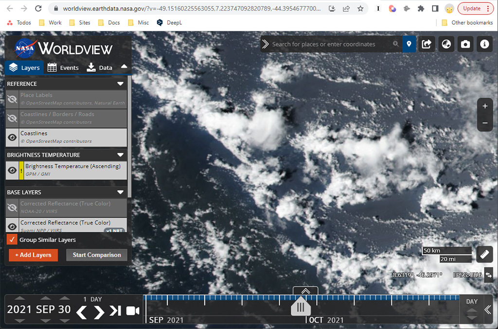
Update frequency: Popular satellite layers update multiple times daily, some within 1–2 hours, providing near-real-time data for weather and environmental monitoring.
Available Layers:
- Forest fires, floods, and other natural disasters.
- Images from geostationary meteorological satellites.
- Weather, cloud cover, pressure, and other meteorological indicators.
NASA Worldview works on desktop and mobile devices. The imagery is high-level — 1 pixel equals 300 meters — so it's not suitable for checking your house, driveway, or roof details.
Pros:
- Free access to satellite imagery.
- Large number of satellite layers and maps.
Cons:
- Low resolution; not suitable for viewing your house or property.
Google Maps: Satellite and Street View of Your House
Google Maps is the one most people already have on their phone. It's useful for location, navigation, and Street View, but it's not a true live satellite service for your house.
The Google Maps app includes satellite view plus many other features, such as:
- Creating a custom route.
- Searching for public places.
- Car navigation.
Google Maps is used by trackers, pedometers, and most GPS tools. Street View is often the part people really want when they say they want a "live" look at a house, but it still depends on where Google has coverage.
The app is designed for navigation first. It doesn't replace Google Earth, and it doesn't give you a true 3D satellite feed of your property.
Pros:
- A large variety of satellite maps for viewing your property.
- High accuracy of GPS positioning for finding your exact location.
- Convenient viewing of maps on almost any mobile device.
- Hybrid map display mode can make house outlines easier to read.
Cons:
- Limited Street View coverage in some areas.
- You cannot see truly live maps of your house.
How do you see your house on the map in near-real-time?
Use Live View, available on Android and iOS mobile devices. Here's how:
- Open the Google Maps app on your phone.
- In the search, enter your house address, street name, or zip code.
- Tap the Directions button.
- Select Walking as the travel mode.
- The Live View button appears at the bottom; tap it.
- You will see your house and surroundings in augmented reality if the option is available for that location.
View modes available:
Maps, terrain, traffic, transportation, biking, satellite.
Frequency of map updates:
Maps are updated frequently, but not all places are regularly photographed by Google cars to update Street View imagery of your property.
EarthNow! Landsat Image Viewer: Recent Satellite Images
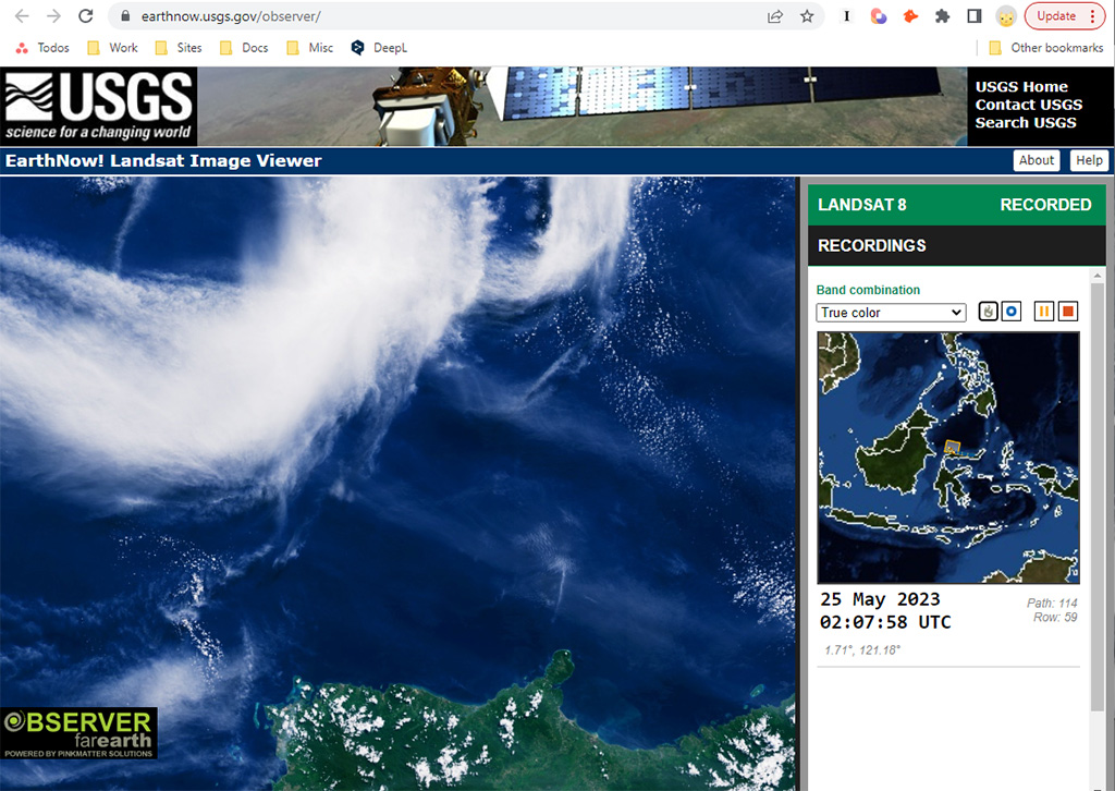
This service offers imagery sourced from Landsat 7 and Landsat 8 satellites, giving users access to free satellite views useful for broad earth observation. It's not a house-level tool, but it does provide recent images that can help you check large-scale changes.
The platform includes replay options and the ability to save results. You can also switch between true color and vegetation-focused views. That makes it more useful for land, environmental, or research work than for looking at a single home.
Pros:
- Access to recent satellite imagery of your location.
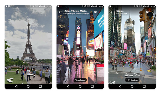
Live Street View app: Satellite and Street-Level Views
This app mixes satellite imagery, street-level views, and navigation tools. The "live" part should be taken loosely—it shows recent imagery, not true real-time feeds.
Key features:
- Explore Tourist Attractions: View major tourist attractions worldwide through detailed satellite imagery.
- View Points of Interest: Identify various points of interest on a satellite map.
- See Your House (Recent Imagery): View your own or others' houses using recent satellite and street-level imagery.
- Access Panoramic Street-Level Imagery: Immerse yourself in panoramic street-level views of different locations.
- View Satellite Information: Access satellite information enriching your understanding of geographical features.
Live Earth Map:
The Live Earth Map feature provides high-detail map rendering and a virtual walking experience within specific locations. The 3D panoramic view allows seamless navigation, and real-time traffic information is available in supported areas.
Viewing locations near your home:
Users can input their home address to access 360 panoramas of the surrounding area. While not all information may be available, you can observe traffic in your vicinity and explore nearby points of interest.
Zoom Earth: Free Recent Satellite and Weather Imagery
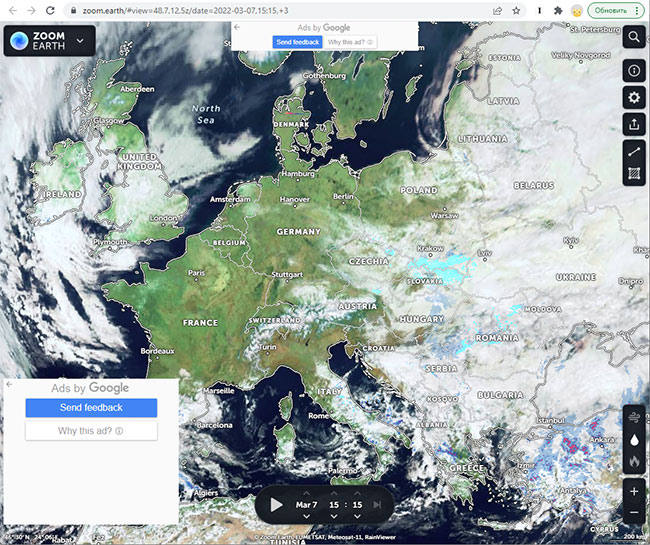
Zoom Earth is probably the closest free option in this list if your goal is current satellite and weather imagery. It's not trying to be a navigation app. It focuses on recent satellite views, radar, storms, fires, and related layers.
Basic functions:
- Viewing Modes: Choose from recent satellite, daily satellite, and base map options.
- Radar Displays: Rain radar, wind radar, forest fire animation, day/night line, and boundary lines.
- Settings Customization: Adjust time zone mode and format.
- Measurement Tools: Measure distance and area on your property.
- Storm Tracking: Real-time storm information, including name, forecast, and trajectory.
Can you find your city, street, or house?
While Zoom Earth is mostly used for weather tracking, it can also work as a simple way to check satellite maps for your city, street, or house. In many cases, the imagery is more useful for seeing conditions in a wider area than for zooming into a single roof.
Given frequent updates to satellite imagery, there's a decent chance your city or town has been mapped recently. Users can choose from HD satellite, recent mode, and standard aerial view options. Locations can be found through geolocation or by entering specific coordinates.
Map update frequency:
Satellite images are updated often, sometimes daily, which is why the platform feels more current than many residential map tools. That said, "daily" doesn't mean your house is being refreshed every day. It depends on the source imagery and the area you're checking.
Bing Maps: Alternative for Satellite Photos
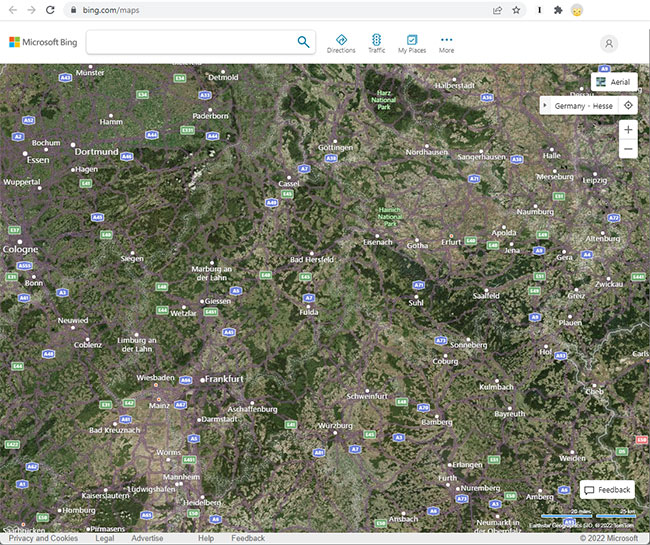
Bing Maps is simpler than Google Maps, and that's partly why some people prefer it for quick satellite checks. It doesn't have the same depth of place data, but the hybrid view can make property outlines easier to spot.
The app offers three viewing modes: standard maps, dark theme, and a hybrid mode that overlays maps onto satellite imagery. You can tap locations, zoom in and out, and search with coordinates or addresses.
One limitation is that address lookup can be patchy, especially for smaller streets or less documented areas. In those cases, coordinates often work better than a street address.
Locating Your City, Street, and House:
Yes, the app allows users to find their city, street, and house. However, addresses in some regions may not be recognized as well, so coordinates may give better results.
View Modes:
The app offers three primary view modes: Road, Dark Road for nighttime visibility, and Satellite Hybrid for a combination of maps and satellite imagery.
Frequency of Map Updates:
Map updates are infrequent, so the imagery may lag behind other services in some regions.
FAQ
What's the difference between "live," "near-real-time," and "recent" satellite imagery?
Live means streaming or on-demand capture, which isn't available for residential satellite imagery. Near-real-time means imagery updated within hours (like weather satellites). Recent means days to weeks old, which is what most residential satellite tools show.
How often are satellite images of my house updated on Google Earth?
There isn't one fixed schedule. Update timing depends on the area, image source, and how often that location is recaptured. Busy cities are often refreshed more frequently than rural areas, but you still shouldn't expect live imagery.
Can I request a satellite update for my property?
Sometimes, yes. In Google Earth, you can send feedback and request an update, but that doesn't guarantee the area will be refreshed soon. The request may never be acted on.
Can I see my house in real time from a satellite?
Not in the way most people mean "real time." Public satellite imagery is usually delayed by days to weeks. If you want the closest thing to current imagery, check weather-focused tools like Zoom Earth or NASA Worldview, or use Street View / Live View for ground-level context.
What is the best free app to see recent satellite views of my property?
For free tools, Google Earth is usually the best place to look for detailed residential imagery, while Zoom Earth is better for current weather and cloud movement. Neither gives you a true live feed of your house.
How can I get the most current satellite image of my house?
Check more than one service. Google Earth, Zoom Earth, and Bing Maps often pull from different image sources, so one may be newer than the others. If you need something fresher and specific, SkyFi is the paid option.
Why can't I find my house in some satellite tools?
Some tools are better at city-level or weather-level viewing than precise address lookup. If the address search fails, try coordinates instead. In some regions, coverage is also limited or outdated.
Is Google Maps Live View the same as satellite imagery?
No. Google Maps Live View uses augmented reality and your phone's camera to overlay directions and information onto the real world. It doesn't show a satellite feed of your home.
Related guides
More useful articles from the Satellite Imagery & Google Earth topic.
- Best High-Resolution Satellite Imagery
Compare free and paid satellite imagery platforms in 2026. Learn the differences between Google Earth, Maxar, Airbus, Sentinel Hub, and USGS EarthExplorer. Find out which service offers the resolution, update frequency, and features you actually need.
- How Old Is Google Earth Imagery?
Learn how often Google Earth imagery updates, why image age varies by city or region, how to check the capture date, and when to use more current satellite imagery tools.
- What Are the Best Google Earth Alternatives? [2026 Guide]
15 powerful Google Earth alternatives for 2026. Expert-reviewed satellite imagery tools, real-time mapping, and GIS solutions for professionals and casual users.
- How to Fix Google Earth Not Working or Won’t Load Issues: Complete Troubleshooting Guide
Practical fixes for Google Earth when it won’t load, keeps crashing, or runs slowly on desktop, web, iPad, and mobile.
- How Often Does Google Earth and Google Maps Update Satellite Images?
Find out how often Google Maps and Google Earth update satellite images, why some areas stay old for years, and how to check the date of a Google Earth image.
About MyGpsTools Editorial Team
MyGpsTools publishes practical guides about GPS apps, maps, navigation tools, EXIF photo metadata, satellite imagery, Android Auto, Apple CarPlay, ZIP code maps, and location-based technologies. We focus on clear instructions, practical checks, official documentation, and reader feedback.