Columbus ZIP Code Map
Search 45 Columbus, Ohio ZIP codes by local area, Franklin County postal place, ZIP type, or coordinates. Includes printable maps for North, South, East, and West Columbus.
Columbus ZIP Codes at a Glance
Columbus, OH has 45 ZIP entries covering Downtown, Ohio State University, Short North, German Village, Franklinton, Clintonville, Easton, and southeast industrial areas. These postal-place records are associated with Franklin County. Nearby suburbs like Dublin, Westerville, Grove City, Hilliard, Gahanna, and Reynoldsburg use separate postal-place rows, so verify suburban addresses with a complete street address.
About ZIP codes in Columbus
Columbus is Ohio's largest city and a major hub for education, government, and business. ZIP code lookup is essential for campus mail, downtown offices, state buildings, delivery routing, real estate searches, and service-area planning. A Columbus address may sit near Downtown, the Arena District, Short North, Ohio State University, Clintonville, German Village, Franklinton, Easton, or the far north side. Use this page as a citywide reference, then confirm the final ZIP with a complete street address.
How to Use This ZIP Code Map
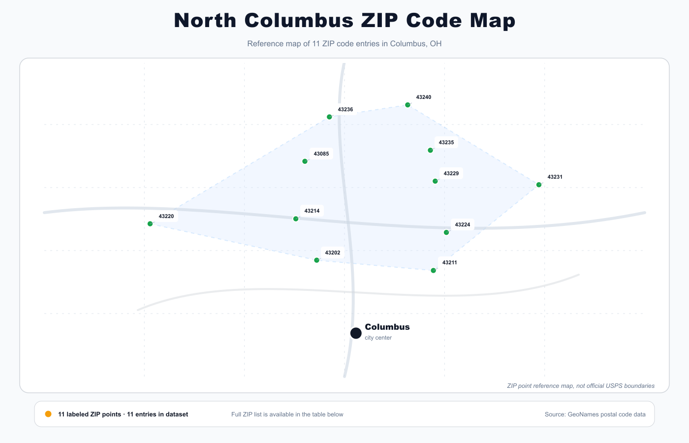
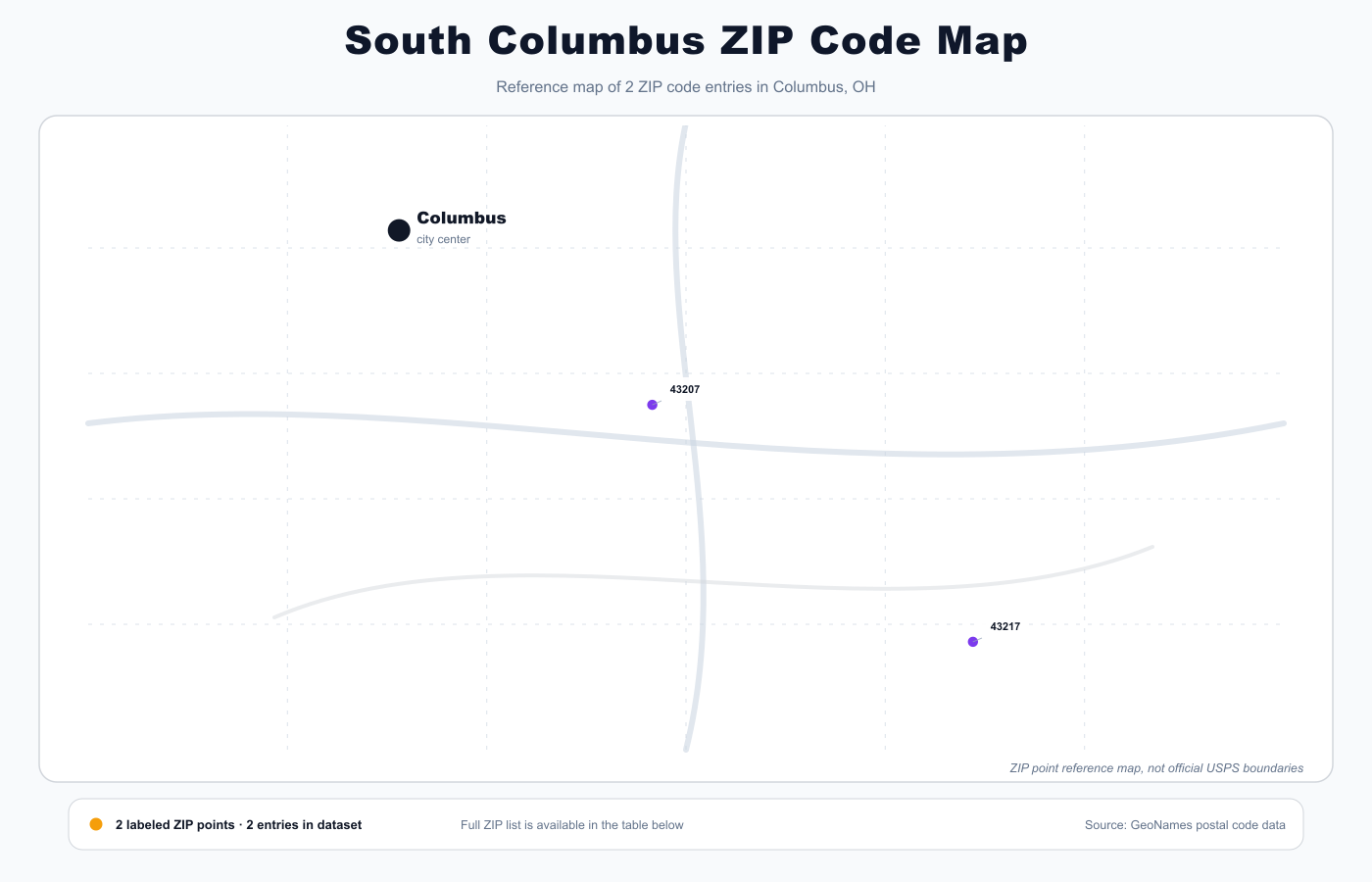
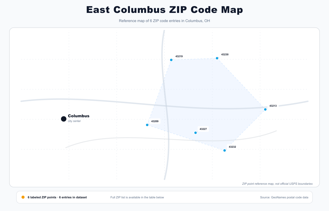
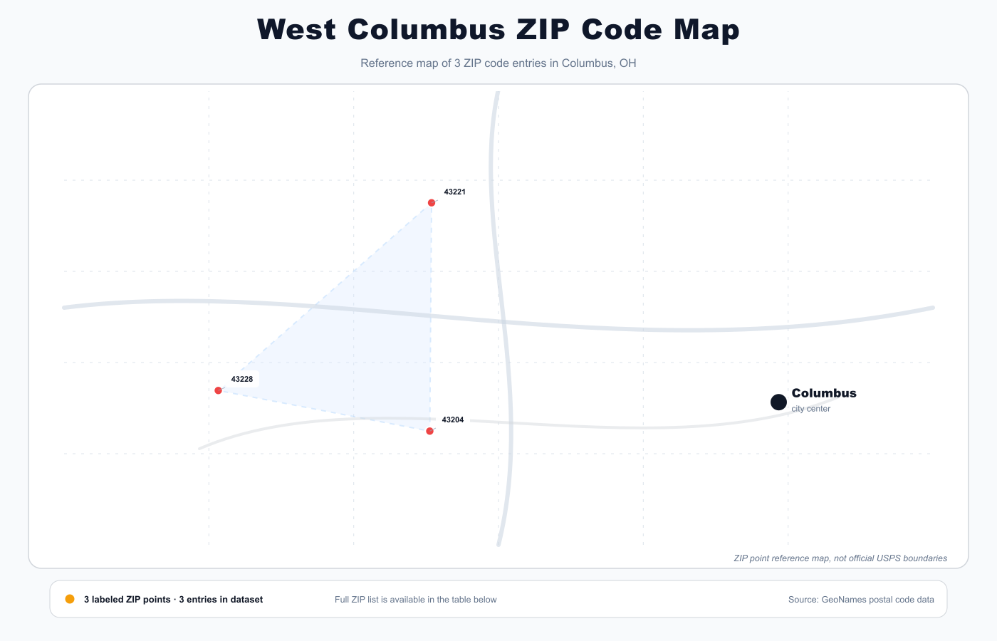
Start with the citywide Columbus ZIP code map for orientation, then switch to the North, South, East, or West map to focus on a specific area. Once you locate your area, use the ZIP code table for coordinates, ZIP type, county, and quick map links. For mailing or official forms, always verify the ZIP with a full street address using USPS lookup.
Data quality note: Some Columbus ZIP entries share the same coordinate point in the source dataset. This typically indicates a postal-place centroid, PO Box, or special-use reference rather than an exact ZIP boundary. This page maps ZIP coordinate points for reference only, not official USPS delivery boundaries.
Columbus ZIP Code Map
Use the main Columbus ZIP code map for a citywide overview, then use the North, South, East, and West maps to focus on one part of the city. Columbus ZIP codes span from Ohio State University and Clintonville in the north to southeast industrial corridors and far north retail districts. These maps are reference graphics based on postal coordinates, not official USPS boundary maps.
Printable Columbus ZIP Code Map
For a printable Columbus ZIP code map, open the main map or one of the directional maps in a larger view and use your browser print dialog. Choose the citywide map for broad reference, or print the North, South, East, or West map when you only need one part of Columbus. Treat printed copies as planning references, not official USPS boundary maps.
Columbus ZIP Code Table
The table lists Columbus ZIP entries with ZIP type, county, coordinates, and quick links for Google Maps and Waze. Regular delivery ZIPs, PO Box ZIPs, and special-use entries can appear together in the source data. Use a full street address when the exact delivery ZIP is critical.
| ZIP Code | Postal place | Type | County | Coordinates | Map |
|---|---|---|---|---|---|
| 43085 | Columbus | Standard / address lookup | Franklin County | 40.0999, -83.0157 | GoogleWaze |
| 43201 | Columbus | Standard / address lookup | Franklin County | 39.9952, -83.0047 | GoogleWaze |
| 43202 | Columbus | Standard / address lookup | Franklin County | 40.0201, -83.0118 | GoogleWaze |
| 43203 | Columbus | Standard / address lookup | Franklin County | 39.9719, -82.9691 | GoogleWaze |
| 43204 | Columbus | Standard / address lookup | Franklin County | 39.9523, -83.0780 | GoogleWaze |
| 43205 | Columbus | Standard / address lookup | Franklin County | 39.9569, -82.9644 | GoogleWaze |
| 43206 | Columbus | Standard / address lookup | Franklin County | 39.9426, -82.9748 | GoogleWaze |
| 43207 | Columbus | Standard / address lookup | Franklin County | 39.9046, -82.9703 | GoogleWaze |
| 43209 | Columbus | Standard / address lookup | Franklin County | 39.9539, -82.9301 | GoogleWaze |
| 43210 | Columbus | Standard / address lookup | Franklin County | 40.0028, -83.0164 | GoogleWaze |
| 43211 | Columbus | Standard / address lookup | Franklin County | 40.0118, -82.9732 | GoogleWaze |
| 43212 | Columbus | Standard / address lookup | Franklin County | 39.9874, -83.0456 | GoogleWaze |
| 43213 | Columbus | Standard / address lookup | Franklin County | 39.9727, -82.8329 | GoogleWaze |
| 43214 | Columbus | Standard / address lookup | Franklin County | 40.0535, -83.0187 | GoogleWaze |
| 43215 | Columbus | Standard / address lookup | Franklin County | 39.9671, -83.0044 | GoogleWaze |
| 43216 | Columbus | PO Box / special use | Franklin County | 39.9690, -83.0114 | GoogleWaze |
| 43217 | Columbus | Standard / address lookup | Franklin County | 39.8277, -82.9342 | GoogleWaze |
| 43218 | Columbus | PO Box / special use | Franklin County | 39.9690, -83.0114 | GoogleWaze |
| 43219 | Columbus | Standard / address lookup | Franklin County | 40.0326, -82.9103 | GoogleWaze |
| 43220 | Columbus | Standard / address lookup | Franklin County | 40.0495, -83.0669 | GoogleWaze |
| 43221 | Columbus | Standard / address lookup | Franklin County | 40.0226, -83.0776 | GoogleWaze |
| 43222 | Columbus | Standard / address lookup | Franklin County | 39.9576, -83.0311 | GoogleWaze |
| 43223 | Columbus | Standard / address lookup | Franklin County | 39.9388, -83.0463 | GoogleWaze |
| 43224 | Columbus | Standard / address lookup | Franklin County | 40.0425, -82.9689 | GoogleWaze |
| 43226 | Columbus | PO Box / special use | Franklin County | 39.9690, -83.0114 | GoogleWaze |
| 43227 | Columbus | Standard / address lookup | Franklin County | 39.9444, -82.8903 | GoogleWaze |
| 43228 | Columbus | Standard / address lookup | Franklin County | 39.9648, -83.1260 | GoogleWaze |
| 43229 | Columbus | Standard / address lookup | Franklin County | 40.0839, -82.9726 | GoogleWaze |
| 43230 | Columbus | Standard / address lookup | Franklin County | 40.0347, -82.8726 | GoogleWaze |
| 43231 | Columbus | Standard / address lookup | Franklin County | 40.0810, -82.9383 | GoogleWaze |
| 43232 | Columbus | Standard / address lookup | Franklin County | 39.9230, -82.8664 | GoogleWaze |
| 43234 | Columbus | PO Box / special use | Franklin County | 39.9690, -83.0114 | GoogleWaze |
| 43235 | Columbus | Standard / address lookup | Franklin County | 40.1088, -82.9742 | GoogleWaze |
| 43236 | Columbus | Standard / address lookup | Franklin County | 40.1357, -83.0076 | GoogleWaze |
| 43240 | Columbus | Standard / address lookup | Franklin County | 40.1454, -82.9817 | GoogleWaze |
| 43251 | Columbus | PO Box / special use | Franklin County | 39.9690, -83.0114 | GoogleWaze |
| 43260 | Columbus | PO Box / special use | Franklin County | 39.9690, -83.0114 | GoogleWaze |
| 43266 | Columbus | PO Box / special use | Franklin County | 39.9690, -83.0114 | GoogleWaze |
| 43268 | Columbus | PO Box / special use | Franklin County | 39.9690, -83.0114 | GoogleWaze |
| 43270 | Columbus | PO Box / special use | Franklin County | 39.9690, -83.0114 | GoogleWaze |
| 43271 | Columbus | PO Box / special use | Franklin County | 39.9690, -83.0114 | GoogleWaze |
| 43272 | Columbus | PO Box / special use | Franklin County | 39.9690, -83.0114 | GoogleWaze |
| 43279 | Columbus | PO Box / special use | Franklin County | 39.9690, -83.0114 | GoogleWaze |
| 43287 | Columbus | PO Box / special use | Franklin County | 39.9690, -83.0114 | GoogleWaze |
| 43291 | Columbus | PO Box / special use | Franklin County | 39.9690, -83.0114 | GoogleWaze |
Columbus ZIP Codes by Local Area
Columbus ZIP codes are easier to understand when tied to recognizable neighborhoods and landmarks. These local area notes highlight common ZIP ranges and areas, but they are not official neighborhood boundaries.
Downtown and Arena District
43215, 43216, 43218, 43226
Downtown Columbus and the Arena District commonly use 43215 and nearby central ZIP entries. Some central 432xx entries are PO Box or special-use records, so address-level lookup is important.
Ohio State University and University District
43201, 43202, 43210
Ohio State University, the University District, and nearby north campus addresses typically involve 43201, 43202, and 43210. Use the exact campus building or street address for delivery.
Short North and Victorian Village
43201, 43212, 43215
Short North, Victorian Village, Harrison West, and Grandview-edge addresses often use 43201, 43212, or 43215, depending on the exact street location.
German Village and south side
43206, 43207, 43223
German Village, Merion Village, and south-side Columbus addresses commonly involve 43206, 43207, and 43223.
Franklinton and west Columbus
43204, 43222, 43228
Franklinton and west Columbus addresses often use 43204, 43222, and 43228, especially along major west-side corridors.
Clintonville and north residential areas
43214, 43220, 43221, 43224, 43229, 43235
Clintonville, Beechwold, and north Columbus residential areas commonly use 43214, 43220, 43221, 43224, 43229, and 43235.
Easton and east Columbus
43213, 43219, 43227, 43230, 43232
East Columbus, Easton, airport-edge, and far east addresses often involve 43213, 43219, 43227, 43230, and 43232.
Southeast industrial corridors
43207, 43217, 43232
Southeast Columbus and industrial corridor addresses may use 43207, 43217, or 43232. Verify the exact street address because ZIP coverage does not follow simple neighborhood lines.
Columbus ZIP Codes by County
This table is built from Columbus postal-place records associated with Franklin County. The broader Columbus metro includes nearby communities in Franklin, Delaware, Fairfield, Licking, Madison, Pickaway, and Union counties, but many of those ZIP codes belong to separate postal places rather than Columbus rows.
Franklin County
43085, 43201, 43202, 43203, 43204, 43205, 43206, 43207, 43209, 43210, 43211, 43212, 43213, 43214, 43215, 43216, 43217, 43218, 43219, 43220, 43221, 43222, 43223, 43224, 43226, 43227, 43228, 43229, 43230, 43231, 43232, 43234, 43235, 43236, 43240, 43251, 43260, 43266, 43268, 43270, 43271, 43272, 43279, 43287, 43291
Nearby ZIP Code Maps
Compare Columbus with nearby Ohio ZIP code maps when an address falls outside the Columbus postal-place rows in this dataset.
ZIP Codes vs ZCTAs
ZIP codes are USPS delivery codes, while ZCTAs are Census geographic approximations used for mapping and statistics. A ZIP code can cross neighborhood or city-limit boundaries, and special-use ZIP codes may not correspond to a normal residential delivery area.
Frequently Asked Questions
What are the main ZIP codes in Columbus, Ohio?
Common Columbus ZIP codes include 43201, 43202, 43204, 43206, 43207, 43212, 43214, 43215, 43220, 43221, 43224, 43228, 43229, 43230, and 43235. The correct ZIP depends on the exact street address.
What county is Columbus in?
Columbus is primarily in Franklin County. The broader metro area extends into nearby counties and suburbs, but this page focuses on Columbus postal-place rows associated with Franklin County.
What ZIP codes cover Downtown Columbus?
Downtown Columbus is most commonly associated with 43215, with some central PO Box or special-use entries also in the dataset. Use the exact building or street address for final delivery confirmation.
What ZIP codes are near Ohio State University?
Ohio State University and the surrounding University District commonly use 43201, 43202, and 43210. Campus buildings, departments, and PO Box addresses may use different ZIP details, so verify the full address.
Why do some Columbus ZIP codes share the same coordinates?
Shared coordinates usually indicate a postal-place centroid, PO Box, or special-use record rather than a distinct ZIP boundary. This map is useful for orientation but is not an official USPS boundary map.
How do I find the ZIP code for a specific Columbus address?
Use a complete street address in USPS lookup, Google Maps, Apple Maps, or another address-level tool. A citywide ZIP map is useful for reference but is not precise enough for final delivery decisions.
Are ZIP codes and ZCTAs the same?
No. ZIP codes are USPS postal delivery codes, while ZCTAs are Census geographic approximations used for mapping and statistics.
What is a special-use ZIP code?
Special-use ZIP codes like PO Boxes do not correspond to normal residential delivery areas. They are used for specific facilities, organizations, or postal services. Always verify with a full address for mailing.
Data sources and methodology
This page combines GeoNames postal code rows, county references, coordinates, and city-level context to create a practical ZIP code guide for Columbus, OH. The maps show coordinate points and directional groupings for orientation. They do not show official USPS boundaries and should be verified against USPS or another official address source for mailing decisions.
For exact mail delivery, always verify the final address and ZIP code with USPS or another official address source.
- GeoNames Postal Code Data
- US Census ZCTA reference
- Manual validation
Last updated: 2026-05-26
Related guides
More useful articles from the ZIP Code Maps & Local City Guides topic.
- Austin ZIP Code Map
Search 74 Austin, Texas ZIP codes by local area, Travis County postal place, coordinates, and map direction. Includes printable maps for North, South, East, and West Austin.
- El Paso ZIP Code Map
Search 137 El Paso ZIP codes by local area, El Paso County postal place, coordinates, and map direction. Includes printable maps for North, South, East, and West El Paso.
- Fort Lauderdale ZIP Code Map
Search 47 Fort Lauderdale ZIP codes by local area, Broward County postal place, coordinates, and map direction. Includes printable maps for North, South, East, and West Fort Lauderdale.
- Fresno ZIP Code Map
Search 58 Fresno ZIP codes by local area, Fresno County postal place, coordinates, and map direction. Includes printable maps for North, South, East, and West Fresno.
- Houston ZIP Code Map
Search 178 Houston ZIP codes by local area, Harris County postal place, or coordinates. Includes printable maps for North, South, East, and West Houston.
About MyGpsTools Editorial Team
MyGpsTools publishes practical guides about GPS apps, maps, navigation tools, EXIF photo metadata, satellite imagery, Android Auto, Apple CarPlay, ZIP code maps, and location-based technologies. We focus on clear instructions, practical checks, official documentation, and reader feedback.