- Published on
- Updated on
Offline maps of London: best apps for iPhone and Android
- Authors
In this article, we are going to share with you the best offline map apps for London. They will be useful for travelers and visitors to the city.
You can use the maps offline - that is, the Internet is not required for them to work fully. As a rule, all maps of London are available immediately after installing the app on iOS or Android.
Also in this article you will find instructions on how to pre-download a map of London via the Google Maps app.
Table of Contents
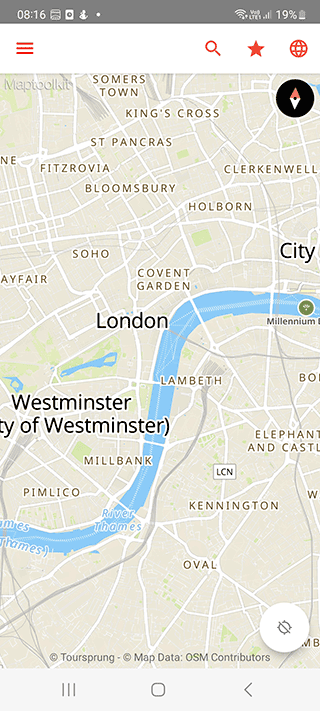
Map of London offline
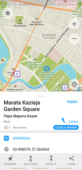
On Google Play, you'll find many apps through which you can view maps of UK cities. However, few of them can work without Internet. The Map of London app is devoid of this disadvantage. Maps are available for all London boroughs and suburbs (Wandsworth, Lambeth, Southwark, Tower Hamlets, Addlestone, Ashford, Banstead, etc.).
Note the features of the application:
- Easy to use: no need to go into settings and download a map of London
- Map updates automatically
- London maps are highly detailed
- Offline search: including POI search
You can say this is a great app if you are planning a day trip to London or planning to stay in this city for a week to explore London boroughs and streets.
Download: Android
Pros:
- Smooth zoom.
- The map displays the names of the buildings
Cons:
- No navigator functions similar to Google Maps or Waze
London Offline City Map

Another offline map of London - compact and easy to use on a cell phone with Android. Will be useful for travelers, visitors to the city. With the app you can:
- Orientate in London and the surrounding area,
- Search for streets and objects on the map by their names,
- Find new places according to your interests,
- Get to know the city better.
All maps of London are preloaded on the phone, the user's participation is not required. The search functions on the map work without the Internet, you do not need to use a mobile connection or roaming for this purpose.
Maps have excellent detail. To display them, they use data from the OpenStreetMap service, which you probably know about.
The application will be useful for tourists if they need to find and build a route to such places of interest as the Tate Modern, British Museum, National Gallery, etc.
Pros:
- No local SIM card required for cards to work
- Stable app
- Handy app for a day trip to London
Google Maps
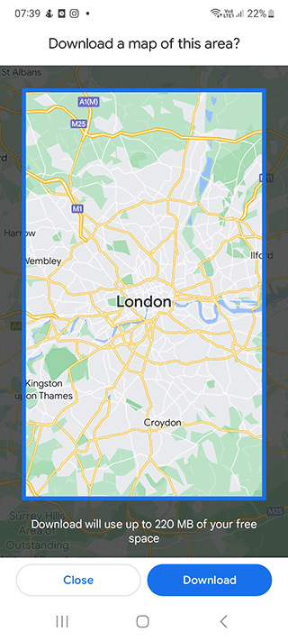
The Google Maps app is installed on Android by default. It is convenient to use to view offline maps of England and London in particular. True, you have to download the map yourself to your mobile device before using it. The size of the map is about 200 MB.
Instructions:
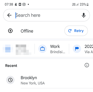
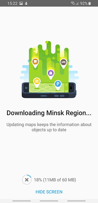
Step 1. Open the Google Maps app.
Step 2. In the search box (Search here) enter London
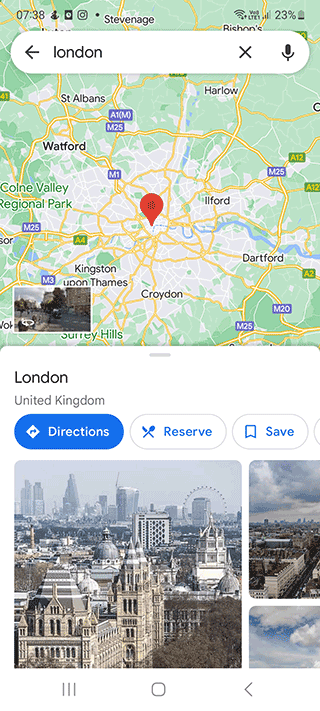
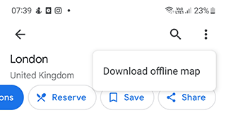
Step 3. Tap the three dot button at the top of the screen
Step 4. Select Download offline map option
Step 5. Select the desired area of the map
Step 6. Tap the Download button
Step 7. The map will be downloaded and available in Offline maps section
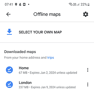
You can update or delete the map of London at any time you wish.
Download Google Maps: iOS | Android
London Offline Map & City Guide

Offline maps with route planner features. Through the application you can make an interesting route to the sights of London or choose the best route to a specified point. The maps do not require wi-fi or mobile connection.
Functions of the application:
- Search for sights in and around London
- Free city guide and information guide
- Download offline maps (paid feature)
- Accessible public transport timetables
- Search and book London hotels
The app can be downloaded for iPadOS and iOS.
Download: iPhone
Pros:
- SYGIC TRAVEL MAPS are used for display
Cons:
- Maps can only be downloaded for a fee
Maps.me

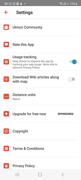
Maps.me is a GPS app for Android which is popular in London, UK. It's distinctive features are high accuracy and the autonomy of maps. You can use it to navigate via Baker Street, Downing Street, Bond Street, etc.
Pros:
The accuracy and high number of details of maps is nearly the most important aspect regardless of the vehicle type. This navigation app is likely to catch the eye of travelers and pedestrians, since its maps show even the smallest details like trails, benches and the names of objects of London city.
Additional layers. Maps.me displays vector maps and via the layers it can also show traffic jams and a subway map.
Plenty of settings. In Maps.me settings you can change the unit of measurement and see the history of movement. There are navigation settings, in particular, you can configure auto zoom, voice instructions and enable the display of speed cameras.
Switching between navigation modes. You can choose from the following navigation modes: car, pedestrian, public transport, taxi and bicycle.
Autonomy. Offline maps of London downloaded onto your mobile device take up little space but they operate in full mode as if internet connection is toggled on. Obviously realtime features will be unavailable, but for a pedestrian or cyclist traffic information isn't as important as for drivers.
Cons:
Limited navigation for London drivers. It's quite difficult to call Maps.me a perfect car navigator. At least, the routes aren't always mapped correctly, not to mention the fact that this navigation app offers no alternative options.
There are errors. Since the London maps are made by the community, the data isn't always relevant, especially for remote and unpopular places.
Pretty inconvenient maps display mode. Maps look quite boring and the feature of scaling might not work.
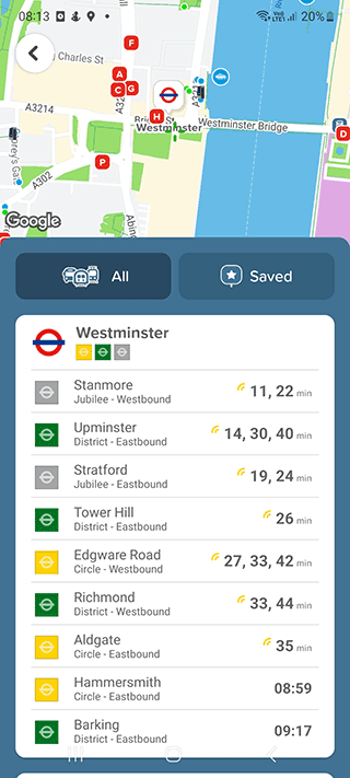
Citymapper – Route maker

This planner allows you to create offline routes not only by car but also by public transport (buses, metro, trains), taxi and bicycle in London city.
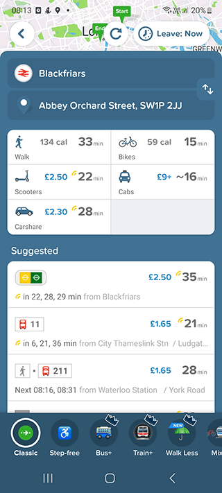
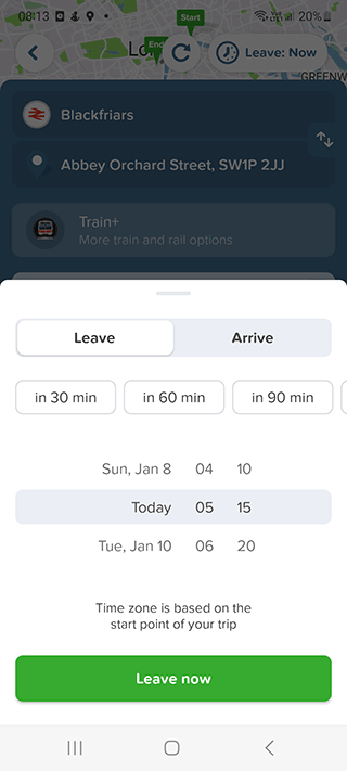
With Citymapper, you can:
- build the most efficient routes taking into account all types of transport of London;
- get information about the arrival and departure of buses and commuter trains;
- plot step-by-step routes between multiple destinations in London,
- receive real-time notifications about each destination: the arrival and departure of transport, failures in its operation, the need to leave a house or a bus;
- optimize your way: find the correct entrance/ exit to the metro, as well as the nearest stop with the time of travel to it and GPS-coordinates;
- save a trip and all necessary stops in your device memory (you can set multiple points with stops);
- share your route with your friends so they can watch your progress and know your arrival time.
There is no advertising content in the app.
Result: 0, total votes: 0
I'm Mike, your guide in the expansive world of technology journalism, with a special focus on GPS technologies and mapping. My journey in this field extends over twenty fruitful years, fueled by a profound passion for technology and an insatiable curiosity to explore its frontiers.