- Published on
- Updated on
YGPS: app functions, GPS satellites search
- Authors
Using YGPS Satellites mobile app you can track the nearest GPS satellites on the virtual map. In this review you will learn where to download this diagnostic utility and how to use it.
Table of contents
Functions of the YGPS app:
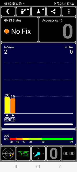
- Signal strength information is available for each satellite.
- Signal strength control.
- Setting up your Android mobile device for stable work with GPS transmitters.
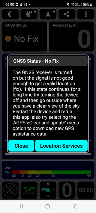
- YGPS is used to check the navigation settings.
You will not be able to use the utility on processors other than MTK. The problem is that other processors are oriented to the Asian market, so in the European area the app with a different processor is not compatible.
Features
App features:
- Available for free download on Android with MTK processors
- Android version does not matter, all versions are supported
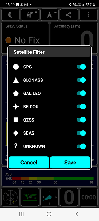
- Fine-tune GPS options and features
- Check GPS signal stability and data transfer quality
App design
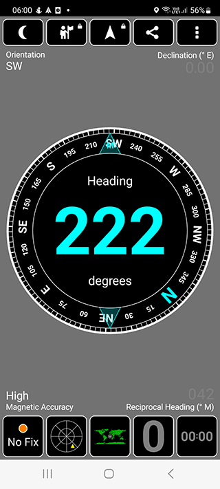
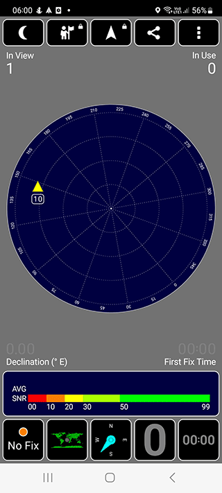
The YGPS App displays a pie chart on the screen. On it you will see all the satellites located in the observable range. The utility also displays active and inactive GPS satellites and calculates signal strength.
If you need to know the specific coordinates of a satellite, you can do it using the latitude and longitude data. Besides, such parameters as satellite speed, time of the first or the last GPS satellite detection on the map are available.
Disadvantages of the YGPS app
- Users complain that YGPS requests too many permissions in Android.
- The app drains the battery very quickly if used actively
If these disadvantages are significant for you, try another app - GPS Status.
Download YGPSRelated guides
More useful articles from the Satellite Imagery & Google Earth topic.
- What Are the Best Google Earth Alternatives? [2026 Guide]
15 powerful Google Earth alternatives for 2026. Expert-reviewed satellite imagery tools, real-time mapping, and GIS solutions for professionals and casual users.
- Best High-Resolution Satellite Images: Alternatives to Google Maps
A practical 2026 guide to high-resolution satellite imagery, free alternatives to Google Earth, and premium platforms like Maxar and Airbus. Learn what each service actually offers and how to find satellite views of a house or location.
- How to Fix Google Earth Not Working or Won’t Load Issues: Complete Troubleshooting Guide
Practical fixes for Google Earth when it won’t load, keeps crashing, or runs slowly on desktop, web, iPad, and mobile.
- How Often Does Google Earth and Google Maps Update Satellite Images?
Find out how often Google Maps and Google Earth update satellite images, why some areas stay old for years, and how to check the date of a Google Earth image.
- How to Get Live Satellite View of Your House: Real-Time Images Guide
Learn what ‘live satellite view’ really means in 2026, which tools can show the most current images of your house, and where the limits are for free and paid services.