How to see satellite view of house in Australia: best services
Best free services that allow users to access satellite imagery of Australia and other continents, displaying a map of Australia and weather information
Satellite imagery provides data about continents, countries, and cities. Watching the changes from a bird's-eye view, you will get a lot of useful information about the weather at the moment. In addition, you can look at your home on satellite images.
In this article, we'll look at some of the best free services that give you access to satellite imagery of Australia and other continents.
Table of contents
NationalMap
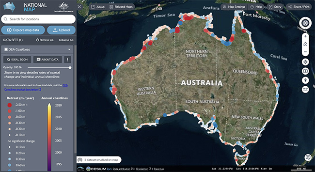
This website provides high resolution imagery from Sentinel-2 satellite and Australian government agencies. All data is stored publicly and free to use.
If your house is located in an Australian city, you can most likely view it from satellite in real time.
How to use the service:
- Go to NationalMap.gov.au (main page). Wait until the map is loaded.
- Select 'Satellite images' option from the left sidebar
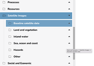
- Select the section with the data you are interested in: Sea, ocean and coast; Hazards; Inland water or any other section.
- Click the + icon to add a layer to the map.
- A map of Australia is available in the right column and the activated layers will be superimposed on top of it.
- Use the control buttons to zoom in and out of details on the map.
The catalog of maps and layers on NationalMap is very extensive, so you are advised to take the time to explore if you are specifically interested in information about Australian cities.
Himawari Satellite viewer
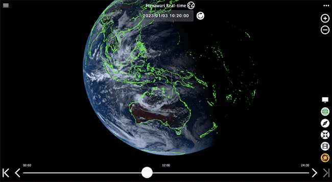
himawari8.nict.go.jp is another interesting service for getting real-time satellite images of Australia or photos of your house. You can select only one layer (satellite image view), and the number of elements on the map is not limited.
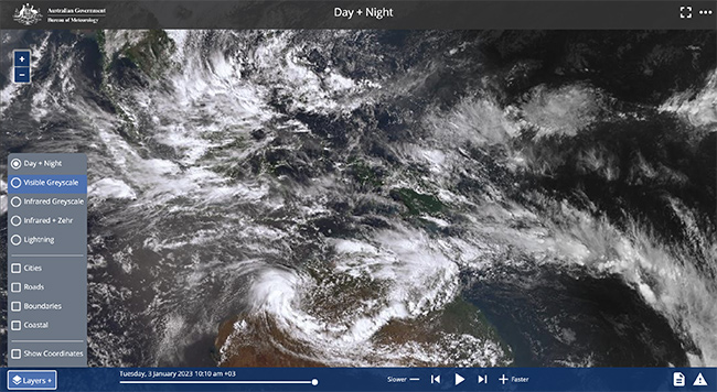
Available modes:
- Day / Night
- Visible greyscale
- Infrared
- Lightning
The Himawari Satellite viewer is easy to use:
- Drag and drop the map to the desired location on the map.
- Use the Detect your location button if you want to move to the current satellite view of your house.
- Use the Zoom in and Zoom out icons to zoom in on the satellite image.
- Use the timeline to get information for a certain period of time.
Real-time satellite imagery is available for all major cities in Australia. You can also view historical city boundaries, road networks and coastlines. If you are interested in coordinates, you can get them using the mouse cursor by pointing it at the desired object or location.
In theory, you can use the Himawari Satellite viewer to get a satellite image of your house on the map – as long as it is within satellite range.
zoom.earth
If you are interested in weather information - temperature, humidity, pressure - then Zoom.Earth will be a great helper. This service provides several options for displaying a map of Australia.
- Live
- Daily HD
- Base Map
- You can choose a mode from the Choose a map column.
- Weather information is also available through this column, just select the desired item (Humidity, Pressure, etc.) to see everything happening in real time on the map.
- The map can be zoomed in and out, dragged using the mouse cursor.
Spectator
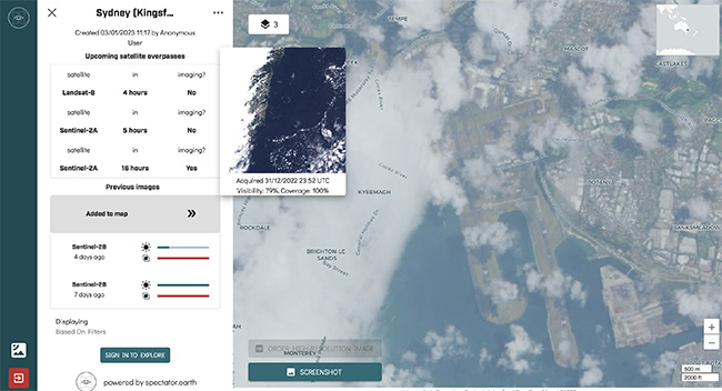
Satellite images and photos of your house are available through this website. Just select satellites and see the schedule yourself. The service doesn't show real-time data for regions and cities in Australia, but you can find images taken today or yesterday here.
How to use the service:
- First, select a city or location in Australia to be monitored.
- Then use the zoom in and out buttons to zoom in and out of the objects on the map.
- Through the side column, select the satellite and date of the captured image to open it on the map.
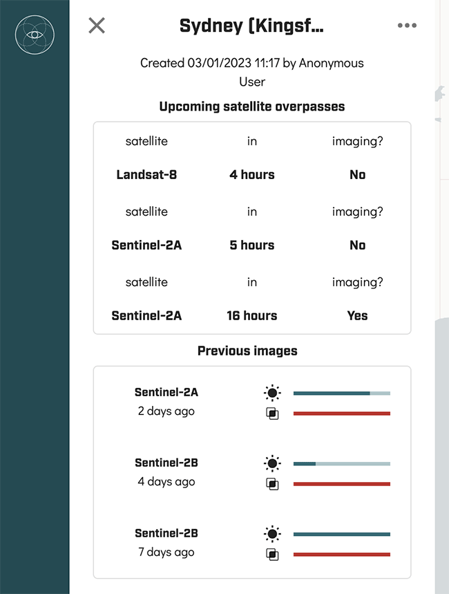
- Press the Screenshot button to save the images on your computer or phone in high resolution.
Related guides
More useful articles from the Satellite Imagery & Google Earth topic.
- Best High-Resolution Satellite Imagery
Compare free and paid satellite imagery platforms in 2026. Learn the differences between Google Earth, Maxar, Airbus, Sentinel Hub, and USGS EarthExplorer. Find out which service offers the resolution, update frequency, and features you actually need.
- How Old Is Google Earth Imagery?
Learn how often Google Earth imagery updates, why image age varies by city or region, how to check the capture date, and when to use more current satellite imagery tools.
- Live Satellite View of Your House
Learn what live satellite view really means in 2026, which tools show recent or near-real-time imagery, and why true live views of a house are not available to regular users.
- What Are the Best Google Earth Alternatives? [2026 Guide]
15 powerful Google Earth alternatives for 2026. Expert-reviewed satellite imagery tools, real-time mapping, and GIS solutions for professionals and casual users.
- How to Fix Google Earth Not Working or Won’t Load Issues: Complete Troubleshooting Guide
Practical fixes for Google Earth when it won’t load, keeps crashing, or runs slowly on desktop, web, iPad, and mobile.
About MyGpsTools Editorial Team
MyGpsTools publishes practical guides about GPS apps, maps, navigation tools, EXIF photo metadata, satellite imagery, Android Auto, Apple CarPlay, ZIP code maps, and location-based technologies. We focus on clear instructions, practical checks, official documentation, and reader feedback.