What Are the Best Google Earth Alternatives? [2026 Guide]
15 powerful Google Earth alternatives for 2026. Expert-reviewed satellite imagery tools, real-time mapping, and GIS solutions for professionals and casual users.
Table of contents
Google Earth Pro has dominated satellite imagery and 3D terrain exploration for years, but it's no longer the only game in town. Whether you're asking is there anything better than Google Earth for your specific workflow, or simply looking for apps like Google Earth that go further — the answer in 2026 is a clear yes.
Why Consider Google Earth Alternatives in 2026?
Google Earth Pro, while comprehensive, has several limitations that push users toward specialized alternatives:
Limitations of Google Earth Pro:
- Imagery can be months or even years out of date — you rarely know exactly when a view was captured
- Mixed imagery patches from different time periods create inconsistencies at different zoom levels
- Limited open-source flexibility for custom development projects
- Not optimized for industry-specific needs like urban planning or environmental research
- Restricted access to raw data for professional analysis
- KML/KMZ-centric import workflow; other formats require conversion
- Projects default to Google Drive, which disrupts workflows outside the Google ecosystem
What users are seeking instead:
- Monthly or near-real-time satellite updates
- Open-source APIs for custom application development
- Offline navigation capabilities for remote areas
- GIS-ready tools built for professionals
- Collaborative mapping without lock-in
The Google Earth competitors listed in this guide serve urban planners, developers, researchers, students, and casual map enthusiasts who need more than traditional Google Earth functionality.
Is There Anything Better Than Google Earth?
The honest answer: no single tool is a direct replacement for everything Google Earth does. Its 3D terrain, Street View integration, historical imagery browser, and sheer polish remain unmatched for casual exploration. But for almost every specific use case — real-time satellite data, GIS analysis, developer APIs, collaborative mapping, or current imagery — there are apps better than Google Earth.
The tools below aren't just substitutes — they're optimized solutions that outperform Google Earth in targeted areas.
The 15 Best Google Earth Alternatives
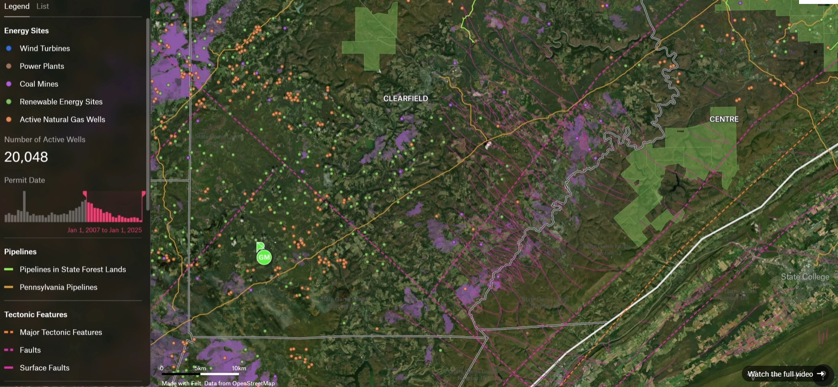
1. Felt – Best for Collaborative GIS Mapping
Felt is a cloud-native GIS platform that represents one of the most compelling modern alternatives to Google Earth for teams. Where Google Earth is built for individual exploration, Felt is designed for collaboration — letting multiple users work on the same map in real time, layer datasets, and run spatial analysis, all with high-quality satellite basemaps underneath.
Key Features:
- Real-time collaboration — share maps via link, annotate, and comment simultaneously
- Import KML, KMZ, GeoJSON, and paste Google My Maps links directly
- Built-in spatial analysis: proximity queries, hotspot analysis, geospatial functions
- High-quality satellite basemaps with modern cloud-native infrastructure
- Felt AI for automated layer generation and data processing
Why it's better: For teams that need to do actual work on top of satellite imagery — not just look at it — Felt offers a combination of usability and analytical power that Google Earth simply doesn't have.
Best for: Urban planners, researchers, field teams, and anyone who needs to collaborate on maps.
2. Nimbo Earth – Best for Up-to-Date Monthly Satellite Maps
Nimbo Earth is one of the most interesting sites like Google Earth to emerge in recent years. Built on the EU's Copernicus Sentinel missions, it delivers updated global satellite mosaics every month — meaning you always know when you're looking at and can track how the land is actually changing.
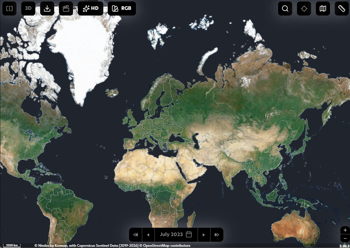
Key Features:
- Monthly updated global satellite maps based on Sentinel-2 imagery
- Consistent imagery at every zoom level (no patchwork from different dates)
- AI-powered resolution enhancement up to 2.5m per pixel
- GIS-compatible basemaps for professional software integration
- Terrain layer (Nimbo Terrain) for 3D mapping workflows
Resolution trade-off: Nimbo's imagery (10m, enhanced to 2.5m) is less sharp than Google Earth's (up to 15cm). But what it loses in detail it gains entirely in recency and consistency — a critical advantage for environmental monitoring, agriculture, and any use case where current ground truth matters more than pixel sharpness.
Why it's better satellite maps than Google: For tracking land changes, conflict zones, deforestation, or flood events, knowing the image date is everything. Nimbo gives you that.
Best for: Environmental researchers, GIS professionals, journalists, and anyone who needs satellite maps that reflect reality today — not two years ago.
3. ArcGIS Earth – Best GIS Tool
ArcGIS Earth is the closest like-for-like Google Earth competitor from a traditional desktop-app perspective — and it's the strongest choice when GIS integration matters. When comparing ArcGIS Earth vs Google Earth, you get many of the same 3D globe features but with the full weight of the Esri ecosystem behind it.
Key Features:
- 3D globe exploration on desktop, iOS, and Android — online and offline
- Access to thousands of public datasets from the ArcGIS Online library
- Import KML, KMZ, shapefiles, and web services
- 3D analysis tools: line of sight, viewsheds, elevation profiles
- Seamless integration with ArcGIS Pro and ArcGIS Online
ArcGIS Earth vs Google Earth: Google Earth wins on visual polish and ease-of-use for casual exploration. ArcGIS Earth wins on data depth, GIS tool integration, and professional workflows. If your organization already uses Esri software, the choice is obvious.
Best for: GIS professionals, urban planners, and organizations requiring enterprise-level mapping solutions.
4. NASA WorldWind – Best Open-Source 3D Globe Engine
NASA WorldWind is an open-source alternative to Google Earth built for developers who want programmatic control over a 3D globe. Unlike Google Earth's fixed UI, WorldWind exposes the entire mapping surface as a programmable JavaScript API — making it one of the most flexible free alternatives to Google Earth for building custom applications.
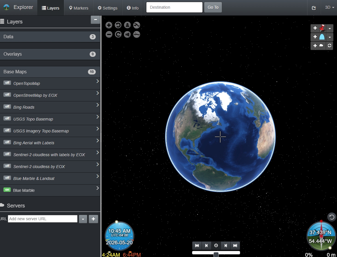
Key Features:
- Open-source WebGL globe with optional 2D map mode
- Multi-source basemaps: OSM, Bing, Sentinel-2, USGS, Blue Marble
- JavaScript API for full developer control over layers, markers, and interaction
- Add markers, toggle timezones, switch day/night modes
- Available for web, Android, and desktop Java environments
Why it's better: If you're building a mapping product or research tool and need a Google Earth-like 3D globe you can fully control, WorldWind is the answer. Google Earth has no equivalent developer API.
Best for: Developers, researchers, and academic institutions building custom geospatial tools.
5. Zoom Earth – Best for Real-Time Weather and Satellites
Zoom Earth delivers live NOAA satellite feeds and weather tracking that makes it an excellent alternative to Google Earth for environmental monitoring. This platform offers real-time hurricane tracking, wildfire monitoring, and climate analysis tools that update every 10 minutes.
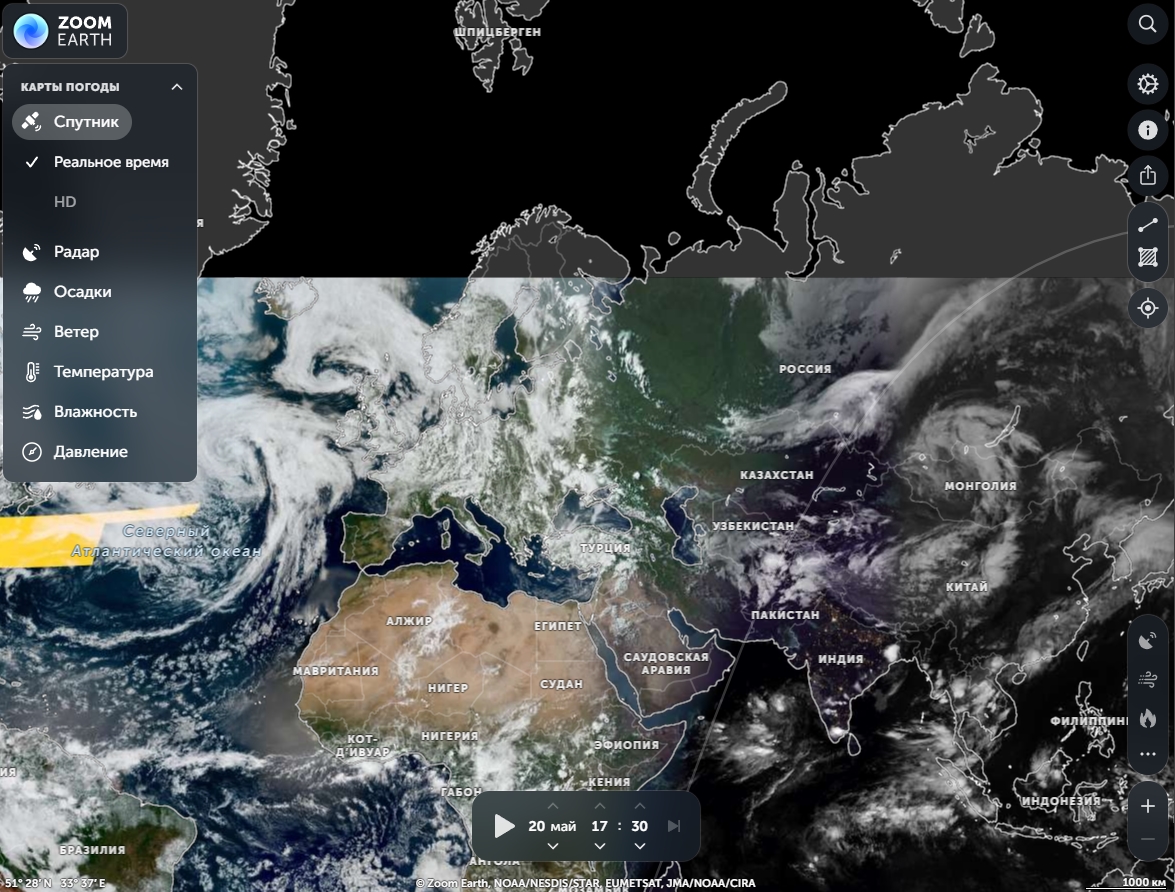
Key Features:
- Live satellite feeds updated every 10 minutes
- Weather pattern tracking and storm alerts
- Global cloud cover and precipitation maps
- Historical weather data comparison tools
- Clean, intuitive interface requiring no sign-up
Best use case: Environmental researchers, meteorologists, and crisis management teams who need current atmospheric conditions. When a storm is forming, Zoom Earth is what's better than Google Earth.
6. NASA Worldview – Best for Environmental and Climate Data
NASA Worldview provides access to over 900 Earth science data layers from NASA's satellite programs, making it a powerful Google Earth Pro alternative for climate research and environmental monitoring. Don't confuse this with NASA WorldWind above — Worldview is a web browser tool focused on scientific data visualization, not a 3D globe engine.
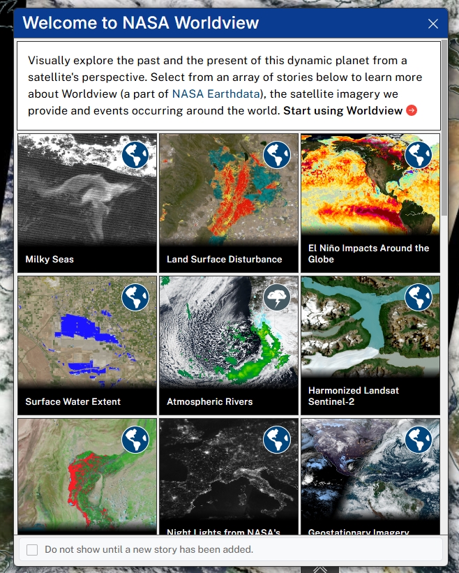
Key Features:
- 900+ scientific data layers from multiple NASA satellites
- Climate tracking with historical comparison tools
- Wildfire monitoring and deforestation insights
- Sea surface temperatures, vegetation health, and atmospheric composition
- Free access to scientific-grade datasets
Why it's superior: NASA Worldview offers specialized scientific overlays that Google Earth doesn't have — making it the premier free alternative to Google Earth for researchers working with environmental data.
7. Sentinel Hub / Copernicus Browser – Best for High-Res Free Satellite Data
Powered by the European Space Agency, Sentinel Hub provides free access to high-resolution Sentinel satellite imagery with advanced filtering for dates, cloud cover, and land use. The Copernicus Browser (formerly EO Browser) gives direct access to the raw images that power tools like Nimbo.
Key Features:
- Free access to Sentinel-1, Sentinel-2, Sentinel-3, and Sentinel-5P data
- Advanced filtering for cloud cover and seasonal comparison
- Custom band combinations for NDVI, false color, moisture analysis
- High-resolution imagery updated regularly
- EO Browser for visual exploration; API access for developers
Why choose this: More current imagery than Google Earth, with specialized filters for agricultural, forestry, and environmental research. One of the best free alternatives to Google Earth for data-driven analysis.
8. Esri Wayback Viewer – Best for Historical Satellite Imagery
Esri Wayback Viewer is a time machine for satellite maps. It lets you step back in time to see how the world looked at any point in Esri's global basemap archive — perfect for tracking urban development, environmental change, or land use shifts over time.
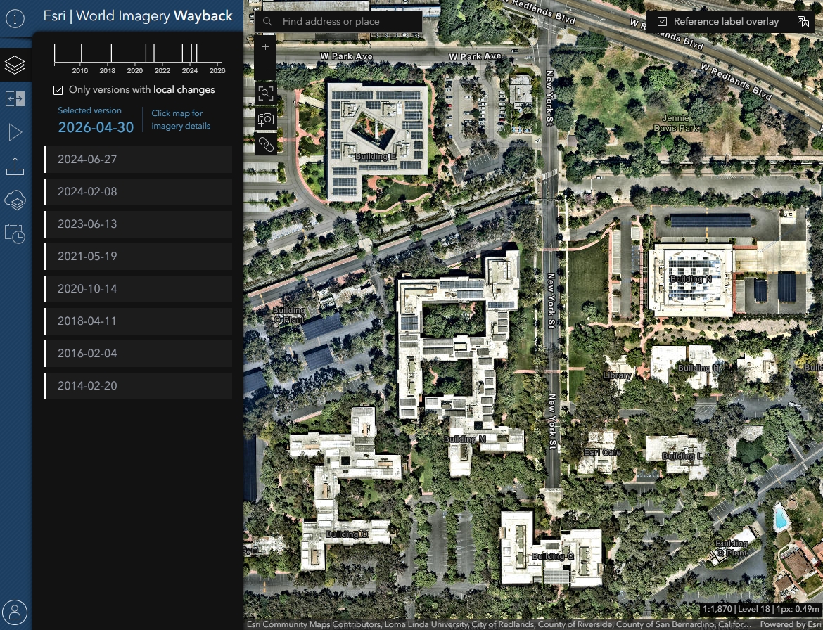
Key Features:
- Side-by-side comparison of maps from different dates
- Regular updates mean you can track recent changes as well as historical ones
- No software to install — runs entirely in the browser
- Tied to the ArcGIS Living Atlas for consistent global coverage
Best use case: Urban development researchers, environmental scientists, journalists, and anyone studying long-term change on a specific location.
9. Esri Landsat Explorer – Best for Long-Range Historical Analysis
Esri Landsat Explorer goes further back than the Wayback Viewer, providing access to decades of Landsat program data dating to 1972 — the longest continuous record of Earth's land surface available anywhere.
Key Features:
- Historical imagery dating back to 1972
- Vegetation, temperature, and moisture analysis layers
- Time-lapse creation tools for long-range change visualization
- Scientific-grade data for research
Best for: Researchers studying long-term environmental changes, climate scientists, and academic institutions.
10. Mapbox – Best for Developers
Mapbox excels as a developer-focused Google Earth competitor with custom map APIs, real-time geolocation services, and open-source flexibility. If you're building any kind of location-based application and need a programmable mapping layer, Mapbox is the industry standard.
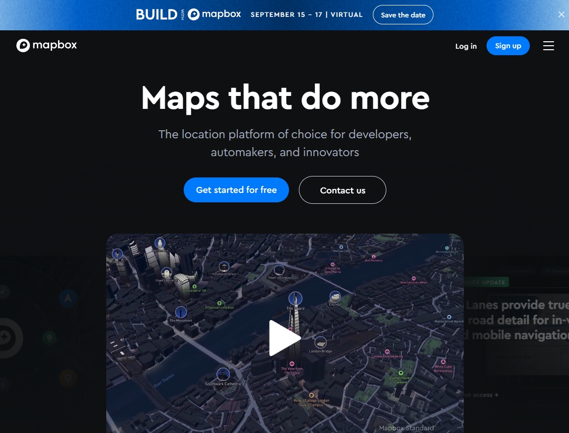
Key Features:
- Custom map APIs and SDKs for web, iOS, and Android
- Real-time location tracking and turn-by-turn navigation
- Open-source tools (Mapbox GL JS)
- Fully customizable styling, including satellite basemaps
- Global geocoding and routing APIs
Perfect for: Developers building location-based applications, startups requiring custom mapping solutions, and businesses needing branded navigation tools.
11. OpenStreetMap – Best Free Open-Source Map
OpenStreetMap is the world's largest open-source mapping project — a community-maintained alternative to Google Earth and Google Maps that forms the data backbone of hundreds of applications. The community often captures local detail that commercial providers miss.
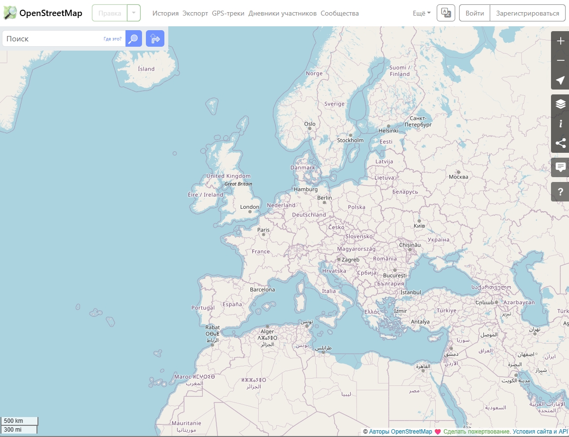
Key Features:
- Community-edited and maintained maps updated continuously
- Free access to all data under an open license
- Used by Wikipedia, Apple Maps, Meta, and many others
- Ideal as a base layer in custom GIS applications
Ideal for: Educational institutions, NGOs, developers who need free map data, and community projects.
12. Bing Maps – Best for Simple Aerial Views
Bing Maps offers a streamlined interface with smooth aerial views and Microsoft ecosystem integration. It's the most straightforward of the apps similar to Google Earth for casual users who just want to look at satellite imagery without any learning curve.
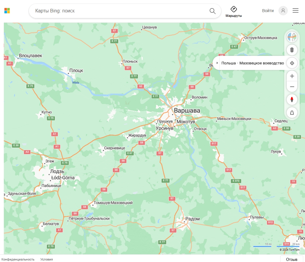
Key Features:
- Clean, user-friendly interface
- 3D aerial views and Bird's Eye imagery
- Integration with Microsoft and Windows ecosystem
- Strong mobile performance
Perfect for: Beginners and general users who want basic satellite views without complex tools. The most direct like-for-like app like Google Earth for non-technical users.
13. Here WeGo – Best for Offline Use
Here WeGo specializes in offline navigation, allowing users to download entire countries and navigate without internet connectivity. It's a less obvious Google Earth alternative, but essential for travelers and remote area exploration.
Key Features:
- Offline map downloads for entire countries
- Turn-by-turn navigation without internet
- Public transit integration for 1,300+ cities
- Free access to core features
Ideal for: Travelers, commuters, and anyone needing reliable offline navigation capabilities.
14. USGS Earth Explorer – Best for Scientific and Government Data
USGS Earth Explorer provides access to detailed geological and land use data from the United States Geological Survey. It's a more technical tool, but unmatched for authoritative US government data.
Key Features:
- Geological survey data and topographic maps
- Land use and land cover datasets
- High-resolution aerial photography going back decades
- Free access to government data archives
Perfect for: Academic researchers, geology students, and professionals requiring authoritative US geological data.
15. Google Earth Studio Alternative: Adobe After Effects + GIS Tools
Google Earth Studio is a separate browser-based animation tool that lets video creators animate fly-throughs using Google Earth imagery. If you're looking for a Google Earth Studio alternative, your best options depend on the use case:
- Cesium (cesium.com) — open-source 3D geospatial platform with full animation control and programmable camera paths
- ArcGIS Earth — supports animation and cinematic 3D tours natively
- Blender + DEM data — for fully custom terrain animation using real elevation models
- Nimbo Earth Terrain — for broadcast and media teams needing cloud-free, consistent terrain renders
These tools offer comparable or superior control for specific workflows, though none have Google Earth Studio's ease of use for quick aerial animations.
What to Consider When Choosing a Google Earth Alternative
Selecting the right tool depends on your specific needs:
Do you need current satellite imagery? Tools like Nimbo Earth and Sentinel Hub deliver monthly updates with known acquisition dates, while Google Earth imagery can be years old with no date transparency.
Do you need real-time data? Zoom Earth and NASA Worldview provide live feeds. Google Earth only shows static snapshots.
Are you building a custom app? Mapbox, NASA WorldWind, and OpenStreetMap offer the APIs and open-source freedom that Google Earth lacks entirely.
Is GIS integration critical? ArcGIS Earth, Felt, and Sentinel Hub provide enterprise-level GIS capabilities.
Do you need historical data? Esri Wayback Viewer and Landsat Explorer cover decades of archived imagery.
Will you use it offline? Here WeGo is built for offline-first navigation.
Tools by user type:
- Casual users: Bing Maps, Zoom Earth, Here WeGo
- Developers: Mapbox, NASA WorldWind, OpenStreetMap
- Researchers: NASA Worldview, Sentinel Hub, Landsat Explorer, Nimbo Earth
- Business / GIS teams: ArcGIS Earth, Felt
- Navigation: Here WeGo
- Historical change analysis: Esri Wayback Viewer, Landsat Explorer, USGS Earth Explorer
Comparison Table: Google Earth vs. Top Alternatives
| Tool | Real-Time / Current | 3D Globe | GIS Support | Open Source | Free Tier | Best For |
|---|---|---|---|---|---|---|
| Felt | ✅ | ❌ | ✅ | ❌ | ✅ | Team collaboration |
| Nimbo Earth | Monthly | ✅ | ✅ | ❌ | ✅ | Current satellite maps |
| ArcGIS Earth | ❌ | ✅ | ✅ | ❌ | ✅ | GIS professionals |
| NASA WorldWind | ❌ | ✅ | ✅ | ✅ | ✅ | Developers |
| Zoom Earth | ✅ | ❌ | ❌ | ❌ | ✅ | Weather tracking |
| NASA Worldview | ✅ | ❌ | ✅ | ❌ | ✅ | Climate research |
| Sentinel Hub | Regular | ❌ | ✅ | ❌ | ✅ | Raw satellite data |
| Esri Wayback | ❌ | ❌ | ✅ | ❌ | ✅ | Historical imagery |
| Mapbox | ✅ | ✅ | ✅ | ✅ | ✅ | Developers |
| OpenStreetMap | ✅ | ❌ | ❌ | ✅ | ✅ | Open data / NGOs |
| Bing Maps | ❌ | ✅ | ❌ | ❌ | ✅ | Casual users |
| Here WeGo | ❌ | ❌ | ❌ | ❌ | ✅ | Offline navigation |
| USGS Earth Explorer | ❌ | ❌ | ✅ | ❌ | ✅ | Scientific research |
Frequently Asked Questions
What's better than Google Earth for satellite imagery? For current imagery with known dates, Nimbo Earth and Sentinel Hub deliver monthly global updates that are more recent than Google Earth's patchwork mosaic. For the highest resolution commercial imagery, professional tools like Maxar's platform or Planet Labs offer daily updates — at a premium cost.
Are there any free alternatives to Google Earth? Yes — the majority of the tools on this list are free or have free tiers. Fully free options include NASA Worldview, NASA WorldWind, OpenStreetMap, Sentinel Hub (basic access), Esri Wayback Viewer, USGS Earth Explorer, Bing Maps, Here WeGo, and Zoom Earth.
What is the best Google Earth Pro alternative? ArcGIS Earth is the most direct Google Earth Pro alternative for professional GIS workflows. For teams, Felt adds collaborative features that Google Earth Pro lacks entirely. For scientific research, Sentinel Hub and NASA Worldview cover specialized data needs.
What are the best apps like Google Earth on mobile? ArcGIS Earth (iOS/Android), Here WeGo (iOS/Android), and Bing Maps (iOS/Android) are the strongest mobile alternatives. Felt also has a web-responsive interface usable on mobile.
Is there a good Google Earth Studio alternative? Cesium is the most powerful open-source alternative to Google Earth Studio for programmable 3D terrain animations. For broadcast/media use, Nimbo Earth Terrain provides cloud-free basemaps optimized for rendering. ArcGIS Earth supports native cinematic tour creation.
Final Thoughts
Google Earth Pro remains a solid choice for casual exploration, historical browsing, and 3D terrain visualization. But when you ask what's better than Google Earth for a specific task, the honest answer is: most of these tools.
The key is matching your needs to the right platform. Teams doing collaborative spatial work should try Felt. Researchers who need to know their imagery is current should look at Nimbo Earth or Sentinel Hub. Developers who want a programmable 3D globe should explore NASA WorldWind or Mapbox. Those comparing ArcGIS Earth vs Google Earth for GIS work will find ArcGIS Earth wins on data depth every time.
These aren't just google earth competitors — they're purpose-built tools that outperform Google Earth precisely where it matters most for your workflow.
Ready to find your perfect mapping solution? At MyGpsTools.com, we help you discover the right tool for every job — whether you're a student, scientist, or startup. Explore our growing library of GPS guides, detailed tool reviews, and step-by-step tutorials today.
Related guides
More useful articles from the Satellite Imagery & Google Earth topic.
- Best High-Resolution Satellite Imagery
Compare free and paid satellite imagery platforms in 2026. Learn the differences between Google Earth, Maxar, Airbus, Sentinel Hub, and USGS EarthExplorer. Find out which service offers the resolution, update frequency, and features you actually need.
- How Old Is Google Earth Imagery?
Learn how often Google Earth imagery updates, why image age varies by city or region, how to check the capture date, and when to use more current satellite imagery tools.
- Live Satellite View of Your House
Learn what live satellite view really means in 2026, which tools show recent or near-real-time imagery, and why true live views of a house are not available to regular users.
- How to Fix Google Earth Not Working or Won’t Load Issues: Complete Troubleshooting Guide
Practical fixes for Google Earth when it won’t load, keeps crashing, or runs slowly on desktop, web, iPad, and mobile.
- How Often Does Google Earth and Google Maps Update Satellite Images?
Find out how often Google Maps and Google Earth update satellite images, why some areas stay old for years, and how to check the date of a Google Earth image.
About MyGpsTools Editorial Team
MyGpsTools publishes practical guides about GPS apps, maps, navigation tools, EXIF photo metadata, satellite imagery, Android Auto, Apple CarPlay, ZIP code maps, and location-based technologies. We focus on clear instructions, practical checks, official documentation, and reader feedback.